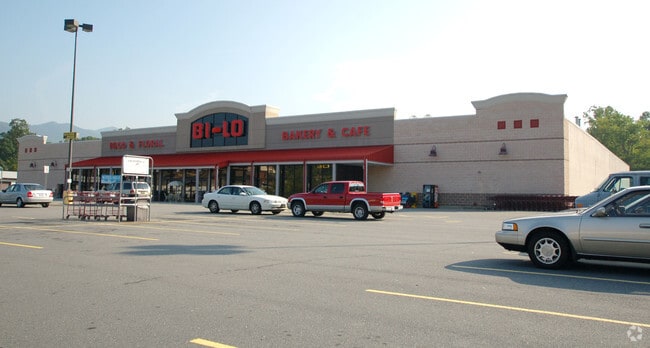
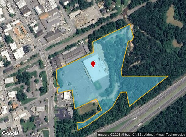
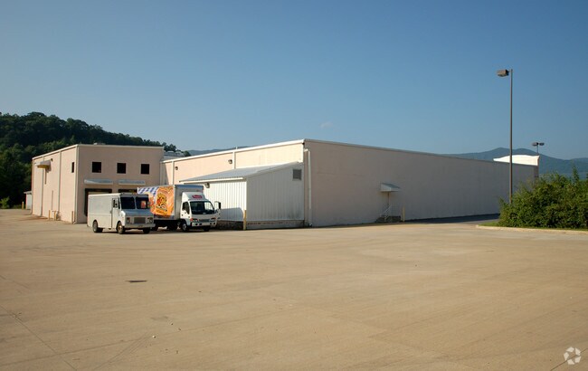
Property Record
205 Nc Highway 9, Black Mountain, NC 28711

NEARBY LISTINGS FOR SALE OR LEASE
Property Detail
205 Nc Highway 9
0619-45-3318-00000
PLAT: 0000-0000
Supermarket
Buncombe
AE
North Carolina
3710061900J
10.74 AC
2024
Buncombe County
2025
Asheville
003105
Asheville, NC
43,219 SF
DEMOGRAPHICS near 205 Nc Highway 9
1 Mile
3 Mile
5 Mile
2024 Total Population
4,671
13,917
19,509
2029 Population
4,869
14,432
20,248
Pop Growth 2024-2029
+ 4.24%
+ 3.70%
+ 3.79%
Average Age
46
46
45
2024 Total Households
2,059
5,785
8,082
HH Growth 2024-2029
+ 3.69%
+ 3.23%
+ 3.32%
Median Household Inc
$70,431
$70,680
$64,723
Avg Household Size
2.20
2.20
2.20
2024 Avg HH Vehicles
2.00
2.00
2.00
Median Home Value
$356,883
$348,296
$316,112
Median Year Built
1986
1986
1985
Nearby Places
Map Layers
Map Styles
 Street
 Aerial
- Restaurants
- Banks
- Shops
- Fitness
- Groceries
PUBLIC TRANSPORTATION
AIRPORT
Asheville Regional
DRIVE
WALK
Distance
Asheville Regional
34 min
22.3 mi
Nearby Properties
Address
Land Use
TOTAL SIZE
Lot Size
Zoning
Address
Land Use
TOTAL SIZE
Lot Size
Zoning
357,586 SF
689.12 AC
CR
Address
Land Use
TOTAL SIZE
Lot Size
Zoning
810,074 SF
46.41 AC
LI-8
Address
Land Use
TOTAL SIZE
Lot Size
Zoning
192,232 SF
119.64 AC
OI-6
Address
Land Use
TOTAL SIZE
Lot Size
Zoning
405,624 SF
75.73 AC
OI-6
Address
Land Use
TOTAL SIZE
Lot Size
Zoning
53,002 SF
7.06 AC
INST
Address
Land Use
TOTAL SIZE
Lot Size
Zoning
771,179 SF
73.04 AC
LI-8
Address
Land Use
TOTAL SIZE
Lot Size
Zoning
31,469 SF
1,153.53 AC
CR
Address
Land Use
TOTAL SIZE
Lot Size
Zoning
72,628 SF
8.65 AC
NMU-8
Address
Land Use
TOTAL SIZE
Lot Size
Zoning
14,692 SF
11 AC
PS
Address
Land Use
TOTAL SIZE
Lot Size
Zoning
32,988 SF
89.19 AC
ICD
Address
Land Use
TOTAL SIZE
Lot Size
Zoning
56,352 SF
48.90 AC
PS
Address
Land Use
TOTAL SIZE
Lot Size
Zoning
37,471 SF
7.56 AC
OI-6
Address
Land Use
TOTAL SIZE
Lot Size
Zoning
96,312 SF
10.79 AC
HB-8
Address
Land Use
TOTAL SIZE
Lot Size
Zoning
28,512 SF
4.22 AC
HB-8
Address
Land Use
TOTAL SIZE
Lot Size
Zoning
45,100 SF
7.29 AC
R-2
Address
Land Use
TOTAL SIZE
Lot Size
Zoning
43,236 SF
26.92 AC
INST
Address
Land Use
TOTAL SIZE
Lot Size
Zoning
18,016 SF
2.61 AC
HB-8
Address
Land Use
TOTAL SIZE
Lot Size
Zoning
42,215 SF
112.91 AC
R-LD
Address
Land Use
TOTAL SIZE
Lot Size
Zoning
165,852 SF
14.02 AC
HI-0
Address
Land Use
TOTAL SIZE
Lot Size
Zoning
27,762 SF
4.45 AC
NMU-8
Address
Land Use
TOTAL SIZE
Lot Size
Zoning
14,172 SF
3.17 AC
HB-8
Address
Land Use
TOTAL SIZE
Lot Size
Zoning
12,592 SF
0.56 AC
INST
Address
Land Use
TOTAL SIZE
Lot Size
Zoning
13,400 SF
0.55 AC
INST RES
Address
Land Use
TOTAL SIZE
Lot Size
Zoning
31,196 SF
43.77 AC
PS
Address
Land Use
TOTAL SIZE
Lot Size
Zoning
19,200 SF
1.25 AC
INST
Address
Land Use
TOTAL SIZE
Lot Size
Zoning
22,704 SF
4.85 AC
CR
Address
Land Use
TOTAL SIZE
Lot Size
Zoning
11,152 SF
0.45 AC
INST
Address
Land Use
TOTAL SIZE
Lot Size
Zoning
16,092 SF
1.94 AC
TND
Address
Land Use
TOTAL SIZE
Lot Size
Zoning
40,644 SF
5.60 AC
HB-8
Address
Land Use
TOTAL SIZE
Lot Size
Zoning
12,368 SF
2.12 AC
HB-8
The World's #1 Commercial Real Estate Marketplace
Connect with us
© 2026 CoStar Group
The information above has been obtained from sources believed reliable. While we do not doubt its accuracy we have not verified it and make no guarantee, warranty or representation about it. It is your responsibility to independently confirm its accuracy and completeness. Any projections, opinions, assumptions, or estimates used are for example only and do not represent the current or future performance of the property. The value of this transaction to you depends on tax and other factors which should be evaluated by your tax, financial, and legal advisors. You and your advisors should conduct a careful, independent investigation of the property to determine to your satisfaction the suitability of the property for your needs.