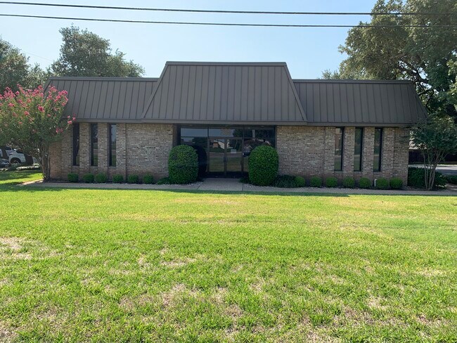
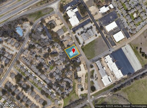
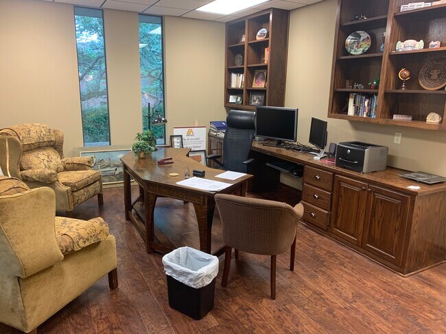
Property Record
205 Old Hewitt Rd, Waco, TX 76712
NEARBY LISTINGS FOR SALE OR LEASE
Property Detail
205 Old Hewitt Rd
Waco, TX
Central Park
36-008408-004100-7
CENTRAL PARK LOT 1 BLOCK 5 ACRES .524
Commercialnec
Mclennan
X
Texas
48309C0530D
1
2024
0.52 AC
2025
Waco & Killeen
003711
Other Market Areas
4,531 SF
DEMOGRAPHICS near 205 Old Hewitt Rd
1 Mile
3 Mile
5 Mile
2024 Total Population
5,611
46,341
105,717
2029 Population
5,927
49,199
112,300
Pop Growth 2024-2029
+ 5.63%
+ 6.17%
+ 6.23%
Average Age
45
40
39
2024 Total Households
2,080
18,459
40,786
HH Growth 2024-2029
+ 5.72%
+ 6.32%
+ 6.36%
Median Household Inc
$81,582
$69,274
$66,710
Avg Household Size
2.40
2.40
2.50
2024 Avg HH Vehicles
2.00
2.00
2.00
Median Home Value
$271,999
$239,936
$210,580
Median Year Built
1983
1982
1978
Nearby Places
Map Layers
Map Styles
 Street
 Aerial
- Restaurants
- Banks
- Shops
- Fitness
- Groceries
PUBLIC TRANSPORTATION
AIRPORT
Waco Regional
DRIVE
WALK
Distance
Waco Regional
25 min
11.9 mi
Freight Ports
Port of Houston
DRIVE
WALK
Distance
Port of Houston
220 min
192.2 mi
SALE & LEASE HISTORY
LISTING DATE
SALE/LEASE

Sep 17, 2022
For Lease
Oct 06, 2020
For Lease
Mar 19, 2020
For Lease
Nearby Properties
Address
Land Use
TOTAL SIZE
Lot Size
Zoning
Address
Land Use
TOTAL SIZE
Lot Size
Zoning
Address
Land Use
TOTAL SIZE
Lot Size
Zoning
Address
Land Use
TOTAL SIZE
Lot Size
Zoning
108,521 SF
70.78 AC
Address
Land Use
TOTAL SIZE
Lot Size
Zoning
693,933 SF
57.98 AC
M2
Address
Land Use
TOTAL SIZE
Lot Size
Zoning
106.92 AC
Address
Land Use
TOTAL SIZE
Lot Size
Zoning
752,540 SF
96.04 AC
M-2
Address
Land Use
TOTAL SIZE
Lot Size
Zoning
285,829 SF
17.35 AC
Address
Land Use
TOTAL SIZE
Lot Size
Zoning
Address
Land Use
TOTAL SIZE
Lot Size
Zoning
462,987 SF
36.18 AC
C-3
Address
Land Use
TOTAL SIZE
Lot Size
Zoning
16,678 SF
19.91 AC
C3
Address
Land Use
TOTAL SIZE
Lot Size
Zoning
Address
Land Use
TOTAL SIZE
Lot Size
Zoning
405,640 SF
64.46 AC
Address
Land Use
TOTAL SIZE
Lot Size
Zoning
459,747 SF
36.13 AC
M2
Address
Land Use
TOTAL SIZE
Lot Size
Zoning
222,388 SF
10.68 AC
R-3C
Address
Land Use
TOTAL SIZE
Lot Size
Zoning
27,245 SF
130.84 AC
R1B
Address
Land Use
TOTAL SIZE
Lot Size
Zoning
108,428 SF
9.27 AC
CS
Address
Land Use
TOTAL SIZE
Lot Size
Zoning
221,876 SF
12.26 AC
C-2
Address
Land Use
TOTAL SIZE
Lot Size
Zoning
211,432 SF
13.86 AC
O2
Address
Land Use
TOTAL SIZE
Lot Size
Zoning
Address
Land Use
TOTAL SIZE
Lot Size
Zoning
108,969 SF
24.73 AC
R-1
Address
Land Use
TOTAL SIZE
Lot Size
Zoning
219,544 SF
23.11 AC
Address
Land Use
TOTAL SIZE
Lot Size
Zoning
186,924 SF
9.14 AC
O-2
Address
Land Use
TOTAL SIZE
Lot Size
Zoning
181,423 SF
16.03 AC
R1B
Address
Land Use
TOTAL SIZE
Lot Size
Zoning
60,536 SF
0.93 AC
Address
Land Use
TOTAL SIZE
Lot Size
Zoning
223,307 SF
27.28 AC
O-2,
Address
Land Use
TOTAL SIZE
Lot Size
Zoning
225,762 SF
29.30 AC
C3
Address
Land Use
TOTAL SIZE
Lot Size
Zoning
228,638 SF
14.56 AC
O-2
Address
Land Use
TOTAL SIZE
Lot Size
Zoning
Address
Land Use
TOTAL SIZE
Lot Size
Zoning
87,492 SF
29.99 AC
R1
Address
Land Use
TOTAL SIZE
Lot Size
Zoning
146,635 SF
8.36 AC
R-3E
The World's #1 Commercial Real Estate Marketplace
Connect with us
© 2025 CoStar Group
The information above has been obtained from sources believed reliable. While we do not doubt its accuracy we have not verified it and make no guarantee, warranty or representation about it. It is your responsibility to independently confirm its accuracy and completeness. Any projections, opinions, assumptions, or estimates used are for example only and do not represent the current or future performance of the property. The value of this transaction to you depends on tax and other factors which should be evaluated by your tax, financial, and legal advisors. You and your advisors should conduct a careful, independent investigation of the property to determine to your satisfaction the suitability of the property for your needs.