Property Record
205 Pine St, Contoocook, NH 03229
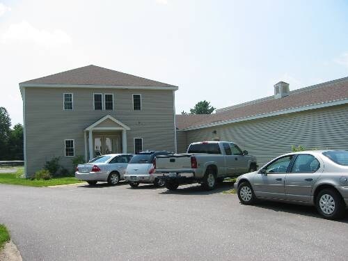

Property Detail
205 Pine St
Commercialnec
Merrimack
B-1 .3
New Hampshire
A Areas with a 1% annual chance of flooding and a 26% chance of flooding over the life of a 30-year mortgage.
4.90 AC
2025
Other Market Areas
2025
Concord, NH
039000
HOPN-000221-000010
16,951 SF
NEARBY LISTINGS FOR SALE OR LEASE
-
-
View all Contoocook listings for sale on LoopNet.com
DEMOGRAPHICS near 205 Pine St
1 mile
3 mile
5 mile
2025 Total Population
1,370
4,491
8,741
2030 Population
1,390
4,582
8,930
Pop Growth 2025-2030
+ 1.46%
+ 2.03%
+ 2.16%
Average Age
45
44
44
2025 Total Households
563
1,787
3,432
HH Growth 2025-2030
+ 1.42%
+ 2.01%
+ 2.21%
Median Household Inc
$109,259
$118,017
$120,743
Avg Household Size
2.40
2.50
2.50
2025 Avg HH Vehicles
2.00
2.00
2.00
Median Home Value
$433,333
$451,532
$442,374
Median Year Built
1967
1970
1975
Nearby Places
Map Layers
Map Styles
 Street
 Aerial
Layers
 Traffic
 Biking
Places
Listings with unknown addresses are not visible on the map
- Restaurants
- Banks
- Shops
- Fitness
- Groceries
PUBLIC TRANSPORTATION
AIRPORT
Manchester Boston Regional
Drive
Walk
Distance
Manchester Boston Regional
50 min
33.3 mi
Freight Ports
Port of Boston
Drive
Walk
Distance
Port of Boston
116 min
81.9 mi
Nearby Properties
Address
Land Use
TOTAL SIZE
Lot Size
Zoning
Address
Land Use
TOTAL SIZE
Lot Size
Zoning
74,265 SF
9.63 AC
R-1
Address
Land Use
TOTAL SIZE
Lot Size
Zoning
298,175 SF
58.66 AC
M-1
Address
Land Use
TOTAL SIZE
Lot Size
Zoning
654 SF
145 AC
R-2 CL
Address
Land Use
TOTAL SIZE
Lot Size
Zoning
34,307 SF
5.80 AC
R-1
Address
Land Use
TOTAL SIZE
Lot Size
Zoning
10,395 SF
67.85 AC
VR-1 .
Address
Land Use
TOTAL SIZE
Lot Size
Zoning
1,472 SF
46.78 AC
R-1
Address
Land Use
TOTAL SIZE
Lot Size
Zoning
55,554 SF
24 AC
M-1
Address
Land Use
TOTAL SIZE
Lot Size
Zoning
9,100 SF
90 AC
C1 - C
Address
Land Use
TOTAL SIZE
Lot Size
Zoning
69,848 SF
5.72 AC
M-1
Address
Land Use
TOTAL SIZE
Lot Size
Zoning
416 SF
5.90 AC
C1 - C
Address
Land Use
TOTAL SIZE
Lot Size
Zoning
4,526 SF
4.92 AC
VB-1 .
Address
Land Use
TOTAL SIZE
Lot Size
Zoning
3,245 SF
39.10 AC
R-2
Address
Land Use
TOTAL SIZE
Lot Size
Zoning
13,830 SF
1.08 AC
VB-1 .
Address
Land Use
TOTAL SIZE
Lot Size
Zoning
1,654 SF
1,307 AC
R-4
Address
Land Use
TOTAL SIZE
Lot Size
Zoning
41,529 SF
7.04 AC
M-1
Address
Land Use
TOTAL SIZE
Lot Size
Zoning
19,980 SF
1.90 AC
VB-1 .
Address
Land Use
TOTAL SIZE
Lot Size
Zoning
59,108 SF
6.71 AC
M-1
Address
Land Use
TOTAL SIZE
Lot Size
Zoning
47 AC
R2 - M
Address
Land Use
TOTAL SIZE
Lot Size
Zoning
11,559 SF
5.10 AC
R-1
Address
Land Use
TOTAL SIZE
Lot Size
Zoning
29,302 SF
7.10 AC
R-1
Address
Land Use
TOTAL SIZE
Lot Size
Zoning
46,379 SF
7.85 AC
M-1
Address
Land Use
TOTAL SIZE
Lot Size
Zoning
2,016 SF
33 AC
R-1
Address
Land Use
TOTAL SIZE
Lot Size
Zoning
25,013 SF
2.23 AC
R-1
Address
Land Use
TOTAL SIZE
Lot Size
Zoning
1,798 SF
0.26 AC
VB-1 .
Address
Land Use
TOTAL SIZE
Lot Size
Zoning
0.12 AC
R-1
Address
Land Use
TOTAL SIZE
Lot Size
Zoning
13,333 SF
1.10 AC
VB-1 .
Address
Land Use
TOTAL SIZE
Lot Size
Zoning
6,250 SF
7.50 AC
C1 - C
Address
Land Use
TOTAL SIZE
Lot Size
Zoning
5,120 SF
5 AC
C1 - C
Address
Land Use
TOTAL SIZE
Lot Size
Zoning
2,669 SF
43.48 AC
R-4
The World's #1 Commercial Real Estate Marketplace
Connect with us
© 2026 CoStar Group
The information above has been obtained from sources believed reliable. While we do not doubt its accuracy we have not verified it and make no guarantee, warranty or representation about it. It is your responsibility to independently confirm its accuracy and completeness. Any projections, opinions, assumptions, or estimates used are for example only and do not represent the current or future performance of the property. The value of this transaction to you depends on tax and other factors which should be evaluated by your tax, financial, and legal advisors. You and your advisors should conduct a careful, independent investigation of the property to determine to your satisfaction the suitability of the property for your needs.