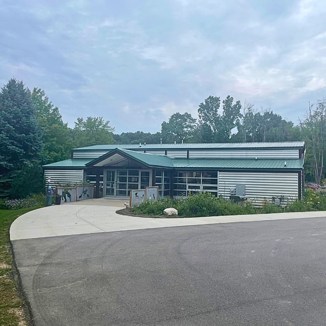
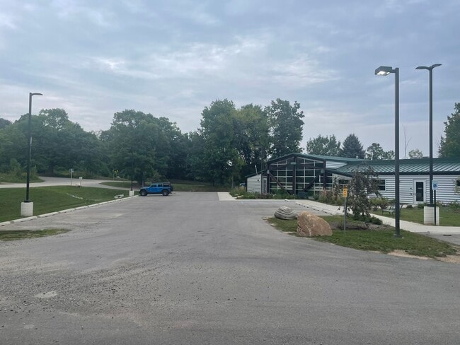
Property Record
205 Rowe Rd, Milford, MI 48380

NEARBY LISTINGS FOR SALE OR LEASE
Property Detail
205 Rowe Rd
16-03-100-007
Highland
Animalhospitalvet
T2N, R7E, SEC 3 THAT PART OF NE FRC 1/4 OF NW FRC 1/4 LYING W OF CEN LI OF MILFORD-HIGHLAND RD EXC W 298 FT OF N 330 FT, ALSO
X
Oakland
26125C0451F
Michigan
2024
3.75 AC
2025
Central I-96 Corridor
132600
Detroit
9,042 SF
Detroit-Warren-Dearborn, MI
DEMOGRAPHICS near 205 Rowe Rd
1 Mile
3 Mile
5 Mile
2024 Total Population
2,498
18,134
46,011
2029 Population
2,478
18,080
45,868
Pop Growth 2024-2029
(0.80%)
(0.30%)
(0.31%)
Average Age
45
44
43
2024 Total Households
992
7,149
17,640
HH Growth 2024-2029
(0.91%)
(0.45%)
(0.36%)
Median Household Inc
$94,559
$106,603
$101,571
Avg Household Size
2.40
2.50
2.60
2024 Avg HH Vehicles
2.00
2.00
2.00
Median Home Value
$360,436
$380,898
$357,267
Median Year Built
1988
1988
1987
Nearby Places
Map Layers
Map Styles
 Street
 Aerial
- Restaurants
- Banks
- Shops
- Fitness
- Groceries
PUBLIC TRANSPORTATION
AIRPORT
Bishop International
DRIVE
WALK
Distance
Bishop International
52 min
34.8 mi
Freight Ports
Port of Toledo
DRIVE
WALK
Distance
Port of Toledo
103 min
83.1 mi
SALE & LEASE HISTORY
LISTING DATE
SALE/LEASE

Sep 21, 2023
For Sale
Nearby Properties
Address
Land Use
TOTAL SIZE
Lot Size
Zoning
Address
Land Use
TOTAL SIZE
Lot Size
Zoning
117,504 SF
12.57 AC
BI
Address
Land Use
TOTAL SIZE
Lot Size
Zoning
89,974 SF
Address
Land Use
TOTAL SIZE
Lot Size
Zoning
70,308 SF
2.43 AC
Address
Land Use
TOTAL SIZE
Lot Size
Zoning
77,287 SF
1.62 AC
Address
Land Use
TOTAL SIZE
Lot Size
Zoning
70,463 SF
7.98 AC
AI
Address
Land Use
TOTAL SIZE
Lot Size
Zoning
7,616 SF
78.67 AC
MM
Address
Land Use
TOTAL SIZE
Lot Size
Zoning
38,453 SF
5.05 AC
Address
Land Use
TOTAL SIZE
Lot Size
Zoning
55,844 SF
5.90 AC
AI
Address
Land Use
TOTAL SIZE
Lot Size
Zoning
72,727 SF
10.51 AC
Address
Land Use
TOTAL SIZE
Lot Size
Zoning
603.37 AC
FC
Address
Land Use
TOTAL SIZE
Lot Size
Zoning
26,054 SF
7.90 AC
AV
Address
Land Use
TOTAL SIZE
Lot Size
Zoning
19,596 SF
3.78 AC
Address
Land Use
TOTAL SIZE
Lot Size
Zoning
51,167 SF
11.08 AC
BI
Address
Land Use
TOTAL SIZE
Lot Size
Zoning
25,641 SF
4.89 AC
AI
Address
Land Use
TOTAL SIZE
Lot Size
Zoning
14,689 SF
2.05 AC
BI
Address
Land Use
TOTAL SIZE
Lot Size
Zoning
67,936 SF
9.68 AC
BI
Address
Land Use
TOTAL SIZE
Lot Size
Zoning
41,748 SF
2.20 AC
AI
Address
Land Use
TOTAL SIZE
Lot Size
Zoning
27,756 SF
228.31 AC
Address
Land Use
TOTAL SIZE
Lot Size
Zoning
34,464 SF
7.45 AC
AI
Address
Land Use
TOTAL SIZE
Lot Size
Zoning
47,996 SF
8.99 AC
BI
Address
Land Use
TOTAL SIZE
Lot Size
Zoning
31,676 SF
3.59 AC
BI
Address
Land Use
TOTAL SIZE
Lot Size
Zoning
36,928 SF
5.16 AC
II
Address
Land Use
TOTAL SIZE
Lot Size
Zoning
68,340 SF
5.48 AC
II
Address
Land Use
TOTAL SIZE
Lot Size
Zoning
45,600 SF
3.44 AC
BI
Address
Land Use
TOTAL SIZE
Lot Size
Zoning
37,646 SF
7.53 AC
SI
Address
Land Use
TOTAL SIZE
Lot Size
Zoning
12,544 SF
0.18 AC
Address
Land Use
TOTAL SIZE
Lot Size
Zoning
27,854 SF
2.08 AC
AI
Address
Land Use
TOTAL SIZE
Lot Size
Zoning
22,605 SF
3.79 AC
BI
Address
Land Use
TOTAL SIZE
Lot Size
Zoning
50.93 AC
MM
Address
Land Use
TOTAL SIZE
Lot Size
Zoning
5,471 SF
1.65 AC
BI
The World's #1 Commercial Real Estate Marketplace
Connect with us
© 2026 CoStar Group
The information above has been obtained from sources believed reliable. While we do not doubt its accuracy we have not verified it and make no guarantee, warranty or representation about it. It is your responsibility to independently confirm its accuracy and completeness. Any projections, opinions, assumptions, or estimates used are for example only and do not represent the current or future performance of the property. The value of this transaction to you depends on tax and other factors which should be evaluated by your tax, financial, and legal advisors. You and your advisors should conduct a careful, independent investigation of the property to determine to your satisfaction the suitability of the property for your needs.