Property Record
205 Schoolhouse Rd, Souderton, PA 18964


Current Lease Availabilities
NEARBY LISTINGS FOR SALE OR LEASE
Property Detail
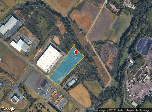
205 Schoolhouse Rd
Philadelphia-Camden-Wilmington, PA-NJ-DE-MD
SEE 34-00-04469-60-9 BLK 26 U 57 SEE 34-00-04469-40-2 BLK 26 U 58
34-00-04469-204
Montgomery
Commercialacreage
Pennsylvania
A
2
42091C0136G
6.98 AC
2024
West Montgomery Cty
2025
Philadelphia
207101
DEMOGRAPHICS near 205 Schoolhouse Rd
1 Mile
3 Mile
5 Mile
2024 Total Population
1,681
50,126
116,517
2029 Population
1,710
51,207
118,102
Pop Growth 2024-2029
+ 1.73%
+ 2.16%
+ 1.36%
Average Age
46
43
43
2024 Total Households
636
19,288
44,928
HH Growth 2024-2029
+ 1.42%
+ 2.10%
+ 1.23%
Median Household Inc
$104,452
$103,183
$101,858
Avg Household Size
2.40
2.50
2.50
2024 Avg HH Vehicles
2.00
2.00
2.00
Median Home Value
$441,721
$363,671
$370,238
Median Year Built
1990
1984
1979
Nearby Places
Map Layers
Map Styles
 Street
 Aerial
- Restaurants
- Banks
- Shops
- Fitness
- Groceries
PUBLIC TRANSPORTATION
COMMUTER RAIL
Lansdale (R5 - Southeastern Pennsylvania Transportation Authority Regional Rail (SEPTA Regional Rail))
DRIVE
WALK
Distance
Lansdale (R5 - Southeastern Pennsylvania Transportation Authority Regional Rail (SEPTA Regional Rail))
12 min
5.5 mi
9Th Street Lansdale (Lansdale/Doylestown Line - SEPTA)
DRIVE
WALK
Distance
9Th Street Lansdale (Lansdale/Doylestown Line - SEPTA)
14 min
6.0 mi
AIRPORT
Philadelphia International
DRIVE
WALK
Distance
Philadelphia International
57 min
39.7 mi
Lehigh Valley International
DRIVE
WALK
Distance
Lehigh Valley International
55 min
40.7 mi
Trenton Mercer
DRIVE
WALK
Distance
Trenton Mercer
63 min
48.0 mi
Freight Ports
Port of Philadelphia
DRIVE
WALK
Distance
Port of Philadelphia
49 min
29.5 mi
Nearby Properties
Address
Land Use
TOTAL SIZE
Lot Size
Zoning
Address
Land Use
TOTAL SIZE
Lot Size
Zoning
437,908 SF
104.29 AC
INST
Address
Land Use
TOTAL SIZE
Lot Size
Zoning
677,546 SF
92.50 AC
INST
Address
Land Use
TOTAL SIZE
Lot Size
Zoning
454,126 SF
37.18 AC
MRC
Address
Land Use
TOTAL SIZE
Lot Size
Zoning
139,733 SF
46.65 AC
R130
Address
Land Use
TOTAL SIZE
Lot Size
Zoning
253,741 SF
9.09 AC
VO
Address
Land Use
TOTAL SIZE
Lot Size
Zoning
832,830 SF
53.72 AC
LI
Address
Land Use
TOTAL SIZE
Lot Size
Zoning
253,915 SF
17.78 AC
GA
Address
Land Use
TOTAL SIZE
Lot Size
Zoning
219,869 SF
41.98 AC
LI
Address
Land Use
TOTAL SIZE
Lot Size
Zoning
211,561 SF
38.80 AC
LI
Address
Land Use
TOTAL SIZE
Lot Size
Zoning
373,104 SF
31.94 AC
LI
Address
Land Use
TOTAL SIZE
Lot Size
Zoning
170,351 SF
71.70 AC
IN
Address
Land Use
TOTAL SIZE
Lot Size
Zoning
179,930 SF
16 AC
IN
Address
Land Use
TOTAL SIZE
Lot Size
Zoning
220,124 SF
33.16 AC
SC
Address
Land Use
TOTAL SIZE
Lot Size
Zoning
152,085 SF
38.16 AC
INST
Address
Land Use
TOTAL SIZE
Lot Size
Zoning
168,557 SF
44.77 AC
RA1
Address
Land Use
TOTAL SIZE
Lot Size
Zoning
149,259 SF
4.30 AC
R3
Address
Land Use
TOTAL SIZE
Lot Size
Zoning
444,718 SF
46.51 AC
LI
Address
Land Use
TOTAL SIZE
Lot Size
Zoning
324,796 SF
42.20 AC
LI
Address
Land Use
TOTAL SIZE
Lot Size
Zoning
156,694 SF
18.82 AC
C
Address
Land Use
TOTAL SIZE
Lot Size
Zoning
156,186 SF
31.41 AC
R1
Address
Land Use
TOTAL SIZE
Lot Size
Zoning
136,281 SF
4.05 AC
R3
Address
Land Use
TOTAL SIZE
Lot Size
Zoning
52,348 SF
21.30 AC
R5
Address
Land Use
TOTAL SIZE
Lot Size
Zoning
216,372 SF
18.46 AC
INST
Address
Land Use
TOTAL SIZE
Lot Size
Zoning
98,782 SF
5.09 AC
BC
Address
Land Use
TOTAL SIZE
Lot Size
Zoning
35.37 AC
LI
Address
Land Use
TOTAL SIZE
Lot Size
Zoning
17,364 SF
31.92 AC
LI
Address
Land Use
TOTAL SIZE
Lot Size
Zoning
197,233 SF
15.66 AC
LI
Address
Land Use
TOTAL SIZE
Lot Size
Zoning
90,217 SF
19 AC
R1
Address
Land Use
TOTAL SIZE
Lot Size
Zoning
246,631 SF
48.78 AC
AO
Address
Land Use
TOTAL SIZE
Lot Size
Zoning
184,471 SF
0.80 AC
INST
The World's #1 Commercial Real Estate Marketplace
Connect with us
© 2026 CoStar Group
The information above has been obtained from sources believed reliable. While we do not doubt its accuracy we have not verified it and make no guarantee, warranty or representation about it. It is your responsibility to independently confirm its accuracy and completeness. Any projections, opinions, assumptions, or estimates used are for example only and do not represent the current or future performance of the property. The value of this transaction to you depends on tax and other factors which should be evaluated by your tax, financial, and legal advisors. You and your advisors should conduct a careful, independent investigation of the property to determine to your satisfaction the suitability of the property for your needs.