Property Record
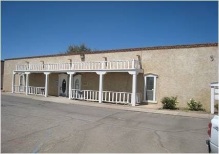
205 W Boutz Rd, Las Cruces, NM 88005

Property Detail
205 W Boutz Rd
02-00204
SUBD: BARKER CENTER #1 895 LOT: LTS 5 6 SUBD: BOUTZ PLAZA CONDOMINIUMS S: 19 T: 23S R: 2E DESC: C81001 BK 155 PGS 411-436 REFERENCE CARD C83001 BK 173 PGS 305-315 REF CARD USRS 11C TR 39
Commercialacreage
DONA ANA
M1
New Mexico
B and X Area of moderate flood hazard, usually the area between the limits of the 100-year and 500-year floods.
5
0
0.36 AC
2025
Las Cruces/Alamogordo
000206
Other Market Areas
4,000 SF
Las Cruces, NM
NEARBY LISTINGS FOR SALE OR LEASE
DEMOGRAPHICS near 205 W Boutz Rd
1 mile
3 mile
5 mile
2025 Total Population
6,969
67,200
108,782
2030 Population
7,193
69,872
113,388
Pop Growth 2025-2030
+ 3.21%
+ 3.98%
+ 4.23%
Average Age
40
37
39
2025 Total Households
3,152
27,756
44,569
HH Growth 2025-2030
+ 3.33%
+ 4.19%
+ 4.42%
Median Household Inc
$33,514
$38,682
$50,628
Avg Household Size
2.20
2.30
2.30
2025 Avg HH Vehicles
1.00
2.00
2.00
Median Home Value
$217,772
$184,993
$227,811
Median Year Built
1977
1979
1984
Nearby Places
Map Layers
Map Styles
 Street
 Aerial
Transit
 Traffic
 Biking
Places
Listings with unknown addresses are not visible on the map
- Restaurants
- Banks
- Shops
- Fitness
- Groceries
Nearby Properties
Address
Land Use
TOTAL SIZE
Lot Size
Zoning
Address
Land Use
TOTAL SIZE
Lot Size
Zoning
198,290 SF
33.76 AC
R4
Address
Land Use
TOTAL SIZE
Lot Size
Zoning
413,000 SF
R4
Address
Land Use
TOTAL SIZE
Lot Size
Zoning
77,691 SF
Address
Land Use
TOTAL SIZE
Lot Size
Zoning
240,030 SF
14.74 AC
R4
Address
Land Use
TOTAL SIZE
Lot Size
Zoning
206,137 SF
9.96 AC
R1
Address
Land Use
TOTAL SIZE
Lot Size
Zoning
49 AC
C1
Address
Land Use
TOTAL SIZE
Lot Size
Zoning
207,825 SF
25.73 AC
A2
Address
Land Use
TOTAL SIZE
Lot Size
Zoning
98,015 SF
7.85 AC
A1
Address
Land Use
TOTAL SIZE
Lot Size
Zoning
394,043 SF
26.74 AC
C2
Address
Land Use
TOTAL SIZE
Lot Size
Zoning
139,122 SF
6.12 AC
C2
Address
Land Use
TOTAL SIZE
Lot Size
Zoning
52,991 SF
5.95 AC
C2
Address
Land Use
TOTAL SIZE
Lot Size
Zoning
72,015 SF
9.84 AC
ER4
Address
Land Use
TOTAL SIZE
Lot Size
Zoning
242,177 SF
21.36 AC
M1
Address
Land Use
TOTAL SIZE
Lot Size
Zoning
27,528 SF
4.65 AC
R1
Address
Land Use
TOTAL SIZE
Lot Size
Zoning
74,724 SF
8 AC
PUD
Address
Land Use
TOTAL SIZE
Lot Size
Zoning
42,295 SF
7.45 AC
C2
Address
Land Use
TOTAL SIZE
Lot Size
Zoning
76,950 SF
3.95 AC
Address
Land Use
TOTAL SIZE
Lot Size
Zoning
79,362 SF
5.90 AC
C2
Address
Land Use
TOTAL SIZE
Lot Size
Zoning
74,625 SF
6.40 AC
C2
Address
Land Use
TOTAL SIZE
Lot Size
Zoning
121,855 SF
12.59 AC
C2
Address
Land Use
TOTAL SIZE
Lot Size
Zoning
69,890 SF
Address
Land Use
TOTAL SIZE
Lot Size
Zoning
17,812 SF
2.65 AC
CBD
Address
Land Use
TOTAL SIZE
Lot Size
Zoning
77,180 SF
2.80 AC
R4
Address
Land Use
TOTAL SIZE
Lot Size
Zoning
136,377 SF
42.51 AC
A2
Address
Land Use
TOTAL SIZE
Lot Size
Zoning
11.35 AC
M1
Address
Land Use
TOTAL SIZE
Lot Size
Zoning
29,222 SF
4.96 AC
M1
Address
Land Use
TOTAL SIZE
Lot Size
Zoning
93,663 SF
4.89 AC
C2
Address
Land Use
TOTAL SIZE
Lot Size
Zoning
88,424 SF
75.20 AC
M1
Address
Land Use
TOTAL SIZE
Lot Size
Zoning
31,343 SF
4.60 AC
C2
Address
Land Use
TOTAL SIZE
Lot Size
Zoning
107,608 SF
6.04 AC
R3
The World's #1 Commercial Real Estate Marketplace
Connect with us
© 2026 CoStar Group
The information above has been obtained from sources believed reliable. While we do not doubt its accuracy we have not verified it and make no guarantee, warranty or representation about it. It is your responsibility to independently confirm its accuracy and completeness. Any projections, opinions, assumptions, or estimates used are for example only and do not represent the current or future performance of the property. The value of this transaction to you depends on tax and other factors which should be evaluated by your tax, financial, and legal advisors. You and your advisors should conduct a careful, independent investigation of the property to determine to your satisfaction the suitability of the property for your needs.