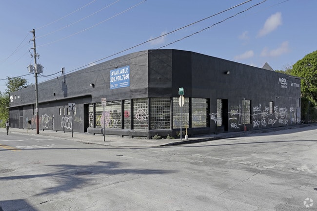
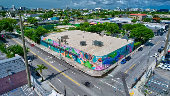
Property Record
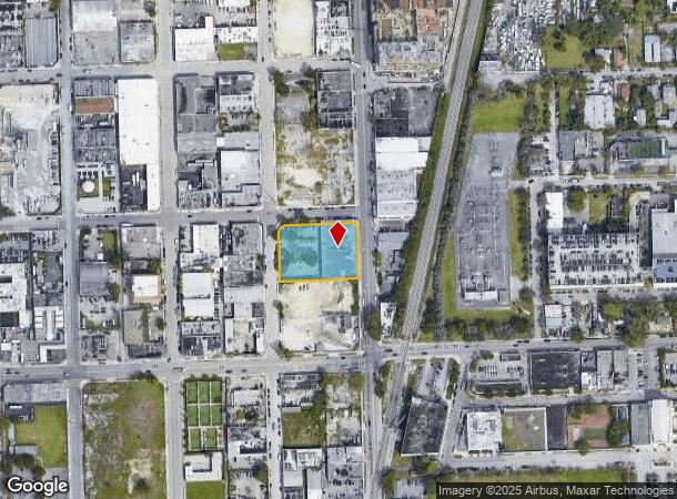
2050 N Miami Ave, Miami, FL 33127

NEARBY LISTINGS FOR SALE OR LEASE
Property Detail
2050 N Miami Ave
Miami-Miami Beach-Kendall, FL
Waddells Add
01-3125-048-0330
25-36 53 41 WADDELLS ADD PB B-53 LOTS 1 THRU 6 INC BLK 11 LESS EXT AREA OD CURVE IN NW & LESS BEG 13.12FTWLY M/L OF NE COR OF LOT 1 S 00 DEG W 14.76FT N 13 DEG W 7.89FT N 44 DEG W 7.31FT N 74 DEG W 6.98FT N 90 DEG E 13.83FT FOR POB FOR R/W LOT SIZE 4
Warehouse
Miami/Dade
X
Florida
12086C0312L
1-6
2024
1.03 AC
2025
Wynwood-Design District
002202
South Florida
19,826 SF
DEMOGRAPHICS near 2050 N Miami Ave
1 Mile
3 Mile
5 Mile
2024 Total Population
52,190
290,578
549,883
2029 Population
53,501
289,630
546,566
Pop Growth 2024-2029
+ 2.51%
(0.33%)
(0.60%)
Average Age
37
40
41
2024 Total Households
25,846
126,872
236,565
HH Growth 2024-2029
+ 2.46%
(0.36%)
(0.53%)
Median Household Inc
$64,792
$51,652
$52,270
Avg Household Size
1.90
2.20
2.20
2024 Avg HH Vehicles
1.00
1.00
1.00
Median Home Value
$459,798
$439,238
$434,535
Median Year Built
2007
1992
1976
Nearby Places
Map Layers
Map Styles
 Street
 Aerial
- Restaurants
- Banks
- Shops
- Fitness
- Groceries
PUBLIC TRANSPORTATION
TRANSIT/SUBWAY
School Board (Metromover Omni Loop - Miami-Dade Transit (Metrorail/Metromover))
DRIVE
WALK
Distance
School Board (Metromover Omni Loop - Miami-Dade Transit (Metrorail/Metromover))
1 min
11 min
0.6 mi
Adrienne Arsht Center (Metromover Omni Loop - Miami-Dade Transit (Metrorail/Metromover))
DRIVE
WALK
Distance
Adrienne Arsht Center (Metromover Omni Loop - Miami-Dade Transit (Metrorail/Metromover))
2 min
17 min
0.9 mi
Eleventh Street (Metromover Omni Loop - Miami-Dade Transit (Metrorail/Metromover))
DRIVE
WALK
Distance
Eleventh Street (Metromover Omni Loop - Miami-Dade Transit (Metrorail/Metromover))
2 min
19 min
1.0 mi
COMMUTER RAIL
Historic Overtown/Lyric Theatre (Metrorail Green Line - Miami-Dade Transit (Metrorail/Metromover))
DRIVE
WALK
Distance
Historic Overtown/Lyric Theatre (Metrorail Green Line - Miami-Dade Transit (Metrorail/Metromover))
3 min
1.2 mi
Miamicentral Station (Metrorail Transfer - MiamiCentral - Tri-Rail, West Palm Beach - MiamiCentral - Tri-Rail)
DRIVE
WALK
Distance
Miamicentral Station (Metrorail Transfer - MiamiCentral - Tri-Rail, West Palm Beach - MiamiCentral - Tri-Rail)
3 min
1.4 mi
AIRPORT
Miami International
DRIVE
WALK
Distance
Miami International
21 min
10.1 mi
Fort Lauderdale/Hollywood International
DRIVE
WALK
Distance
Fort Lauderdale/Hollywood International
32 min
21.9 mi
Freight Ports
Port of Miami
DRIVE
WALK
Distance
Port of Miami
8 min
3.3 mi
SALE & LEASE HISTORY
LISTING DATE
SALE/LEASE

Jun 27, 2017
For Lease
Jul 29, 2024
For Lease
Aug 02, 2024
For Lease
Nearby Properties
Address
Land Use
TOTAL SIZE
Lot Size
Zoning
Address
Land Use
TOTAL SIZE
Lot Size
Zoning
1,050,691 SF
0.83 AC
6408
Address
Land Use
TOTAL SIZE
Lot Size
Zoning
4,758,614 SF
810.91 AC
8000
Address
Land Use
TOTAL SIZE
Lot Size
Zoning
955,966 SF
38.91 AC
9600
Address
Land Use
TOTAL SIZE
Lot Size
Zoning
2,559,318 SF
2.21 AC
6407
Address
Land Use
TOTAL SIZE
Lot Size
Zoning
2,039,308 SF
2.46 AC
6401
Address
Land Use
TOTAL SIZE
Lot Size
Zoning
928,000 SF
14.30 AC
8000
Address
Land Use
TOTAL SIZE
Lot Size
Zoning
1,110,657 SF
3.83 AC
6407
Address
Land Use
TOTAL SIZE
Lot Size
Zoning
16.13 AC
6100
Address
Land Use
TOTAL SIZE
Lot Size
Zoning
1,346,294 SF
1.89 AC
6408
Address
Land Use
TOTAL SIZE
Lot Size
Zoning
2,403,353 SF
7.37 AC
6100
Address
Land Use
TOTAL SIZE
Lot Size
Zoning
1,938,271 SF
6.62 AC
6402
Address
Land Use
TOTAL SIZE
Lot Size
Zoning
1,162,113 SF
1.92 AC
6407
Address
Land Use
TOTAL SIZE
Lot Size
Zoning
1,075,124 SF
1.61 AC
6405
Address
Land Use
TOTAL SIZE
Lot Size
Zoning
1,544,491 SF
0.97 AC
6401
Address
Land Use
TOTAL SIZE
Lot Size
Zoning
782,686 SF
0.06 AC
6401
Address
Land Use
TOTAL SIZE
Lot Size
Zoning
1,657,362 SF
1.15 AC
6401
Address
Land Use
TOTAL SIZE
Lot Size
Zoning
1,072,012 SF
1.78 AC
6407
Address
Land Use
TOTAL SIZE
Lot Size
Zoning
244,533 SF
3.53 AC
6600
Address
Land Use
TOTAL SIZE
Lot Size
Zoning
694,863 SF
1.90 AC
6407
Address
Land Use
TOTAL SIZE
Lot Size
Zoning
656,821 SF
2.06 AC
6407
Address
Land Use
TOTAL SIZE
Lot Size
Zoning
303,989 SF
1.47 AC
6600
Address
Land Use
TOTAL SIZE
Lot Size
Zoning
416,675 SF
6.48 AC
6401
Address
Land Use
TOTAL SIZE
Lot Size
Zoning
256,089 SF
20.35 AC
7600
Address
Land Use
TOTAL SIZE
Lot Size
Zoning
1,004,006 SF
0.92 AC
6401
Address
Land Use
TOTAL SIZE
Lot Size
Zoning
2.50 AC
6407
Address
Land Use
TOTAL SIZE
Lot Size
Zoning
585,775 SF
1.86 AC
6101
Address
Land Use
TOTAL SIZE
Lot Size
Zoning
868,860 SF
2.14 AC
6402
Address
Land Use
TOTAL SIZE
Lot Size
Zoning
491,308 SF
0.14 AC
6401
Address
Land Use
TOTAL SIZE
Lot Size
Zoning
903,993 SF
0.60 AC
6412
Address
Land Use
TOTAL SIZE
Lot Size
Zoning
872,245 SF
0.56 AC
6401
The World's #1 Commercial Real Estate Marketplace
Connect with us
© 2025 CoStar Group
The information above has been obtained from sources believed reliable. While we do not doubt its accuracy we have not verified it and make no guarantee, warranty or representation about it. It is your responsibility to independently confirm its accuracy and completeness. Any projections, opinions, assumptions, or estimates used are for example only and do not represent the current or future performance of the property. The value of this transaction to you depends on tax and other factors which should be evaluated by your tax, financial, and legal advisors. You and your advisors should conduct a careful, independent investigation of the property to determine to your satisfaction the suitability of the property for your needs.