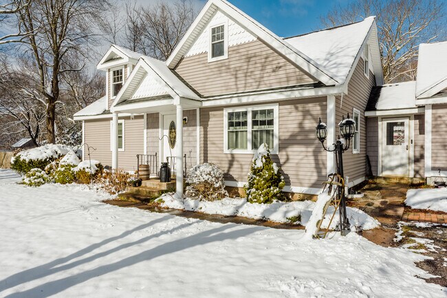
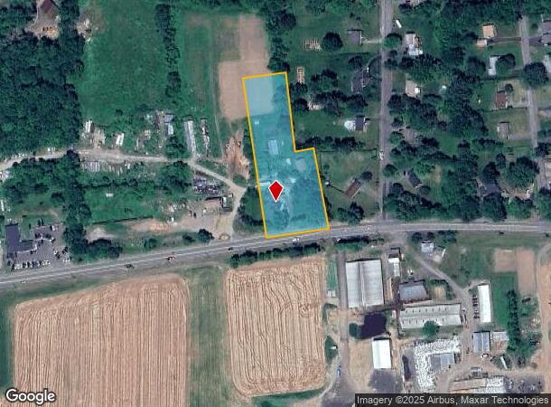
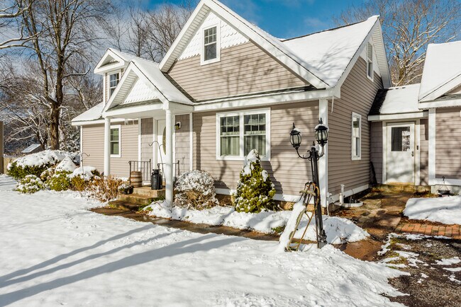
Property Record
2050 Boston Tpke, Coventry, CT 06238

NEARBY LISTINGS FOR SALE OR LEASE
Property Detail
2050 Boston Tpke
Hartford-West Hartford-East Hartford, CT
Tolland
COVE-000009-000011-000026
Connecticut
Commercialofficeresidentialmixeduse
134
2025
2 AC
2025
Tolland County
850100
Hartford
DEMOGRAPHICS near 2050 Boston Tpke
1 Mile
3 Mile
5 Mile
2024 Total Population
1,109
8,597
33,310
2029 Population
1,100
8,551
33,231
Pop Growth 2024-2029
(0.81%)
(0.54%)
(0.24%)
Average Age
42
43
43
2024 Total Households
423
3,353
13,568
HH Growth 2024-2029
(0.95%)
(0.57%)
(0.25%)
Median Household Inc
$96,551
$99,741
$93,598
Avg Household Size
2.60
2.50
2.40
2024 Avg HH Vehicles
2.00
2.00
2.00
Median Home Value
$298,518
$303,516
$282,570
Median Year Built
1974
1971
1972
Nearby Places
Map Layers
Map Styles
 Street
 Aerial
- Restaurants
- Banks
- Shops
- Fitness
- Groceries
PUBLIC TRANSPORTATION
AIRPORT
Bradley International
DRIVE
WALK
Distance
Bradley International
49 min
31.1 mi
Freight Ports
Port of New Haven
DRIVE
WALK
Distance
Port of New Haven
69 min
53.2 mi
SALE & LEASE HISTORY
LISTING DATE
SALE/LEASE

Dec 09, 2022
For Sale
Nearby Properties
Address
Land Use
TOTAL SIZE
Lot Size
Zoning
Address
Land Use
TOTAL SIZE
Lot Size
Zoning
45,704 SF
9.29 AC
GR80
Address
Land Use
TOTAL SIZE
Lot Size
Zoning
270.50 AC
R-40
Address
Land Use
TOTAL SIZE
Lot Size
Zoning
10.23 AC
C
Address
Land Use
TOTAL SIZE
Lot Size
Zoning
14,844 SF
5.01 AC
C
Address
Land Use
TOTAL SIZE
Lot Size
Zoning
29,413 SF
22.78 AC
C
Address
Land Use
TOTAL SIZE
Lot Size
Zoning
57.60 AC
R-40
Address
Land Use
TOTAL SIZE
Lot Size
Zoning
9.33 AC
C/A
Address
Land Use
TOTAL SIZE
Lot Size
Zoning
4,381 SF
2.53 AC
C
Address
Land Use
TOTAL SIZE
Lot Size
Zoning
8,023 SF
1.12 AC
C
Address
Land Use
TOTAL SIZE
Lot Size
Zoning
34,435 SF
2 AC
GB
Address
Land Use
TOTAL SIZE
Lot Size
Zoning
10,938 SF
1.11 AC
GR40
Address
Land Use
TOTAL SIZE
Lot Size
Zoning
112.67 AC
GR80
Address
Land Use
TOTAL SIZE
Lot Size
Zoning
20,000 SF
33.04 AC
GB
Address
Land Use
TOTAL SIZE
Lot Size
Zoning
9 AC
R-2
Address
Land Use
TOTAL SIZE
Lot Size
Zoning
6,650 SF
1.12 AC
C
Address
Land Use
TOTAL SIZE
Lot Size
Zoning
61.42 AC
OPEN S
Address
Land Use
TOTAL SIZE
Lot Size
Zoning
1.94 AC
GR40
Address
Land Use
TOTAL SIZE
Lot Size
Zoning
10,716 SF
1.85 AC
GB
Address
Land Use
TOTAL SIZE
Lot Size
Zoning
6,800 SF
15.90 AC
GR40
Address
Land Use
TOTAL SIZE
Lot Size
Zoning
4,960 SF
16 AC
I
Address
Land Use
TOTAL SIZE
Lot Size
Zoning
Address
Land Use
TOTAL SIZE
Lot Size
Zoning
3.30 AC
Address
Land Use
TOTAL SIZE
Lot Size
Zoning
1.35 AC
GB
Address
Land Use
TOTAL SIZE
Lot Size
Zoning
1,856 SF
24.79 AC
GR80
Address
Land Use
TOTAL SIZE
Lot Size
Zoning
26,901 SF
6.67 AC
GB
Address
Land Use
TOTAL SIZE
Lot Size
Zoning
6,738 SF
0.92 AC
R-1
Address
Land Use
TOTAL SIZE
Lot Size
Zoning
6,439 SF
5.49 AC
GR40
Address
Land Use
TOTAL SIZE
Lot Size
Zoning
2,048 SF
4.71 AC
C
Address
Land Use
TOTAL SIZE
Lot Size
Zoning
23.33 AC
GR80
Address
Land Use
TOTAL SIZE
Lot Size
Zoning
4,400 SF
1.52 AC
C
The World's #1 Commercial Real Estate Marketplace
Connect with us
© 2026 CoStar Group
The information above has been obtained from sources believed reliable. While we do not doubt its accuracy we have not verified it and make no guarantee, warranty or representation about it. It is your responsibility to independently confirm its accuracy and completeness. Any projections, opinions, assumptions, or estimates used are for example only and do not represent the current or future performance of the property. The value of this transaction to you depends on tax and other factors which should be evaluated by your tax, financial, and legal advisors. You and your advisors should conduct a careful, independent investigation of the property to determine to your satisfaction the suitability of the property for your needs.