Property Record
2050 E 15Th Ave, Eugene, OR 97403
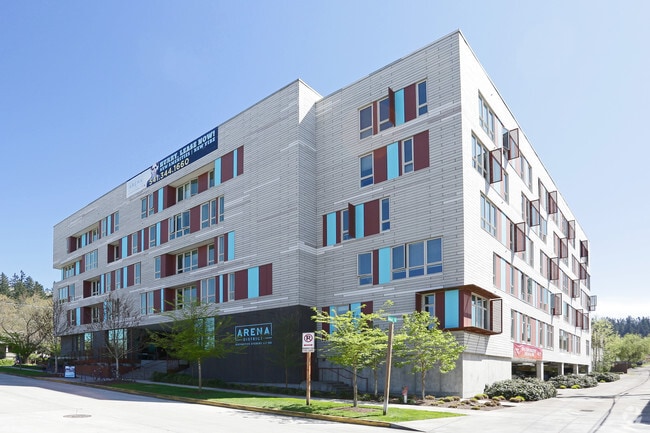


Property Detail
2050 E 15Th Ave
Eugene-Springfield, OR
SUBDIVISION PLAT FAIRMOUNT SQUARE LOT 1 TL 12600
1742640
Lane
Multifamilydwelling
Oregon
R-1
1
B and X Area of moderate flood hazard, usually the area between the limits of the 100-year and 500-year floods.
0.59 AC
2025
Fairmont
2025
Portland
003700
NEARBY LISTINGS FOR SALE OR LEASE
DEMOGRAPHICS near 2050 E 15Th Ave
1 mile
3 mile
5 mile
2025 Total Population
17,817
111,119
195,663
2030 Population
18,149
110,501
194,482
Pop Growth 2025-2030
+ 1.86%
(0.56%)
(0.60%)
Average Age
31
38
40
2025 Total Households
5,823
47,655
82,139
HH Growth 2025-2030
+ 2.20%
(0.69%)
(0.72%)
Median Household Inc
$42,492
$56,887
$67,100
Avg Household Size
2.20
2.10
2.20
2025 Avg HH Vehicles
2.00
2.00
2.00
Median Home Value
$694,117
$477,304
$467,582
Median Year Built
1987
1973
1975
Nearby Places
Map Layers
Map Styles
 Street
 Aerial
Transit
 Traffic
 Biking
Places
Listings with unknown addresses are not visible on the map
- Restaurants
- Banks
- Shops
- Fitness
- Groceries
PUBLIC TRANSPORTATION
COMMUTER RAIL
Drive
Walk
Distance
5 min
2.1 mi
AIRPORT
Mahlon Sweet Field
Drive
Walk
Distance
Mahlon Sweet Field
22 min
11.2 mi
Nearby Properties
Address
Land Use
TOTAL SIZE
Lot Size
Zoning
Address
Land Use
TOTAL SIZE
Lot Size
Zoning
110.25 AC
PL
Address
Land Use
TOTAL SIZE
Lot Size
Zoning
15.37 AC
PL
Address
Land Use
TOTAL SIZE
Lot Size
Zoning
71.87 AC
PL
Address
Land Use
TOTAL SIZE
Lot Size
Zoning
121.46 AC
E25
Address
Land Use
TOTAL SIZE
Lot Size
Zoning
1.56 AC
C-2
Address
Land Use
TOTAL SIZE
Lot Size
Zoning
1.86 AC
C-2
Address
Land Use
TOTAL SIZE
Lot Size
Zoning
24 AC
C-2
Address
Land Use
TOTAL SIZE
Lot Size
Zoning
13.82 AC
PL
Address
Land Use
TOTAL SIZE
Lot Size
Zoning
9.81 AC
C-2
Address
Land Use
TOTAL SIZE
Lot Size
Zoning
3.99 AC
I-3
Address
Land Use
TOTAL SIZE
Lot Size
Zoning
5.87 AC
C-2
Address
Land Use
TOTAL SIZE
Lot Size
Zoning
2.76 AC
C-3
Address
Land Use
TOTAL SIZE
Lot Size
Zoning
3.10 AC
S-WS
Address
Land Use
TOTAL SIZE
Lot Size
Zoning
2.56 AC
C-2
Address
Land Use
TOTAL SIZE
Lot Size
Zoning
1.23 AC
C-3
Address
Land Use
TOTAL SIZE
Lot Size
Zoning
16.80 AC
PL
Address
Land Use
TOTAL SIZE
Lot Size
Zoning
2.77 AC
C-2
Address
Land Use
TOTAL SIZE
Lot Size
Zoning
3.29 AC
S-RP
Address
Land Use
TOTAL SIZE
Lot Size
Zoning
1.21 AC
C-2
Address
Land Use
TOTAL SIZE
Lot Size
Zoning
14.54 AC
C-2
Address
Land Use
TOTAL SIZE
Lot Size
Zoning
2.15 AC
PL
Address
Land Use
TOTAL SIZE
Lot Size
Zoning
17.37 AC
AG
Address
Land Use
TOTAL SIZE
Lot Size
Zoning
25.78 AC
C-2
Address
Land Use
TOTAL SIZE
Lot Size
Zoning
4.31 AC
C-2
Address
Land Use
TOTAL SIZE
Lot Size
Zoning
Address
Land Use
TOTAL SIZE
Lot Size
Zoning
2.59 AC
C-2
Address
Land Use
TOTAL SIZE
Lot Size
Zoning
5.70 AC
R-1
Address
Land Use
TOTAL SIZE
Lot Size
Zoning
1.08 AC
C-2
Address
Land Use
TOTAL SIZE
Lot Size
Zoning
0.54 AC
C-2
Address
Land Use
TOTAL SIZE
Lot Size
Zoning
46.88 AC
PL
The World's #1 Commercial Real Estate Marketplace
Connect with us
© 2026 CoStar Group
The information above has been obtained from sources believed reliable. While we do not doubt its accuracy we have not verified it and make no guarantee, warranty or representation about it. It is your responsibility to independently confirm its accuracy and completeness. Any projections, opinions, assumptions, or estimates used are for example only and do not represent the current or future performance of the property. The value of this transaction to you depends on tax and other factors which should be evaluated by your tax, financial, and legal advisors. You and your advisors should conduct a careful, independent investigation of the property to determine to your satisfaction the suitability of the property for your needs.