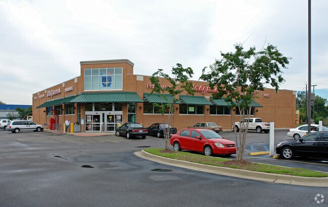
Property Record
2050 Government St, Mobile, AL 36606


Property Detail
2050 Government St
Mobile, AL
LOT 1 REGIONS AT THE LOOP MBK 98/16 #SEC 28 T4S R1W #MP29 10 28 2 002
29-10-28-2-002-001
Mobile
Storesoffices
Alabama
B and X Area of moderate flood hazard, usually the area between the limits of the 100-year and 500-year floods.
1
2025
2.07 AC
2025
Midtown
002501
Mobile
14,488 SF
NEARBY LISTINGS FOR SALE OR LEASE
DEMOGRAPHICS near 2050 Government St
1 mile
3 mile
5 mile
2025 Total Population
11,132
71,570
128,227
2030 Population
11,129
72,705
129,519
Pop Growth 2025-2030
(0.03%)
+ 1.59%
+ 1.01%
Average Age
41
40
40
2025 Total Households
4,875
30,497
53,113
HH Growth 2025-2030
(0.21%)
+ 1.47%
+ 0.95%
Median Household Inc
$69,558
$39,813
$43,225
Avg Household Size
2.20
2.20
2.30
2025 Avg HH Vehicles
2.00
1.00
2.00
Median Home Value
$217,677
$132,137
$143,711
Median Year Built
1951
1962
1965
Nearby Places
Map Layers
Map Styles
 Street
 Aerial
Layers
 Traffic
 Biking
Places
Listings with unknown addresses are not visible on the map
- Restaurants
- Banks
- Shops
- Fitness
- Groceries
PUBLIC TRANSPORTATION
AIRPORT
Mobile International
Drive
Walk
Distance
Mobile International
9 min
3.7 mi
Mobile Regional
Drive
Walk
Distance
Mobile Regional
24 min
10.7 mi
Freight Ports
Port of Mobile
Drive
Walk
Distance
Port of Mobile
9 min
3.7 mi
SALE & LEASE HISTORY
LISTING DATE
SALE/LEASE

Dec 19, 2017
For Sale
Nearby Properties
Address
Land Use
TOTAL SIZE
Lot Size
Zoning
Address
Land Use
TOTAL SIZE
Lot Size
Zoning
115,875 SF
144.02 AC
Address
Land Use
TOTAL SIZE
Lot Size
Zoning
171,670 SF
20.19 AC
Address
Land Use
TOTAL SIZE
Lot Size
Zoning
296,060 SF
40.49 AC
Address
Land Use
TOTAL SIZE
Lot Size
Zoning
339,141 SF
7.18 AC
Address
Land Use
TOTAL SIZE
Lot Size
Zoning
224,336 SF
2.43 AC
Address
Land Use
TOTAL SIZE
Lot Size
Zoning
141,209 SF
10.20 AC
Address
Land Use
TOTAL SIZE
Lot Size
Zoning
288,486 SF
16.32 AC
Address
Land Use
TOTAL SIZE
Lot Size
Zoning
32,556 SF
11.38 AC
Address
Land Use
TOTAL SIZE
Lot Size
Zoning
118,712 SF
9.90 AC
Address
Land Use
TOTAL SIZE
Lot Size
Zoning
359,478 SF
3.69 AC
Address
Land Use
TOTAL SIZE
Lot Size
Zoning
24,437 SF
32.74 AC
Address
Land Use
TOTAL SIZE
Lot Size
Zoning
169,511 SF
44.42 AC
Address
Land Use
TOTAL SIZE
Lot Size
Zoning
104,160 SF
2.20 AC
Address
Land Use
TOTAL SIZE
Lot Size
Zoning
139,460 SF
27.51 AC
Address
Land Use
TOTAL SIZE
Lot Size
Zoning
30,504 SF
16.45 AC
Address
Land Use
TOTAL SIZE
Lot Size
Zoning
106,800 SF
17.69 AC
Address
Land Use
TOTAL SIZE
Lot Size
Zoning
58,192 SF
1.81 AC
Address
Land Use
TOTAL SIZE
Lot Size
Zoning
91,391 SF
14.93 AC
Address
Land Use
TOTAL SIZE
Lot Size
Zoning
194,016 SF
10.74 AC
Address
Land Use
TOTAL SIZE
Lot Size
Zoning
102,380 SF
12.24 AC
Address
Land Use
TOTAL SIZE
Lot Size
Zoning
46,557 SF
14.66 AC
Address
Land Use
TOTAL SIZE
Lot Size
Zoning
30,972 SF
4.75 AC
Address
Land Use
TOTAL SIZE
Lot Size
Zoning
228,018 SF
4.80 AC
Address
Land Use
TOTAL SIZE
Lot Size
Zoning
568,560 SF
34.83 AC
Address
Land Use
TOTAL SIZE
Lot Size
Zoning
277,067 SF
93.54 AC
Address
Land Use
TOTAL SIZE
Lot Size
Zoning
34,016 SF
162.48 AC
Address
Land Use
TOTAL SIZE
Lot Size
Zoning
56,656 SF
13.61 AC
Address
Land Use
TOTAL SIZE
Lot Size
Zoning
9,104 SF
13.52 AC
Address
Land Use
TOTAL SIZE
Lot Size
Zoning
208,683 SF
11.68 AC
Address
Land Use
TOTAL SIZE
Lot Size
Zoning
29,448 SF
7.64 AC
The World's #1 Commercial Real Estate Marketplace
Connect with us
© 2026 CoStar Group
The information above has been obtained from sources believed reliable. While we do not doubt its accuracy we have not verified it and make no guarantee, warranty or representation about it. It is your responsibility to independently confirm its accuracy and completeness. Any projections, opinions, assumptions, or estimates used are for example only and do not represent the current or future performance of the property. The value of this transaction to you depends on tax and other factors which should be evaluated by your tax, financial, and legal advisors. You and your advisors should conduct a careful, independent investigation of the property to determine to your satisfaction the suitability of the property for your needs.