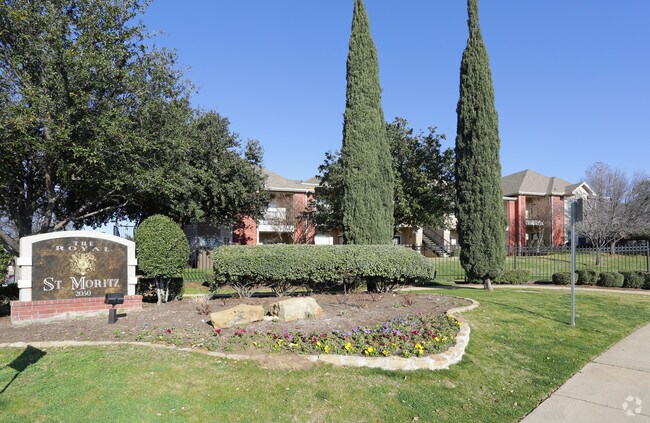
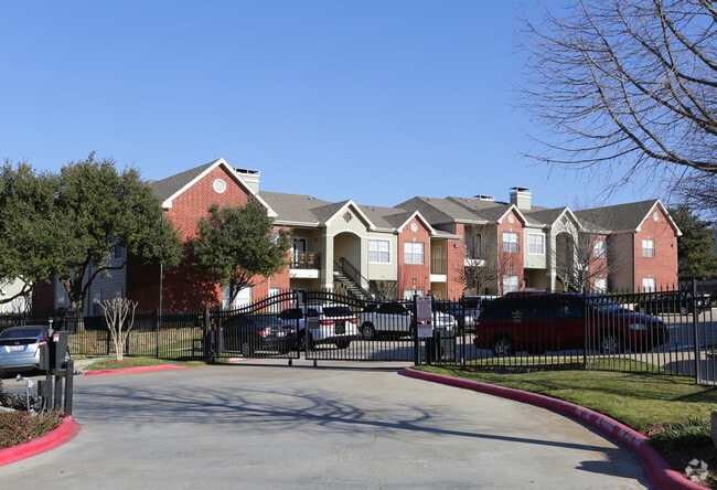
Property Record
2050 Grayson Dr, Grapevine, TX 76051


Property Detail
2050 Grayson Dr
Dallas-Fort Worth-Arlington, TX
ST MORITZ ADDITION BLOCK 1 LOT 1
06824943
Tarrant
Multifamilydwelling
Texas
A Areas with a 1% annual chance of flooding and a 26% chance of flooding over the life of a 30-year mortgage.
1
2024
18.20 AC
2025
Grapevine
113636
Dallas/Ft Worth
321,993 SF
NEARBY LISTINGS FOR SALE OR LEASE
-
-
View all Grapevine listings for sale on LoopNet.com
DEMOGRAPHICS near 2050 Grayson Dr
1 mile
3 mile
5 mile
2025 Total Population
9,331
64,799
158,034
2030 Population
9,768
68,101
165,718
Pop Growth 2025-2030
+ 4.68%
+ 5.10%
+ 4.86%
Average Age
37
40
41
2025 Total Households
3,708
24,523
60,820
HH Growth 2025-2030
+ 4.85%
+ 5.16%
+ 4.88%
Median Household Inc
$71,888
$129,123
$121,428
Avg Household Size
2.50
2.60
2.60
2025 Avg HH Vehicles
2.00
2.00
2.00
Median Home Value
$465,510
$642,931
$607,474
Median Year Built
1988
1992
1990
Nearby Places
Map Layers
Map Styles
 Street
 Aerial
Transit
 Traffic
 Biking
Places
Listings with unknown addresses are not visible on the map
- Restaurants
- Banks
- Shops
- Fitness
- Groceries
PUBLIC TRANSPORTATION
COMMUTER RAIL
Centreport Station (TRINITY RAILWAY - Dallas Area Rapid Transit (DART))
Drive
Walk
Distance
Centreport Station (TRINITY RAILWAY - Dallas Area Rapid Transit (DART))
13 min
8.5 mi
AIRPORT
Dallas-Fort Worth International
Drive
Walk
Distance
Dallas-Fort Worth International
11 min
7.0 mi
Dallas Love Field
Drive
Walk
Distance
Dallas Love Field
30 min
20.7 mi
Freight Ports
Port of Shreveport
Drive
Walk
Distance
Port of Shreveport
240 min
220.6 mi
Nearby Properties
Address
Land Use
TOTAL SIZE
Lot Size
Zoning
Address
Land Use
TOTAL SIZE
Lot Size
Zoning
624,642 SF
15.38 AC
Address
Land Use
TOTAL SIZE
Lot Size
Zoning
394,769 SF
20.39 AC
Address
Land Use
TOTAL SIZE
Lot Size
Zoning
394,769 SF
20.36 AC
Address
Land Use
TOTAL SIZE
Lot Size
Zoning
332,665 SF
9.83 AC
Address
Land Use
TOTAL SIZE
Lot Size
Zoning
630,765 SF
321.80 AC
Address
Land Use
TOTAL SIZE
Lot Size
Zoning
397,272 SF
12.35 AC
Address
Land Use
TOTAL SIZE
Lot Size
Zoning
360,898 SF
5.51 AC
Address
Land Use
TOTAL SIZE
Lot Size
Zoning
464,476 SF
5.08 AC
Address
Land Use
TOTAL SIZE
Lot Size
Zoning
401,397 SF
14.94 AC
Address
Land Use
TOTAL SIZE
Lot Size
Zoning
203,458 SF
16.58 AC
Address
Land Use
TOTAL SIZE
Lot Size
Zoning
264,000 SF
15.06 AC
Address
Land Use
TOTAL SIZE
Lot Size
Zoning
234,200 SF
274.75 AC
Address
Land Use
TOTAL SIZE
Lot Size
Zoning
270,453 SF
17.48 AC
Address
Land Use
TOTAL SIZE
Lot Size
Zoning
235,902 SF
16.20 AC
Address
Land Use
TOTAL SIZE
Lot Size
Zoning
305,047 SF
10.16 AC
Address
Land Use
TOTAL SIZE
Lot Size
Zoning
230,666 SF
13.33 AC
Address
Land Use
TOTAL SIZE
Lot Size
Zoning
300,000 SF
27.13 AC
Address
Land Use
TOTAL SIZE
Lot Size
Zoning
242,000 SF
3.72 AC
Address
Land Use
TOTAL SIZE
Lot Size
Zoning
150,510 SF
6.35 AC
Address
Land Use
TOTAL SIZE
Lot Size
Zoning
214,908 SF
13.55 AC
Address
Land Use
TOTAL SIZE
Lot Size
Zoning
196,350 SF
12.05 AC
Address
Land Use
TOTAL SIZE
Lot Size
Zoning
921,172 SF
105 AC
Address
Land Use
TOTAL SIZE
Lot Size
Zoning
177,093 SF
10.79 AC
Address
Land Use
TOTAL SIZE
Lot Size
Zoning
247,505 SF
32 AC
Address
Land Use
TOTAL SIZE
Lot Size
Zoning
306,052 SF
1.92 AC
Address
Land Use
TOTAL SIZE
Lot Size
Zoning
255,288 SF
10.57 AC
Address
Land Use
TOTAL SIZE
Lot Size
Zoning
99,780 SF
0.38 AC
Address
Land Use
TOTAL SIZE
Lot Size
Zoning
206,950 SF
12.13 AC
Address
Land Use
TOTAL SIZE
Lot Size
Zoning
886,100 SF
160 AC
The World's #1 Commercial Real Estate Marketplace
Connect with us
© 2026 CoStar Group
The information above has been obtained from sources believed reliable. While we do not doubt its accuracy we have not verified it and make no guarantee, warranty or representation about it. It is your responsibility to independently confirm its accuracy and completeness. Any projections, opinions, assumptions, or estimates used are for example only and do not represent the current or future performance of the property. The value of this transaction to you depends on tax and other factors which should be evaluated by your tax, financial, and legal advisors. You and your advisors should conduct a careful, independent investigation of the property to determine to your satisfaction the suitability of the property for your needs.