Property Record
2050 Lambs Rd, Charlottesville, VA 22901

NEARBY LISTINGS FOR SALE OR LEASE
-
-
View all Charlottesville listings for sale on LoopNet.com
Property Detail
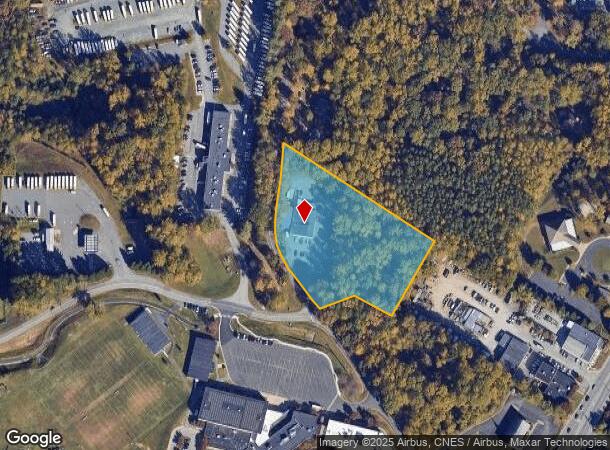
2050 Lambs Rd
06100-00-00-00500
ACREAGE
Distributionwarehouseregional
Albemarle
X
Virginia
51003C0260D
3.26 AC
2025
Charlottesville
2025
Other Market Areas
010802
Charlottesville, VA
6,299 SF
DEMOGRAPHICS near 2050 Lambs Rd
1 Mile
3 Mile
5 Mile
2024 Total Population
8,982
48,748
102,122
2029 Population
9,346
49,802
103,271
Pop Growth 2024-2029
+ 4.05%
+ 2.16%
+ 1.13%
Average Age
38
37
37
2024 Total Households
4,009
18,751
41,254
HH Growth 2024-2029
+ 4.44%
+ 2.49%
+ 1.25%
Median Household Inc
$60,680
$70,864
$78,223
Avg Household Size
2.10
2.20
2.20
2024 Avg HH Vehicles
2.00
2.00
2.00
Median Home Value
$251,200
$425,042
$420,705
Median Year Built
1983
1982
1983
Nearby Places
Map Layers
Map Styles
 Street
 Aerial
- Restaurants
- Banks
- Shops
- Fitness
- Groceries
PUBLIC TRANSPORTATION
COMMUTER RAIL
DRIVE
WALK
Distance
11 min
4.3 mi
AIRPORT
Charlottesville-Albemarle
DRIVE
WALK
Distance
Charlottesville-Albemarle
13 min
6.5 mi
Nearby Properties
Address
Land Use
TOTAL SIZE
Lot Size
Zoning
Address
Land Use
TOTAL SIZE
Lot Size
Zoning
13,125 SF
100.40 AC
R1 RESIDEN
Address
Land Use
TOTAL SIZE
Lot Size
Zoning
61,177 SF
30.40 AC
R1 RESIDEN
Address
Land Use
TOTAL SIZE
Lot Size
Zoning
34.70 AC
RURAL AREA
Address
Land Use
TOTAL SIZE
Lot Size
Zoning
497,658 SF
39.83 AC
NX-10
Address
Land Use
TOTAL SIZE
Lot Size
Zoning
3,465 SF
145.17 AC
CV
Address
Land Use
TOTAL SIZE
Lot Size
Zoning
254,749 SF
80.72 AC
CM
Address
Land Use
TOTAL SIZE
Lot Size
Zoning
62,900 SF
4.71 AC
NX-10
Address
Land Use
TOTAL SIZE
Lot Size
Zoning
12,180 SF
26.20 AC
RURAL AREA
Address
Land Use
TOTAL SIZE
Lot Size
Zoning
10,270 SF
3.59 AC
RX-5
Address
Land Use
TOTAL SIZE
Lot Size
Zoning
12,876 SF
32.70 AC
NEIGHBORHO
Address
Land Use
TOTAL SIZE
Lot Size
Zoning
393,960 SF
16.14 AC
NMD
Address
Land Use
TOTAL SIZE
Lot Size
Zoning
78,332 SF
33.82 AC
CM
Address
Land Use
TOTAL SIZE
Lot Size
Zoning
46,770 SF
216.69 AC
RURAL AREA
Address
Land Use
TOTAL SIZE
Lot Size
Zoning
Address
Land Use
TOTAL SIZE
Lot Size
Zoning
195,000 SF
11.16 AC
R1 RESIDEN
Address
Land Use
TOTAL SIZE
Lot Size
Zoning
1.38 AC
CX-3
Address
Land Use
TOTAL SIZE
Lot Size
Zoning
263,304 SF
9.77 AC
R15 RESIDE
Address
Land Use
TOTAL SIZE
Lot Size
Zoning
226,576 SF
2.72 AC
Address
Land Use
TOTAL SIZE
Lot Size
Zoning
1,872 SF
2.15 AC
CM
Address
Land Use
TOTAL SIZE
Lot Size
Zoning
5,136 SF
4.27 AC
RX-5
Address
Land Use
TOTAL SIZE
Lot Size
Zoning
249,740 SF
42.40 AC
CM
Address
Land Use
TOTAL SIZE
Lot Size
Zoning
167.59 AC
R1 RESIDEN
Address
Land Use
TOTAL SIZE
Lot Size
Zoning
288,555 SF
30.98 AC
PDSC
Address
Land Use
TOTAL SIZE
Lot Size
Zoning
16,000 SF
29.86 AC
R1 RESIDEN
Address
Land Use
TOTAL SIZE
Lot Size
Zoning
53,436 SF
13.09 AC
LIGHT INDU
Address
Land Use
TOTAL SIZE
Lot Size
Zoning
100 SF
19 AC
RURAL AREA
Address
Land Use
TOTAL SIZE
Lot Size
Zoning
103,624 SF
9.49 AC
NX-10
Address
Land Use
TOTAL SIZE
Lot Size
Zoning
62,547 SF
271.10 AC
RURAL AREA
Address
Land Use
TOTAL SIZE
Lot Size
Zoning
281,480 SF
5.35 AC
CM
Address
Land Use
TOTAL SIZE
Lot Size
Zoning
366,877 SF
25.42 AC
LIGHT INDU
The World's #1 Commercial Real Estate Marketplace
Connect with us
© 2026 CoStar Group
The information above has been obtained from sources believed reliable. While we do not doubt its accuracy we have not verified it and make no guarantee, warranty or representation about it. It is your responsibility to independently confirm its accuracy and completeness. Any projections, opinions, assumptions, or estimates used are for example only and do not represent the current or future performance of the property. The value of this transaction to you depends on tax and other factors which should be evaluated by your tax, financial, and legal advisors. You and your advisors should conduct a careful, independent investigation of the property to determine to your satisfaction the suitability of the property for your needs.