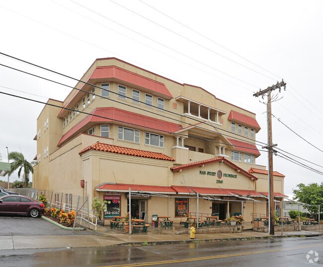
Property Record
2050 Main St, Wailuku, HI 96793

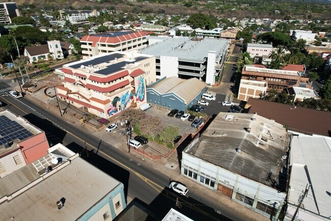

NEARBY LISTINGS FOR SALE OR LEASE
Property Detail
2050 Main St
Kahului-Wailuku-Lahaina, HI
Wailuku Promenade Consolidation - Land C
2-3-4-013-096-0000
2ND: LOT 3-B 14,009 SF NO DES MAP 4 LCAPP 1142
Commercialnec
Maui
X
Hawaii
1500030391E
4,5
2024
0.32 AC
2025
West Maui
030901
Hawaii
28,012 SF
DEMOGRAPHICS near 2050 Main St
1 Mile
3 Mile
5 Mile
2024 Total Population
12,710
53,460
53,997
2029 Population
12,667
52,432
52,952
Pop Growth 2024-2029
(0.34%)
(1.92%)
(1.94%)
Average Age
40
40
40
2024 Total Households
4,170
15,486
15,631
HH Growth 2024-2029
(1.06%)
(2.55%)
(2.57%)
Median Household Inc
$69,832
$81,347
$81,511
Avg Household Size
2.80
3.20
3.20
2024 Avg HH Vehicles
2.00
2.00
2.00
Median Home Value
$676,832
$673,273
$672,316
Median Year Built
1992
1986
1986
Nearby Places
Map Layers
Map Styles
 Street
 Aerial
- Restaurants
- Banks
- Shops
- Fitness
- Groceries
PUBLIC TRANSPORTATION
AIRPORT
Kahului
DRIVE
WALK
Distance
Kahului
17 min
6.9 mi
SALE & LEASE HISTORY
LISTING DATE
SALE/LEASE

Sep 25, 2016
For Lease
Sep 23, 2016
For Sale
Nov 15, 2023
For Sale
Nov 03, 2017
For Lease
Jan 31, 2023
For Lease
Jan 17, 2019
For Lease
Nearby Properties
Address
Land Use
TOTAL SIZE
Lot Size
Zoning
Address
Land Use
TOTAL SIZE
Lot Size
Zoning
14.34 AC
500
Address
Land Use
TOTAL SIZE
Lot Size
Zoning
191,252 SF
25.37 AC
420
Address
Land Use
TOTAL SIZE
Lot Size
Zoning
43,434 SF
13.89 AC
410
Address
Land Use
TOTAL SIZE
Lot Size
Zoning
103,221 SF
12.93 AC
720
Address
Land Use
TOTAL SIZE
Lot Size
Zoning
5.11 AC
Address
Land Use
TOTAL SIZE
Lot Size
Zoning
19.54 AC
720
Address
Land Use
TOTAL SIZE
Lot Size
Zoning
72,457 SF
2.96 AC
320
Address
Land Use
TOTAL SIZE
Lot Size
Zoning
24,848 SF
11.41 AC
500
Address
Land Use
TOTAL SIZE
Lot Size
Zoning
552,589 SF
24.60 AC
420
Address
Land Use
TOTAL SIZE
Lot Size
Zoning
81,702 SF
4.40 AC
Address
Land Use
TOTAL SIZE
Lot Size
Zoning
72,377 SF
6.06 AC
720
Address
Land Use
TOTAL SIZE
Lot Size
Zoning
1.83 AC
Address
Land Use
TOTAL SIZE
Lot Size
Zoning
16.75 AC
320
Address
Land Use
TOTAL SIZE
Lot Size
Zoning
94,025 SF
0.84 AC
370
Address
Land Use
TOTAL SIZE
Lot Size
Zoning
69,340 SF
5.33 AC
320
Address
Land Use
TOTAL SIZE
Lot Size
Zoning
103,520 SF
4.50 AC
720
Address
Land Use
TOTAL SIZE
Lot Size
Zoning
2.01 AC
Address
Land Use
TOTAL SIZE
Lot Size
Zoning
42,501 SF
2.59 AC
420
Address
Land Use
TOTAL SIZE
Lot Size
Zoning
191,383 SF
12.82 AC
420
Address
Land Use
TOTAL SIZE
Lot Size
Zoning
82,080 SF
3.23 AC
320
Address
Land Use
TOTAL SIZE
Lot Size
Zoning
144,700 SF
7.69 AC
410
Address
Land Use
TOTAL SIZE
Lot Size
Zoning
Address
Land Use
TOTAL SIZE
Lot Size
Zoning
42,672 SF
4.50 AC
720
Address
Land Use
TOTAL SIZE
Lot Size
Zoning
117,800 SF
6.21 AC
420
Address
Land Use
TOTAL SIZE
Lot Size
Zoning
58,034 SF
1.56 AC
320
Address
Land Use
TOTAL SIZE
Lot Size
Zoning
10.52 AC
120
Address
Land Use
TOTAL SIZE
Lot Size
Zoning
53,632 SF
9.10 AC
420
Address
Land Use
TOTAL SIZE
Lot Size
Zoning
45,466 SF
2.71 AC
420
Address
Land Use
TOTAL SIZE
Lot Size
Zoning
26,036 SF
3.24 AC
420
Address
Land Use
TOTAL SIZE
Lot Size
Zoning
128,404 SF
10.50 AC
420
The World's #1 Commercial Real Estate Marketplace
Connect with us
© 2025 CoStar Group
The information above has been obtained from sources believed reliable. While we do not doubt its accuracy we have not verified it and make no guarantee, warranty or representation about it. It is your responsibility to independently confirm its accuracy and completeness. Any projections, opinions, assumptions, or estimates used are for example only and do not represent the current or future performance of the property. The value of this transaction to you depends on tax and other factors which should be evaluated by your tax, financial, and legal advisors. You and your advisors should conduct a careful, independent investigation of the property to determine to your satisfaction the suitability of the property for your needs.