Property Record
2050 N State Highway 360, Grand Prairie, TX 75050
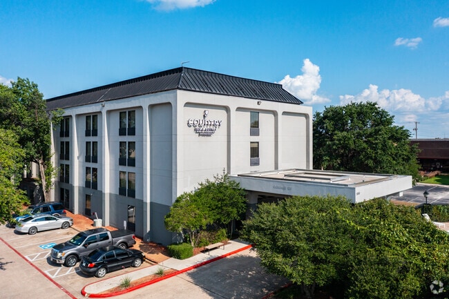

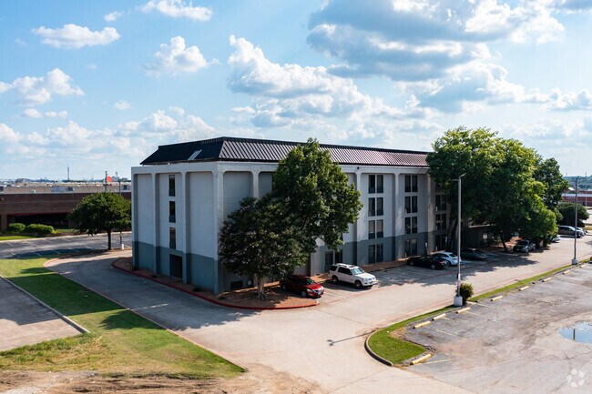
Property Detail
2050 N State Highway 360
Dallas-Fort Worth-Arlington, TX
GSID COMM #5 INST #3 BLOCK 1 LOT 1 SITE 11 TR B PARCEL 1
05949440
Tarrant
Commercialnec
Texas
B and X Area of moderate flood hazard, usually the area between the limits of the 100-year and 500-year floods.
1
2024
1.48 AC
2025
Arlington
113003
Dallas/Ft Worth
57,069 SF
NEARBY LISTINGS FOR SALE OR LEASE
-
-
View all Grand Prairie listings for sale on LoopNet.com
DEMOGRAPHICS near 2050 N State Highway 360
1 mile
3 mile
5 mile
2025 Total Population
14,097
82,463
249,899
2030 Population
14,787
87,032
261,803
Pop Growth 2025-2030
+ 4.89%
+ 5.54%
+ 4.76%
Average Age
34
36
36
2025 Total Households
7,086
38,051
97,140
HH Growth 2025-2030
+ 5.12%
+ 5.50%
+ 4.91%
Median Household Inc
$65,475
$64,241
$61,913
Avg Household Size
2.00
2.10
2.50
2025 Avg HH Vehicles
2.00
2.00
2.00
Median Home Value
$391,747
$363,971
$296,540
Median Year Built
1988
1987
1983
Nearby Places
Map Layers
Map Styles
 Street
 Aerial
Transit
 Traffic
 Biking
Places
Listings with unknown addresses are not visible on the map
- Restaurants
- Banks
- Shops
- Fitness
- Groceries
PUBLIC TRANSPORTATION
COMMUTER RAIL
Drive
Walk
Distance
8 min
3.7 mi
Drive
Walk
Distance
13 min
4.5 mi
AIRPORT
Dallas-Fort Worth International
Drive
Walk
Distance
Dallas-Fort Worth International
17 min
9.9 mi
Dallas Love Field
Drive
Walk
Distance
Dallas Love Field
28 min
18.7 mi
Nearby Properties
Address
Land Use
TOTAL SIZE
Lot Size
Zoning
Address
Land Use
TOTAL SIZE
Lot Size
Zoning
1,400,000 SF
15.30 AC
Address
Land Use
TOTAL SIZE
Lot Size
Zoning
3,204,300 SF
124.04 AC
Address
Land Use
TOTAL SIZE
Lot Size
Zoning
378,182 SF
5.02 AC
Address
Land Use
TOTAL SIZE
Lot Size
Zoning
287,560 SF
3.28 AC
Address
Land Use
TOTAL SIZE
Lot Size
Zoning
467,694 SF
24.03 AC
Address
Land Use
TOTAL SIZE
Lot Size
Zoning
458,819 SF
15.88 AC
Address
Land Use
TOTAL SIZE
Lot Size
Zoning
516,974 SF
23.81 AC
Address
Land Use
TOTAL SIZE
Lot Size
Zoning
485,911 SF
54.76 AC
Address
Land Use
TOTAL SIZE
Lot Size
Zoning
521,200 SF
7.99 AC
Address
Land Use
TOTAL SIZE
Lot Size
Zoning
548,095 SF
7.19 AC
Address
Land Use
TOTAL SIZE
Lot Size
Zoning
522,294 SF
18.35 AC
Address
Land Use
TOTAL SIZE
Lot Size
Zoning
1,261,810 SF
80.53 AC
Address
Land Use
TOTAL SIZE
Lot Size
Zoning
294,296 SF
12.08 AC
Address
Land Use
TOTAL SIZE
Lot Size
Zoning
324,303 SF
23.15 AC
Address
Land Use
TOTAL SIZE
Lot Size
Zoning
450,535 SF
27.23 AC
Address
Land Use
TOTAL SIZE
Lot Size
Zoning
139,821 SF
Address
Land Use
TOTAL SIZE
Lot Size
Zoning
342,583 SF
23.87 AC
Address
Land Use
TOTAL SIZE
Lot Size
Zoning
339,965 SF
15.59 AC
Address
Land Use
TOTAL SIZE
Lot Size
Zoning
358,350 SF
13.15 AC
Address
Land Use
TOTAL SIZE
Lot Size
Zoning
576,000 SF
55.36 AC
Z123
Address
Land Use
TOTAL SIZE
Lot Size
Zoning
539,000 SF
3.91 AC
Address
Land Use
TOTAL SIZE
Lot Size
Zoning
300,915 SF
24.90 AC
Address
Land Use
TOTAL SIZE
Lot Size
Zoning
285,194 SF
15.91 AC
Address
Land Use
TOTAL SIZE
Lot Size
Zoning
313,349 SF
15.39 AC
Address
Land Use
TOTAL SIZE
Lot Size
Zoning
520,000 SF
28.92 AC
Z123
Address
Land Use
TOTAL SIZE
Lot Size
Zoning
345,216 SF
21.64 AC
Address
Land Use
TOTAL SIZE
Lot Size
Zoning
137,878 SF
189.88 AC
Address
Land Use
TOTAL SIZE
Lot Size
Zoning
334,660 SF
17.59 AC
Address
Land Use
TOTAL SIZE
Lot Size
Zoning
253,710 SF
11.50 AC
Address
Land Use
TOTAL SIZE
Lot Size
Zoning
500,256 SF
25.64 AC
Z123
The World's #1 Commercial Real Estate Marketplace
Connect with us
© 2026 CoStar Group
The information above has been obtained from sources believed reliable. While we do not doubt its accuracy we have not verified it and make no guarantee, warranty or representation about it. It is your responsibility to independently confirm its accuracy and completeness. Any projections, opinions, assumptions, or estimates used are for example only and do not represent the current or future performance of the property. The value of this transaction to you depends on tax and other factors which should be evaluated by your tax, financial, and legal advisors. You and your advisors should conduct a careful, independent investigation of the property to determine to your satisfaction the suitability of the property for your needs.