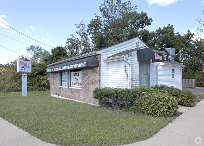
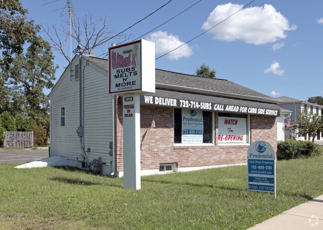
Property Record
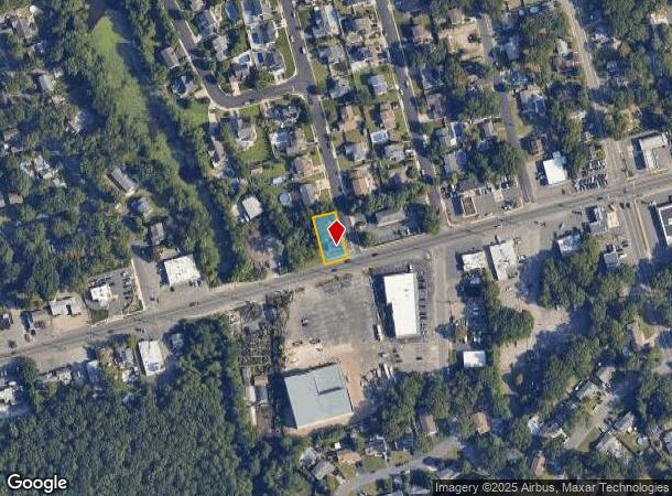
2050 Route 88, Brick, NJ 08724
NEARBY LISTINGS FOR SALE OR LEASE
Property Detail
2050 Route 88
New York-Jersey City-White Plains, NY-NJ
Point Pleasant Manor Sec C
07-01032-01-00002
50X125
Commercialnec
Ocean
X
New Jersey
34025C0455F
2
2024
0.14 AC
2025
Ocean County
713000
Northern New Jersey
764 SF
DEMOGRAPHICS near 2050 Route 88
1 Mile
3 Mile
5 Mile
2024 Total Population
9,814
80,913
166,266
2029 Population
10,361
85,608
175,109
Pop Growth 2024-2029
+ 5.57%
+ 5.80%
+ 5.32%
Average Age
42
42
42
2024 Total Households
3,827
31,415
63,523
HH Growth 2024-2029
+ 4.96%
+ 5.25%
+ 5.06%
Median Household Inc
$82,239
$90,531
$91,053
Avg Household Size
2.50
2.50
2.50
2024 Avg HH Vehicles
2.00
2.00
2.00
Median Home Value
$353,724
$360,333
$383,701
Median Year Built
1972
1973
1975
Nearby Places
Map Layers
Map Styles
 Street
 Aerial
- Restaurants
- Banks
- Shops
- Fitness
- Groceries
PUBLIC TRANSPORTATION
COMMUTER RAIL
Bay Head (North Jersey Coast Line - NJ Transit Commuter Rail (NJ Transit))
DRIVE
WALK
Distance
Bay Head (North Jersey Coast Line - NJ Transit Commuter Rail (NJ Transit))
8 min
3.8 mi
Point Pleasant Beach (North Jersey Coast Line - NJ Transit Commuter Rail (NJ Transit))
DRIVE
WALK
Distance
Point Pleasant Beach (North Jersey Coast Line - NJ Transit Commuter Rail (NJ Transit))
7 min
4.2 mi
Freight Ports
New York Container Terminal
DRIVE
WALK
Distance
New York Container Terminal
69 min
51.3 mi
Nearby Properties
Address
Land Use
TOTAL SIZE
Lot Size
Zoning
Address
Land Use
TOTAL SIZE
Lot Size
Zoning
50.10 AC
C
Address
Land Use
TOTAL SIZE
Lot Size
Zoning
45.53 AC
B3
Address
Land Use
TOTAL SIZE
Lot Size
Zoning
22.88 AC
HS
Address
Land Use
TOTAL SIZE
Lot Size
Zoning
21,850 SF
30.98 AC
R-1A
Address
Land Use
TOTAL SIZE
Lot Size
Zoning
29.34 AC
B4
Address
Land Use
TOTAL SIZE
Lot Size
Zoning
25.22 AC
B3
Address
Land Use
TOTAL SIZE
Lot Size
Zoning
34,337 SF
99.30 AC
R-1
Address
Land Use
TOTAL SIZE
Lot Size
Zoning
49.57 AC
RR1
Address
Land Use
TOTAL SIZE
Lot Size
Zoning
26.37 AC
R75
Address
Land Use
TOTAL SIZE
Lot Size
Zoning
30 AC
RR1
Address
Land Use
TOTAL SIZE
Lot Size
Zoning
39.84 AC
OPT
Address
Land Use
TOTAL SIZE
Lot Size
Zoning
26.43 AC
B3
Address
Land Use
TOTAL SIZE
Lot Size
Zoning
3,792 SF
7.64 AC
R-1A
Address
Land Use
TOTAL SIZE
Lot Size
Zoning
11.83 AC
B3
Address
Land Use
TOTAL SIZE
Lot Size
Zoning
9,429 SF
9.12 AC
B3
Address
Land Use
TOTAL SIZE
Lot Size
Zoning
63,136 SF
10.31 AC
R-1A
Address
Land Use
TOTAL SIZE
Lot Size
Zoning
47.75 AC
RR2
Address
Land Use
TOTAL SIZE
Lot Size
Zoning
14.38 AC
B3
Address
Land Use
TOTAL SIZE
Lot Size
Zoning
32.50 AC
RM
Address
Land Use
TOTAL SIZE
Lot Size
Zoning
18.39 AC
B3
Address
Land Use
TOTAL SIZE
Lot Size
Zoning
194,670 SF
22 AC
M1
Address
Land Use
TOTAL SIZE
Lot Size
Zoning
10.84 AC
RM
Address
Land Use
TOTAL SIZE
Lot Size
Zoning
5,121 SF
26.15 AC
B3
Address
Land Use
TOTAL SIZE
Lot Size
Zoning
149,402 SF
9.79 AC
M1
Address
Land Use
TOTAL SIZE
Lot Size
Zoning
7.32 AC
RM
Address
Land Use
TOTAL SIZE
Lot Size
Zoning
5.09 AC
HS
Address
Land Use
TOTAL SIZE
Lot Size
Zoning
13.15 AC
B3
Address
Land Use
TOTAL SIZE
Lot Size
Zoning
21.36 AC
RM
Address
Land Use
TOTAL SIZE
Lot Size
Zoning
16.85 AC
B2
Address
Land Use
TOTAL SIZE
Lot Size
Zoning
40.43 AC
R-1
The World's #1 Commercial Real Estate Marketplace
Connect with us
© 2025 CoStar Group
The information above has been obtained from sources believed reliable. While we do not doubt its accuracy we have not verified it and make no guarantee, warranty or representation about it. It is your responsibility to independently confirm its accuracy and completeness. Any projections, opinions, assumptions, or estimates used are for example only and do not represent the current or future performance of the property. The value of this transaction to you depends on tax and other factors which should be evaluated by your tax, financial, and legal advisors. You and your advisors should conduct a careful, independent investigation of the property to determine to your satisfaction the suitability of the property for your needs.