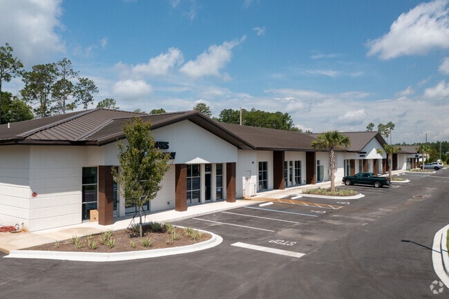
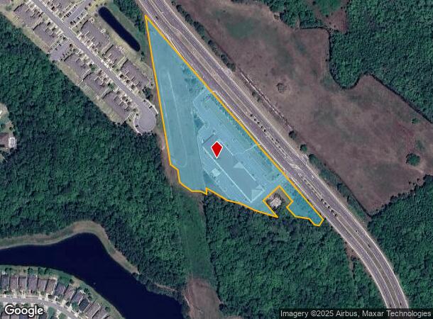
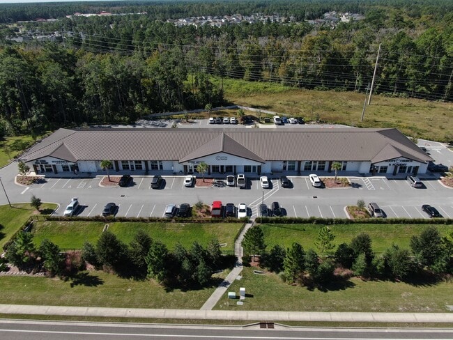
Property Record
2050 Saint Johns Pkwy, Saint Johns, FL 32259
Current Lease Availabilities
NEARBY LISTINGS FOR SALE OR LEASE
Property Detail
2050 Saint Johns Pkwy
023630-0090
2-9 PT OF SECS 7 & 6 LYING W OF RUSSELL SAMPSON RD - FOURTH DEED PARCEL (EX JEA LIFT STATION IN OR2900/859) (EX PT TO DURBIN CROSSING CDD IN OR3045/1877) OR2036/1084 & 4293/1440 & 4729/383(Q/C)
Commercialnec
St. Johns
AE
Florida
12109C0160J
2-9
2023
5.75 AC
2025
St Johns County
020808
Jacksonville (Florida)
23,842 SF
Jacksonville, FL
DEMOGRAPHICS near 2050 Saint Johns Pkwy
1 Mile
3 Mile
5 Mile
2024 Total Population
4,308
45,009
110,422
2029 Population
5,753
55,615
137,781
Pop Growth 2024-2029
+ 33.54%
+ 23.56%
+ 24.78%
Average Age
34
36
37
2024 Total Households
1,264
15,340
37,993
HH Growth 2024-2029
+ 33.39%
+ 21.30%
+ 23.17%
Median Household Inc
$155,667
$127,465
$116,792
Avg Household Size
3.40
2.90
2.90
2024 Avg HH Vehicles
2.00
2.00
2.00
Median Home Value
$447,644
$391,663
$386,254
Median Year Built
2011
2010
2010
Nearby Places
Map Layers
Map Styles
 Street
 Aerial
- Restaurants
- Banks
- Shops
- Fitness
- Groceries
PUBLIC TRANSPORTATION
AIRPORT
Jacksonville International
DRIVE
WALK
Distance
Jacksonville International
47 min
36.0 mi
Freight Ports
Jacksonville Port
DRIVE
WALK
Distance
Jacksonville Port
35 min
24.9 mi
Nearby Properties
Address
Land Use
TOTAL SIZE
Lot Size
Zoning
Address
Land Use
TOTAL SIZE
Lot Size
Zoning
534,591 SF
39.81 AC
PUD
Address
Land Use
TOTAL SIZE
Lot Size
Zoning
470,627 SF
21.61 AC
PUD
Address
Land Use
TOTAL SIZE
Lot Size
Zoning
450,888 SF
27.01 AC
PUD
Address
Land Use
TOTAL SIZE
Lot Size
Zoning
381,269 SF
25.73 AC
PUD
Address
Land Use
TOTAL SIZE
Lot Size
Zoning
211,499 SF
74.05 AC
Address
Land Use
TOTAL SIZE
Lot Size
Zoning
340,852 SF
19.65 AC
PUD
Address
Land Use
TOTAL SIZE
Lot Size
Zoning
311,304 SF
18.93 AC
PUD
Address
Land Use
TOTAL SIZE
Lot Size
Zoning
371,039 SF
20.63 AC
Address
Land Use
TOTAL SIZE
Lot Size
Zoning
241,882 SF
10.83 AC
PUD
Address
Land Use
TOTAL SIZE
Lot Size
Zoning
427,236 SF
69.60 AC
PUD
Address
Land Use
TOTAL SIZE
Lot Size
Zoning
378,384 SF
21 AC
Address
Land Use
TOTAL SIZE
Lot Size
Zoning
153,270 SF
15.96 AC
OR
Address
Land Use
TOTAL SIZE
Lot Size
Zoning
288,257 SF
16.56 AC
Address
Land Use
TOTAL SIZE
Lot Size
Zoning
289,228 SF
38.96 AC
Address
Land Use
TOTAL SIZE
Lot Size
Zoning
233,849 SF
101.31 AC
OR
Address
Land Use
TOTAL SIZE
Lot Size
Zoning
171,277 SF
7.36 AC
PUD
Address
Land Use
TOTAL SIZE
Lot Size
Zoning
148,628 SF
8.91 AC
Address
Land Use
TOTAL SIZE
Lot Size
Zoning
158,388 SF
33.46 AC
OR
Address
Land Use
TOTAL SIZE
Lot Size
Zoning
84,096 SF
12.75 AC
OR
Address
Land Use
TOTAL SIZE
Lot Size
Zoning
45.39 AC
Address
Land Use
TOTAL SIZE
Lot Size
Zoning
79,647 SF
13.02 AC
Address
Land Use
TOTAL SIZE
Lot Size
Zoning
78,903 SF
22.19 AC
Address
Land Use
TOTAL SIZE
Lot Size
Zoning
191,230 SF
17.62 AC
Address
Land Use
TOTAL SIZE
Lot Size
Zoning
54,544 SF
12.20 AC
PUD
Address
Land Use
TOTAL SIZE
Lot Size
Zoning
123,398 SF
25.30 AC
PUD
Address
Land Use
TOTAL SIZE
Lot Size
Zoning
70,936 SF
8.88 AC
PUD
Address
Land Use
TOTAL SIZE
Lot Size
Zoning
64,525 SF
6.91 AC
PUD
Address
Land Use
TOTAL SIZE
Lot Size
Zoning
80,540 SF
15.46 AC
PUD
Address
Land Use
TOTAL SIZE
Lot Size
Zoning
22,271 SF
11.29 AC
PUD
Address
Land Use
TOTAL SIZE
Lot Size
Zoning
23,892 SF
17.83 AC
The World's #1 Commercial Real Estate Marketplace
Connect with us
© 2026 CoStar Group
The information above has been obtained from sources believed reliable. While we do not doubt its accuracy we have not verified it and make no guarantee, warranty or representation about it. It is your responsibility to independently confirm its accuracy and completeness. Any projections, opinions, assumptions, or estimates used are for example only and do not represent the current or future performance of the property. The value of this transaction to you depends on tax and other factors which should be evaluated by your tax, financial, and legal advisors. You and your advisors should conduct a careful, independent investigation of the property to determine to your satisfaction the suitability of the property for your needs.