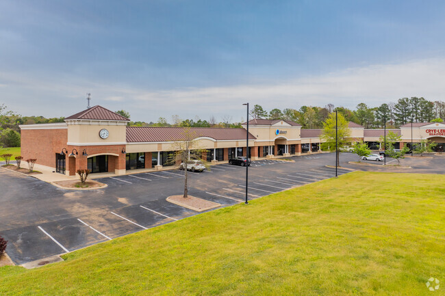
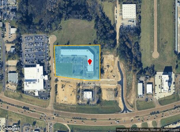
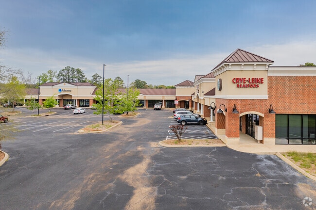
Property Record
2050 Treetops Blvd, Flowood, MS 39232
NEARBY LISTINGS FOR SALE OR LEASE
Property Detail
2050 Treetops Blvd
E10K-000012-00030
APPROX 4.462 AC IN LOT 6 N OF HWY 25
Professionalbldglegalinsurancerealestateetc
Rankin
AE
Mississippi
28121C0178G
6
2024
4.46 AC
2024
Brandon/Flowood/Pearl
020304
Jackson
38,802 SF
Jackson, MS
DEMOGRAPHICS near 2050 Treetops Blvd
1 Mile
3 Mile
5 Mile
2024 Total Population
988
17,904
89,510
2029 Population
998
17,301
87,391
Pop Growth 2024-2029
+ 1.01%
(3.37%)
(2.37%)
Average Age
35
39
39
2024 Total Households
594
7,874
39,338
HH Growth 2024-2029
+ 1.18%
(3.37%)
(2.55%)
Median Household Inc
$50,702
$65,689
$46,330
Avg Household Size
1.60
2.20
2.20
2024 Avg HH Vehicles
2.00
2.00
2.00
Median Home Value
$333,333
$240,245
$157,106
Median Year Built
1988
1972
1973
Nearby Places
Map Layers
Map Styles
 Street
 Aerial
- Restaurants
- Banks
- Shops
- Fitness
- Groceries
PUBLIC TRANSPORTATION
COMMUTER RAIL
Jackson (City of New Orleans - Amtrak)
DRIVE
WALK
Distance
Jackson (City of New Orleans - Amtrak)
10 min
6.5 mi
AIRPORT
Jackson-Medgar Wiley Evers International
DRIVE
WALK
Distance
Jackson-Medgar Wiley Evers International
15 min
7.2 mi
Freight Ports
Port of Greater Baton Rouge
DRIVE
WALK
Distance
Port of Greater Baton Rouge
204 min
182.8 mi
SALE & LEASE HISTORY
LISTING DATE
SALE/LEASE

Sep 25, 2016
For Lease
Jan 30, 2023
For Sale
Nearby Properties
Address
Land Use
TOTAL SIZE
Lot Size
Zoning
Address
Land Use
TOTAL SIZE
Lot Size
Zoning
14,236 SF
7.38 AC
Address
Land Use
TOTAL SIZE
Lot Size
Zoning
48,134 SF
6.62 AC
Address
Land Use
TOTAL SIZE
Lot Size
Zoning
7,561 SF
153.82 AC
Address
Land Use
TOTAL SIZE
Lot Size
Zoning
117,983 SF
7.01 AC
Address
Land Use
TOTAL SIZE
Lot Size
Zoning
19,639 SF
4.07 AC
Address
Land Use
TOTAL SIZE
Lot Size
Zoning
236.80 AC
Address
Land Use
TOTAL SIZE
Lot Size
Zoning
33,960 SF
19,602 AC
Address
Land Use
TOTAL SIZE
Lot Size
Zoning
121,590 SF
Address
Land Use
TOTAL SIZE
Lot Size
Zoning
6,639 SF
35.63 AC
Address
Land Use
TOTAL SIZE
Lot Size
Zoning
125,008 SF
18 AC
Address
Land Use
TOTAL SIZE
Lot Size
Zoning
30,925 SF
38.73 AC
Address
Land Use
TOTAL SIZE
Lot Size
Zoning
59,840 SF
2.72 AC
Address
Land Use
TOTAL SIZE
Lot Size
Zoning
64,949 SF
3 AC
Address
Land Use
TOTAL SIZE
Lot Size
Zoning
81,649 SF
5.60 AC
Address
Land Use
TOTAL SIZE
Lot Size
Zoning
1,787 SF
16.82 AC
Address
Land Use
TOTAL SIZE
Lot Size
Zoning
40.72 AC
Address
Land Use
TOTAL SIZE
Lot Size
Zoning
74,153 SF
4.52 AC
Address
Land Use
TOTAL SIZE
Lot Size
Zoning
67,575 SF
3 AC
Address
Land Use
TOTAL SIZE
Lot Size
Zoning
5,354 SF
0.68 AC
Address
Land Use
TOTAL SIZE
Lot Size
Zoning
66,102 SF
6.21 AC
Address
Land Use
TOTAL SIZE
Lot Size
Zoning
15,115 SF
2.48 AC
Address
Land Use
TOTAL SIZE
Lot Size
Zoning
230,401 SF
643,381.54 AC
Address
Land Use
TOTAL SIZE
Lot Size
Zoning
90,610 SF
Address
Land Use
TOTAL SIZE
Lot Size
Zoning
4.38 AC
Address
Land Use
TOTAL SIZE
Lot Size
Zoning
20.54 AC
Address
Land Use
TOTAL SIZE
Lot Size
Zoning
15,645 SF
1.10 AC
Address
Land Use
TOTAL SIZE
Lot Size
Zoning
2,457 SF
11.42 AC
Address
Land Use
TOTAL SIZE
Lot Size
Zoning
23,589 SF
110,808.08 AC
The World's #1 Commercial Real Estate Marketplace
Connect with us
© 2025 CoStar Group
The information above has been obtained from sources believed reliable. While we do not doubt its accuracy we have not verified it and make no guarantee, warranty or representation about it. It is your responsibility to independently confirm its accuracy and completeness. Any projections, opinions, assumptions, or estimates used are for example only and do not represent the current or future performance of the property. The value of this transaction to you depends on tax and other factors which should be evaluated by your tax, financial, and legal advisors. You and your advisors should conduct a careful, independent investigation of the property to determine to your satisfaction the suitability of the property for your needs.