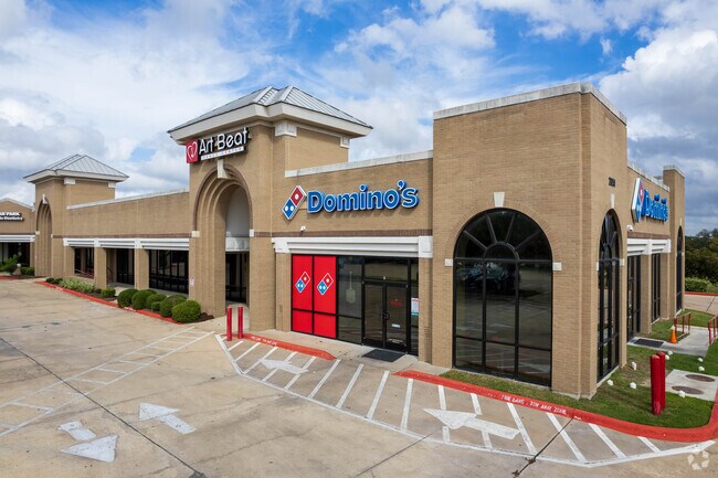
Property Record
2051 Cypress Creek Rd, Cedar Park, TX 78613

Property Detail
2051 Cypress Creek Rd
Austin-Round Rock-San Marcos, TX
S7944 - CYPRESS BEND SEC 3 RESUB, BLOCK A, LOT 1-A, ACRES 4.491
R427518
Williamson
Commercialnec
Texas
B and X Area of moderate flood hazard, usually the area between the limits of the 100-year and 500-year floods.
1-a
2024
4.49 AC
2025
Cedar Park
020326
Austin
34,662 SF
NEARBY LISTINGS FOR SALE OR LEASE
DEMOGRAPHICS near 2051 Cypress Creek Rd
1 mile
3 mile
5 mile
2025 Total Population
14,809
75,492
190,205
2030 Population
16,174
83,629
211,021
Pop Growth 2025-2030
+ 9.22%
+ 10.78%
+ 10.94%
Average Age
39
38
38
2025 Total Households
5,165
29,347
74,996
HH Growth 2025-2030
+ 10.20%
+ 11.60%
+ 11.70%
Median Household Inc
$154,426
$118,588
$113,611
Avg Household Size
2.90
2.50
2.50
2025 Avg HH Vehicles
2.00
2.00
2.00
Median Home Value
$546,555
$531,640
$559,069
Median Year Built
1998
1999
2002
Nearby Places
Map Layers
Map Styles
 Street
 Aerial
Transit
 Traffic
 Biking
Places
Listings with unknown addresses are not visible on the map
- Restaurants
- Banks
- Shops
- Fitness
- Groceries
PUBLIC TRANSPORTATION
AIRPORT
Austin-Bergstrom International
Drive
Walk
Distance
Austin-Bergstrom International
45 min
31.2 mi
Freight Ports
Calhoun Port
Drive
Walk
Distance
Calhoun Port
210 min
174.7 mi
SALE & LEASE HISTORY
LISTING DATE
SALE/LEASE

Sep 24, 2016
For Sale
Jul 06, 2018
For Lease
Nearby Properties
Address
Land Use
TOTAL SIZE
Lot Size
Zoning
Address
Land Use
TOTAL SIZE
Lot Size
Zoning
676,868 SF
13.54 AC
3-PD
Address
Land Use
TOTAL SIZE
Lot Size
Zoning
557,037 SF
29.48 AC
Address
Land Use
TOTAL SIZE
Lot Size
Zoning
256,338 SF
26.47 AC
Address
Land Use
TOTAL SIZE
Lot Size
Zoning
423,057 SF
21.90 AC
4-GRMUCO
Address
Land Use
TOTAL SIZE
Lot Size
Zoning
369,192 SF
78.87 AC
Address
Land Use
TOTAL SIZE
Lot Size
Zoning
385,918 SF
23.61 AC
Address
Land Use
TOTAL SIZE
Lot Size
Zoning
557,037 SF
32.48 AC
Address
Land Use
TOTAL SIZE
Lot Size
Zoning
468,870 SF
22 AC
4-GRMUCO
Address
Land Use
TOTAL SIZE
Lot Size
Zoning
306,900 SF
34.50 AC
Address
Land Use
TOTAL SIZE
Lot Size
Zoning
320,454 SF
19.56 AC
Address
Land Use
TOTAL SIZE
Lot Size
Zoning
324,508 SF
24.08 AC
Address
Land Use
TOTAL SIZE
Lot Size
Zoning
197,066 SF
16.10 AC
Address
Land Use
TOTAL SIZE
Lot Size
Zoning
301,811 SF
18.22 AC
Address
Land Use
TOTAL SIZE
Lot Size
Zoning
338,434 SF
40.57 AC
3-PD
Address
Land Use
TOTAL SIZE
Lot Size
Zoning
365,955 SF
22.84 AC
Address
Land Use
TOTAL SIZE
Lot Size
Zoning
239,754 SF
19.14 AC
3-PUD
Address
Land Use
TOTAL SIZE
Lot Size
Zoning
172,975 SF
33.88 AC
Address
Land Use
TOTAL SIZE
Lot Size
Zoning
395,632 SF
20.25 AC
Address
Land Use
TOTAL SIZE
Lot Size
Zoning
292,606 SF
12.98 AC
Address
Land Use
TOTAL SIZE
Lot Size
Zoning
306,445 SF
23.59 AC
Address
Land Use
TOTAL SIZE
Lot Size
Zoning
349,200 SF
28.91 AC
Address
Land Use
TOTAL SIZE
Lot Size
Zoning
275,271 SF
14.14 AC
Address
Land Use
TOTAL SIZE
Lot Size
Zoning
264,559 SF
12.23 AC
Address
Land Use
TOTAL SIZE
Lot Size
Zoning
474,472 SF
9.22 AC
Address
Land Use
TOTAL SIZE
Lot Size
Zoning
289,330 SF
25.35 AC
Address
Land Use
TOTAL SIZE
Lot Size
Zoning
299,893 SF
23.10 AC
Address
Land Use
TOTAL SIZE
Lot Size
Zoning
341,389 SF
12.19 AC
4-GRMUCO
Address
Land Use
TOTAL SIZE
Lot Size
Zoning
241,094 SF
13.80 AC
Address
Land Use
TOTAL SIZE
Lot Size
Zoning
320,712 SF
35.56 AC
Address
Land Use
TOTAL SIZE
Lot Size
Zoning
241,374 SF
12.69 AC
The World's #1 Commercial Real Estate Marketplace
Connect with us
© 2026 CoStar Group
The information above has been obtained from sources believed reliable. While we do not doubt its accuracy we have not verified it and make no guarantee, warranty or representation about it. It is your responsibility to independently confirm its accuracy and completeness. Any projections, opinions, assumptions, or estimates used are for example only and do not represent the current or future performance of the property. The value of this transaction to you depends on tax and other factors which should be evaluated by your tax, financial, and legal advisors. You and your advisors should conduct a careful, independent investigation of the property to determine to your satisfaction the suitability of the property for your needs.