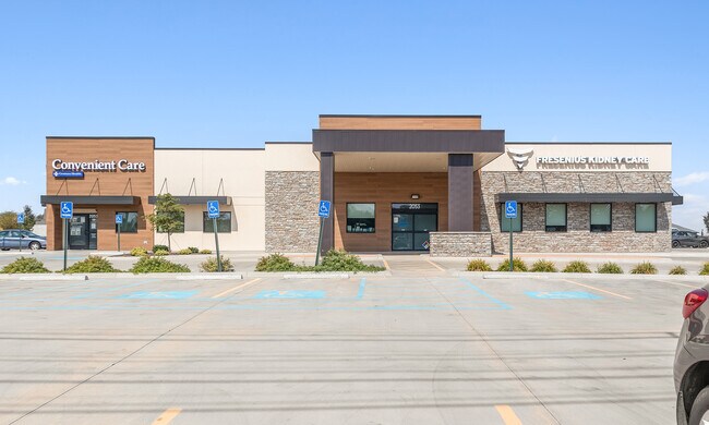
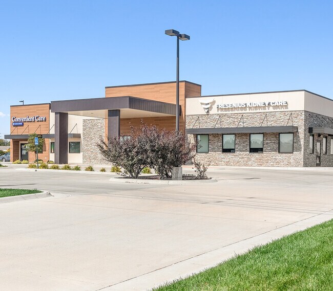
Property Record
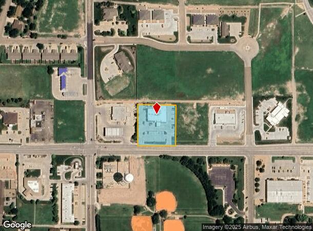
2051 E Mary St, Garden City, KS 67846

NEARBY LISTINGS FOR SALE OR LEASE
Property Detail
2051 E Mary St
Other Market Areas
Northeast Business Center First Addition
Garden City, KS
NORTHEAST BUSINESS CENTER FIRST ADDITION REPLAT LOTS 6 & 7, S04, T24, R32W, BLOCK 01, LOT 7A, ACRES 1.29
272-04-0-00-03-007.00-0
Finney
Medicalbuilding
Kansas
2025
7
2025
1.29 AC
960404
Kansas Area
10,933 SF
DEMOGRAPHICS near 2051 E Mary St
1 Mile
3 Mile
5 Mile
2024 Total Population
6,754
28,777
32,933
2029 Population
6,497
27,867
31,946
Pop Growth 2024-2029
(3.81%)
(3.16%)
(3.00%)
Average Age
37
35
35
2024 Total Households
2,542
9,894
11,267
HH Growth 2024-2029
(3.82%)
(3.18%)
(3.02%)
Median Household Inc
$73,168
$63,845
$63,238
Avg Household Size
2.60
2.80
2.80
2024 Avg HH Vehicles
2.00
2.00
2.00
Median Home Value
$201,979
$161,999
$162,940
Median Year Built
1983
1975
1976
Nearby Places
- Restaurants
- Banks
- Shops
- Fitness
- Groceries
PUBLIC TRANSPORTATION
COMMUTER RAIL
DRIVE
WALK
Distance
6 min
3.2 mi
SALE & LEASE HISTORY
LISTING DATE
SALE/LEASE

Oct 05, 2021
For Sale
Oct 05, 2020
For Sale
Jan 19, 2021
For Sale
Nearby Properties
Address
Land Use
TOTAL SIZE
Lot Size
Zoning
Address
Land Use
TOTAL SIZE
Lot Size
Zoning
485,653 SF
107.22 AC
Address
Land Use
TOTAL SIZE
Lot Size
Zoning
21,733 SF
60.54 AC
PF
Address
Land Use
TOTAL SIZE
Lot Size
Zoning
182,177 SF
22.83 AC
R2
Address
Land Use
TOTAL SIZE
Lot Size
Zoning
73,757 SF
25.61 AC
A
Address
Land Use
TOTAL SIZE
Lot Size
Zoning
86,664 SF
1.25 AC
CO
Address
Land Use
TOTAL SIZE
Lot Size
Zoning
6,300 SF
55.93 AC
Address
Land Use
TOTAL SIZE
Lot Size
Zoning
90,384 SF
27.14 AC
R2
Address
Land Use
TOTAL SIZE
Lot Size
Zoning
2,720 SF
13.43 AC
A
Address
Land Use
TOTAL SIZE
Lot Size
Zoning
39,413 SF
7.39 AC
R1
Address
Land Use
TOTAL SIZE
Lot Size
Zoning
38,748 SF
30.25 AC
R3
Address
Land Use
TOTAL SIZE
Lot Size
Zoning
91,579 SF
9.37 AC
R2
Address
Land Use
TOTAL SIZE
Lot Size
Zoning
38,151 SF
9.04 AC
R3
Address
Land Use
TOTAL SIZE
Lot Size
Zoning
69,088 SF
12.86 AC
Address
Land Use
TOTAL SIZE
Lot Size
Zoning
37,343 SF
12.42 AC
A
Address
Land Use
TOTAL SIZE
Lot Size
Zoning
64,065 SF
7.91 AC
R1
Address
Land Use
TOTAL SIZE
Lot Size
Zoning
69,088 SF
13.95 AC
A
Address
Land Use
TOTAL SIZE
Lot Size
Zoning
27,433 SF
1.81 AC
R4
Address
Land Use
TOTAL SIZE
Lot Size
Zoning
44,962 SF
19.78 AC
A
Address
Land Use
TOTAL SIZE
Lot Size
Zoning
21,875 SF
17.05 AC
I3
Address
Land Use
TOTAL SIZE
Lot Size
Zoning
28,917 SF
3.99 AC
A
Address
Land Use
TOTAL SIZE
Lot Size
Zoning
64,277 SF
4.97 AC
R2
Address
Land Use
TOTAL SIZE
Lot Size
Zoning
17,938 SF
3.90 AC
I3
Address
Land Use
TOTAL SIZE
Lot Size
Zoning
60,280 SF
15.25 AC
A
Address
Land Use
TOTAL SIZE
Lot Size
Zoning
52,727 SF
4.58 AC
R4
Address
Land Use
TOTAL SIZE
Lot Size
Zoning
182,192 SF
24.54 AC
Address
Land Use
TOTAL SIZE
Lot Size
Zoning
51,489 SF
3.34 AC
R2
Address
Land Use
TOTAL SIZE
Lot Size
Zoning
121,301 SF
15.46 AC
A
Address
Land Use
TOTAL SIZE
Lot Size
Zoning
21,794 SF
3.12 AC
Address
Land Use
TOTAL SIZE
Lot Size
Zoning
22,578 SF
1.23 AC
C0
Address
Land Use
TOTAL SIZE
Lot Size
Zoning
46,619 SF
3.46 AC
R1
The World's #1 Commercial Real Estate Marketplace
Connect with us
© 2025 CoStar Group
The information above has been obtained from sources believed reliable. While we do not doubt its accuracy we have not verified it and make no guarantee, warranty or representation about it. It is your responsibility to independently confirm its accuracy and completeness. Any projections, opinions, assumptions, or estimates used are for example only and do not represent the current or future performance of the property. The value of this transaction to you depends on tax and other factors which should be evaluated by your tax, financial, and legal advisors. You and your advisors should conduct a careful, independent investigation of the property to determine to your satisfaction the suitability of the property for your needs.