Property Record
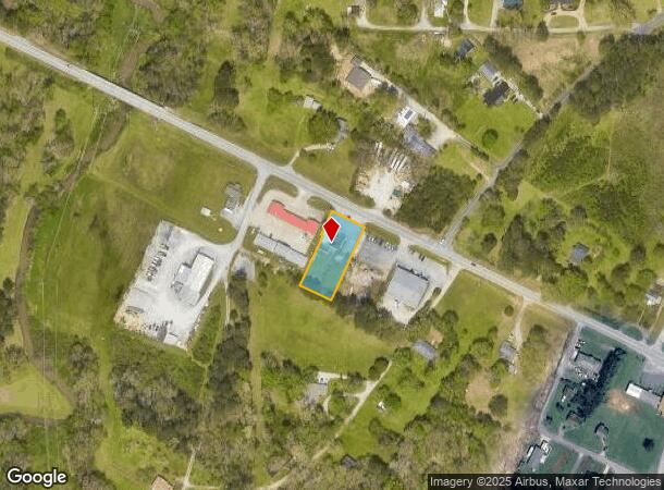
2052 Highway 41, Ringgold, GA 30736

NEARBY LISTINGS FOR SALE OR LEASE
Property Detail
2052 Highway 41
Chattanooga, TN-GA
Com- Hwy 41 Corridor
0020C-102-002
LOT 2 CAPITAL BANK ADVANCED CTR SLEEP
Officebuilding
Catoosa
X
Georgia
13047C0035E
2
2024
0.57 AC
2024
Catoosa County
030402
Chattanooga
3,262 SF
DEMOGRAPHICS near 2052 Highway 41
1 Mile
3 Mile
5 Mile
2024 Total Population
3,214
27,268
95,388
2029 Population
3,339
28,443
99,873
Pop Growth 2024-2029
+ 3.89%
+ 4.31%
+ 4.70%
Average Age
41
42
41
2024 Total Households
1,218
10,828
38,792
HH Growth 2024-2029
+ 3.94%
+ 4.40%
+ 4.80%
Median Household Inc
$64,812
$66,059
$64,501
Avg Household Size
2.60
2.50
2.40
2024 Avg HH Vehicles
2.00
2.00
2.00
Median Home Value
$223,077
$237,098
$226,520
Median Year Built
1986
1988
1983
Nearby Places
Map Layers
Map Styles
 Street
 Aerial
- Restaurants
- Banks
- Shops
- Fitness
- Groceries
PUBLIC TRANSPORTATION
AIRPORT
Lovell Field
DRIVE
WALK
Distance
Lovell Field
18 min
7.6 mi
Nearby Properties
Address
Land Use
TOTAL SIZE
Lot Size
Zoning
Address
Land Use
TOTAL SIZE
Lot Size
Zoning
176.54 AC
R1
Address
Land Use
TOTAL SIZE
Lot Size
Zoning
34,862 SF
63.85 AC
A-1
Address
Land Use
TOTAL SIZE
Lot Size
Zoning
233,109 SF
18.99 AC
FOR C-1
Address
Land Use
TOTAL SIZE
Lot Size
Zoning
85,068 SF
9.57 AC
Address
Land Use
TOTAL SIZE
Lot Size
Zoning
88,285 SF
7 AC
R3
Address
Land Use
TOTAL SIZE
Lot Size
Zoning
135,954 SF
11.83 AC
R3
Address
Land Use
TOTAL SIZE
Lot Size
Zoning
66,027 SF
2.84 AC
C2
Address
Land Use
TOTAL SIZE
Lot Size
Zoning
2,299 SF
7.03 AC
C-R
Address
Land Use
TOTAL SIZE
Lot Size
Zoning
139,638 SF
16.69 AC
FOR C-2
Address
Land Use
TOTAL SIZE
Lot Size
Zoning
58,911 SF
12.37 AC
FOR C-2
Address
Land Use
TOTAL SIZE
Lot Size
Zoning
67,304 SF
0.63 AC
C-1
Address
Land Use
TOTAL SIZE
Lot Size
Zoning
56,946 SF
2.12 AC
Address
Land Use
TOTAL SIZE
Lot Size
Zoning
57,528 SF
3.23 AC
R1
Address
Land Use
TOTAL SIZE
Lot Size
Zoning
31,891 SF
25.91 AC
C-1
Address
Land Use
TOTAL SIZE
Lot Size
Zoning
72,123 SF
13.84 AC
RIN I-1
Address
Land Use
TOTAL SIZE
Lot Size
Zoning
67,897 SF
12 AC
R-1
Address
Land Use
TOTAL SIZE
Lot Size
Zoning
50,668 SF
1.43 AC
Address
Land Use
TOTAL SIZE
Lot Size
Zoning
49,686 SF
8.54 AC
FOR C-1
Address
Land Use
TOTAL SIZE
Lot Size
Zoning
63,406 SF
9.81 AC
SZ
Address
Land Use
TOTAL SIZE
Lot Size
Zoning
4,096 SF
4.96 AC
FOR PM
Address
Land Use
TOTAL SIZE
Lot Size
Zoning
46,288 SF
2.40 AC
RIN C-2
Address
Land Use
TOTAL SIZE
Lot Size
Zoning
103,322 SF
5.04 AC
C1
Address
Land Use
TOTAL SIZE
Lot Size
Zoning
51,085 SF
1.32 AC
C1
Address
Land Use
TOTAL SIZE
Lot Size
Zoning
5,924 SF
16.27 AC
C2
Address
Land Use
TOTAL SIZE
Lot Size
Zoning
67,739 SF
9.58 AC
FOR C-2
Address
Land Use
TOTAL SIZE
Lot Size
Zoning
50,508 SF
2.35 AC
C2
Address
Land Use
TOTAL SIZE
Lot Size
Zoning
49,610 SF
5.96 AC
FOR C-2
Address
Land Use
TOTAL SIZE
Lot Size
Zoning
36,000 SF
6.02 AC
FOR R-5
Address
Land Use
TOTAL SIZE
Lot Size
Zoning
12,858 SF
18.80 AC
R-1
Address
Land Use
TOTAL SIZE
Lot Size
Zoning
66,000 SF
0.93 AC
C1
The World's #1 Commercial Real Estate Marketplace
Connect with us
© 2026 CoStar Group
The information above has been obtained from sources believed reliable. While we do not doubt its accuracy we have not verified it and make no guarantee, warranty or representation about it. It is your responsibility to independently confirm its accuracy and completeness. Any projections, opinions, assumptions, or estimates used are for example only and do not represent the current or future performance of the property. The value of this transaction to you depends on tax and other factors which should be evaluated by your tax, financial, and legal advisors. You and your advisors should conduct a careful, independent investigation of the property to determine to your satisfaction the suitability of the property for your needs.