Property Record
2052 South Rd, Poughkeepsie, NY 12601
This Property Is For Sale
NEARBY LISTINGS FOR SALE OR LEASE
Property Detail
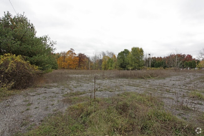
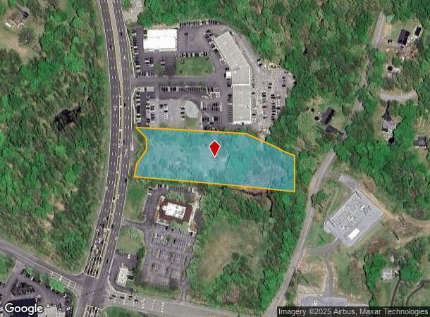
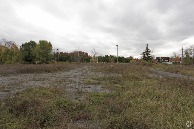
2052 South Rd
Dutchess County-Putnam County, NY
2.8 AC (C)
134689-6159-03-437403-0000
Dutchess
Commercialacreage
New York
X
437
36027C0368E
2.80 AC
2025
Fishkill
2024
Westchester/So Connecticut
140700
DEMOGRAPHICS near 2052 South Rd
1 Mile
3 Mile
5 Mile
2024 Total Population
4,850
32,032
85,609
2029 Population
4,862
31,993
85,377
Pop Growth 2024-2029
+ 0.25%
(0.12%)
(0.27%)
Average Age
42
42
42
2024 Total Households
1,756
12,201
32,703
HH Growth 2024-2029
+ 0.23%
(0.14%)
(0.27%)
Median Household Inc
$111,115
$98,471
$91,887
Avg Household Size
2.70
2.50
2.50
2024 Avg HH Vehicles
2.00
2.00
2.00
Median Home Value
$282,022
$332,679
$331,034
Median Year Built
1967
1965
1965
Nearby Places
- Restaurants
- Banks
- Shops
- Fitness
- Groceries
PUBLIC TRANSPORTATION
COMMUTER RAIL
New Hamburg Station (Hudson Line - Metro-North Commuter Railroad Company (Metro-North))
DRIVE
WALK
Distance
New Hamburg Station (Hudson Line - Metro-North Commuter Railroad Company (Metro-North))
12 min
4.7 mi
Poughkeepsie Station (Hudson Line - Metro-North Commuter Railroad Company (Metro-North))
DRIVE
WALK
Distance
Poughkeepsie Station (Hudson Line - Metro-North Commuter Railroad Company (Metro-North))
10 min
5.8 mi
AIRPORT
New York Stewart International
DRIVE
WALK
Distance
New York Stewart International
35 min
24.7 mi
Freight Ports
NY - Red Hook Container Terminal
DRIVE
WALK
Distance
NY - Red Hook Container Terminal
1 min
65.4 mi
Nearby Properties
Address
Land Use
TOTAL SIZE
Lot Size
Zoning
Address
Land Use
TOTAL SIZE
Lot Size
Zoning
193.80 AC
IH
Address
Land Use
TOTAL SIZE
Lot Size
Zoning
802,007 SF
78.21 AC
BH
Address
Land Use
TOTAL SIZE
Lot Size
Zoning
11.76 AC
R4A
Address
Land Use
TOTAL SIZE
Lot Size
Zoning
11,803 SF
99.04 AC
IH
Address
Land Use
TOTAL SIZE
Lot Size
Zoning
293,984 SF
47.95 AC
RMF5
Address
Land Use
TOTAL SIZE
Lot Size
Zoning
50,363 SF
47.88 AC
IH/R1
Address
Land Use
TOTAL SIZE
Lot Size
Zoning
16,947 SF
6.40 AC
IH
Address
Land Use
TOTAL SIZE
Lot Size
Zoning
197,820 SF
56.20 AC
R20
Address
Land Use
TOTAL SIZE
Lot Size
Zoning
535,543 SF
72.62 AC
BSC
Address
Land Use
TOTAL SIZE
Lot Size
Zoning
143,274 SF
31.04 AC
R20/40
Address
Land Use
TOTAL SIZE
Lot Size
Zoning
179,351 SF
18.34 AC
IN
Address
Land Use
TOTAL SIZE
Lot Size
Zoning
104,800 SF
17.20 AC
R20
Address
Land Use
TOTAL SIZE
Lot Size
Zoning
126,616 SF
25.57 AC
R20
Address
Land Use
TOTAL SIZE
Lot Size
Zoning
151,698 SF
22.50 AC
PI
Address
Land Use
TOTAL SIZE
Lot Size
Zoning
272,228 SF
25.20 AC
BSC
Address
Land Use
TOTAL SIZE
Lot Size
Zoning
6.70 AC
R-1.5A
Address
Land Use
TOTAL SIZE
Lot Size
Zoning
32,920 SF
21.55 AC
CB-30
Address
Land Use
TOTAL SIZE
Lot Size
Zoning
40,030 SF
4.50 AC
HB
Address
Land Use
TOTAL SIZE
Lot Size
Zoning
55,752 SF
16.14 AC
RM
Address
Land Use
TOTAL SIZE
Lot Size
Zoning
114,443 SF
43.60 AC
IN
Address
Land Use
TOTAL SIZE
Lot Size
Zoning
147,858 SF
12.45 AC
BSC
Address
Land Use
TOTAL SIZE
Lot Size
Zoning
98,700 SF
10 AC
BSC
Address
Land Use
TOTAL SIZE
Lot Size
Zoning
92,574 SF
9.31 AC
BH
Address
Land Use
TOTAL SIZE
Lot Size
Zoning
70,830 SF
23.68 AC
R20
Address
Land Use
TOTAL SIZE
Lot Size
Zoning
128,883 SF
8.63 AC
BH
Address
Land Use
TOTAL SIZE
Lot Size
Zoning
106,025 SF
7.20 AC
RM2
Address
Land Use
TOTAL SIZE
Lot Size
Zoning
160,214 SF
17.47 AC
R20
Address
Land Use
TOTAL SIZE
Lot Size
Zoning
512,000 SF
67 AC
AI
Address
Land Use
TOTAL SIZE
Lot Size
Zoning
52,807 SF
10.87 AC
R20
Address
Land Use
TOTAL SIZE
Lot Size
Zoning
328,878 SF
30.82 AC
PI
The World's #1 Commercial Real Estate Marketplace
Connect with us
© 2025 CoStar Group
The information above has been obtained from sources believed reliable. While we do not doubt its accuracy we have not verified it and make no guarantee, warranty or representation about it. It is your responsibility to independently confirm its accuracy and completeness. Any projections, opinions, assumptions, or estimates used are for example only and do not represent the current or future performance of the property. The value of this transaction to you depends on tax and other factors which should be evaluated by your tax, financial, and legal advisors. You and your advisors should conduct a careful, independent investigation of the property to determine to your satisfaction the suitability of the property for your needs.