Property Record
Experiment Station Rd, Watkinsville, GA 30677

This Property Is For Sale
NEARBY LISTINGS FOR SALE OR LEASE
Property Detail
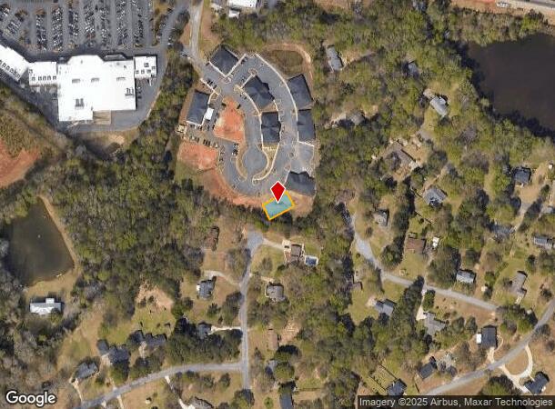
Experiment Station Rd
Other Market Areas
Butler's Crossing Professional Park
Athens-Clarke County, GA
1710/720 2021/86 2020/107 - FUTURE DEVELOPME
B-06M-700
Oconee
Commercialacreage
Georgia
2025
700
2025
0.14 AC
030402
Athens/Gainesville
DEMOGRAPHICS near Experiment Station Rd
1 Mile
3 Mile
5 Mile
2024 Total Population
1,693
15,813
43,661
2029 Population
1,962
18,401
48,612
Pop Growth 2024-2029
+ 15.89%
+ 16.37%
+ 11.34%
Average Age
40
39
39
2024 Total Households
592
5,512
16,392
HH Growth 2024-2029
+ 15.88%
+ 16.40%
+ 10.58%
Median Household Inc
$96,461
$102,696
$90,440
Avg Household Size
2.90
2.80
2.60
2024 Avg HH Vehicles
2.00
2.00
2.00
Median Home Value
$389,677
$417,617
$436,654
Median Year Built
1990
1993
1994
Nearby Places
Map Layers
Map Styles
 Street
 Aerial
- Restaurants
- Banks
- Shops
- Fitness
- Groceries
Nearby Properties
Address
Land Use
TOTAL SIZE
Lot Size
Zoning
Address
Land Use
TOTAL SIZE
Lot Size
Zoning
11,600 SF
154.32 AC
AR
Address
Land Use
TOTAL SIZE
Lot Size
Zoning
20,748 SF
80.77 AC
AG
Address
Land Use
TOTAL SIZE
Lot Size
Zoning
107,030 SF
34.62 AC
AR
Address
Land Use
TOTAL SIZE
Lot Size
Zoning
70,000 SF
5.40 AC
O-B-P
Address
Land Use
TOTAL SIZE
Lot Size
Zoning
12,483 SF
8.13 AC
Address
Land Use
TOTAL SIZE
Lot Size
Zoning
68,931 SF
5.56 AC
O-B-P
Address
Land Use
TOTAL SIZE
Lot Size
Zoning
29,376 SF
197.43 AC
AG
Address
Land Use
TOTAL SIZE
Lot Size
Zoning
5,216 SF
12.81 AC
R-3
Address
Land Use
TOTAL SIZE
Lot Size
Zoning
29,032 SF
14 AC
AG
Address
Land Use
TOTAL SIZE
Lot Size
Zoning
76,360 SF
10.25 AC
B-1
Address
Land Use
TOTAL SIZE
Lot Size
Zoning
37,572 SF
0.43 AC
O-B-P
Address
Land Use
TOTAL SIZE
Lot Size
Zoning
27,200 SF
6.65 AC
002
Address
Land Use
TOTAL SIZE
Lot Size
Zoning
57,735 SF
35 AC
AG
Address
Land Use
TOTAL SIZE
Lot Size
Zoning
78,525 SF
15.81 AC
Address
Land Use
TOTAL SIZE
Lot Size
Zoning
60,596 SF
15 AC
001
Address
Land Use
TOTAL SIZE
Lot Size
Zoning
25,519 SF
7.63 AC
OIP
Address
Land Use
TOTAL SIZE
Lot Size
Zoning
5,880 SF
17.18 AC
AG
Address
Land Use
TOTAL SIZE
Lot Size
Zoning
45,945 SF
2.27 AC
OIP
Address
Land Use
TOTAL SIZE
Lot Size
Zoning
58,862 SF
1.15 AC
Address
Land Use
TOTAL SIZE
Lot Size
Zoning
Address
Land Use
TOTAL SIZE
Lot Size
Zoning
16,800 SF
37.92 AC
AG
Address
Land Use
TOTAL SIZE
Lot Size
Zoning
37,572 SF
0.43 AC
O-B-P
Address
Land Use
TOTAL SIZE
Lot Size
Zoning
4,000 SF
253.45 AC
AG
Address
Land Use
TOTAL SIZE
Lot Size
Zoning
18,962 SF
0.43 AC
O-B-P
Address
Land Use
TOTAL SIZE
Lot Size
Zoning
3,600 SF
3.28 AC
B-2
Address
Land Use
TOTAL SIZE
Lot Size
Zoning
26,837 SF
3.64 AC
AG
Address
Land Use
TOTAL SIZE
Lot Size
Zoning
61.15 AC
AG
Address
Land Use
TOTAL SIZE
Lot Size
Zoning
20,504 SF
9.96 AC
O-B-P
Address
Land Use
TOTAL SIZE
Lot Size
Zoning
101,830 SF
12.68 AC
B-2
Address
Land Use
TOTAL SIZE
Lot Size
Zoning
The World's #1 Commercial Real Estate Marketplace
Connect with us
© 2025 CoStar Group
The information above has been obtained from sources believed reliable. While we do not doubt its accuracy we have not verified it and make no guarantee, warranty or representation about it. It is your responsibility to independently confirm its accuracy and completeness. Any projections, opinions, assumptions, or estimates used are for example only and do not represent the current or future performance of the property. The value of this transaction to you depends on tax and other factors which should be evaluated by your tax, financial, and legal advisors. You and your advisors should conduct a careful, independent investigation of the property to determine to your satisfaction the suitability of the property for your needs.