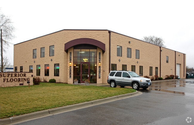
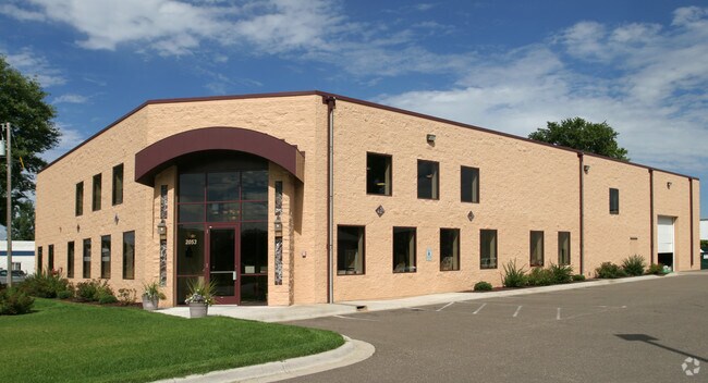
Property Record
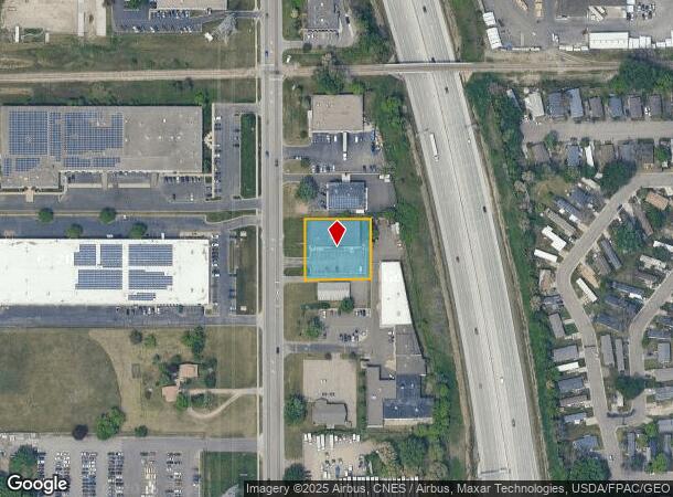
2053 Old Highway 8 Nw, Saint Paul, MN 55112
NEARBY LISTINGS FOR SALE OR LEASE
Property Detail
2053 Old Highway 8 Nw
Minneapolis-St. Paul-Bloomington, MN-WI
Mounds Center
16-30-23-32-0007
MOUNDS CENTER SUBJ TO STH 8-63 THE S 75 FT OF N 390 FT OF PART NW 1/4 ...SD MOUNDS CENTER LOT 11 BLK 4
Heavyindustrial
Ramsey
X
Minnesota
27053C0250F
11
2024
0.57 AC
2025
North Central
041105
Minneapolis/St Paul
9,028 SF
DEMOGRAPHICS near 2053 Old Highway 8 Nw
1 Mile
3 Mile
5 Mile
2024 Total Population
2,307
61,108
184,160
2029 Population
2,254
60,325
184,716
Pop Growth 2024-2029
(2.30%)
(1.28%)
+ 0.30%
Average Age
38
41
41
2024 Total Households
861
24,445
74,081
HH Growth 2024-2029
(2.79%)
(1.42%)
+ 0.21%
Median Household Inc
$66,986
$84,114
$80,038
Avg Household Size
2.70
2.40
2.40
2024 Avg HH Vehicles
2.00
2.00
2.00
Median Home Value
$265,878
$304,159
$291,361
Median Year Built
1982
1975
1973
Nearby Places
Map Layers
Map Styles
 Street
 Aerial
- Restaurants
- Banks
- Shops
- Fitness
- Groceries
PUBLIC TRANSPORTATION
COMMUTER RAIL
Fridley Station (Northstar Corridor - Northstar Commuter Rail)
DRIVE
WALK
Distance
Fridley Station (Northstar Corridor - Northstar Commuter Rail)
11 min
6.4 mi
AIRPORT
Minneapolis-St Paul International/Wold-Chamberlain
DRIVE
WALK
Distance
Minneapolis-St Paul International/Wold-Chamberlain
32 min
19.7 mi
Nearby Properties
Address
Land Use
TOTAL SIZE
Lot Size
Zoning
Address
Land Use
TOTAL SIZE
Lot Size
Zoning
2,443,869 SF
31.79 AC
Address
Land Use
TOTAL SIZE
Lot Size
Zoning
70,115 SF
191.32 AC
Address
Land Use
TOTAL SIZE
Lot Size
Zoning
467.27 AC
Address
Land Use
TOTAL SIZE
Lot Size
Zoning
372.05 AC
Address
Land Use
TOTAL SIZE
Lot Size
Zoning
141,716 SF
567.20 AC
Address
Land Use
TOTAL SIZE
Lot Size
Zoning
Address
Land Use
TOTAL SIZE
Lot Size
Zoning
9,320 SF
77.38 AC
Address
Land Use
TOTAL SIZE
Lot Size
Zoning
4.18 AC
Address
Land Use
TOTAL SIZE
Lot Size
Zoning
663,908 SF
109.91 AC
Address
Land Use
TOTAL SIZE
Lot Size
Zoning
Address
Land Use
TOTAL SIZE
Lot Size
Zoning
33,060 SF
20.14 AC
Address
Land Use
TOTAL SIZE
Lot Size
Zoning
223.30 AC
Address
Land Use
TOTAL SIZE
Lot Size
Zoning
Address
Land Use
TOTAL SIZE
Lot Size
Zoning
260,375 SF
4.24 AC
Address
Land Use
TOTAL SIZE
Lot Size
Zoning
3.83 AC
Address
Land Use
TOTAL SIZE
Lot Size
Zoning
606,798 SF
49.16 AC
Address
Land Use
TOTAL SIZE
Lot Size
Zoning
21.94 AC
Address
Land Use
TOTAL SIZE
Lot Size
Zoning
539,671 SF
26.93 AC
Address
Land Use
TOTAL SIZE
Lot Size
Zoning
109.41 AC
Address
Land Use
TOTAL SIZE
Lot Size
Zoning
115.62 AC
Address
Land Use
TOTAL SIZE
Lot Size
Zoning
334,568 SF
30.27 AC
Address
Land Use
TOTAL SIZE
Lot Size
Zoning
309,863 SF
56.34 AC
Address
Land Use
TOTAL SIZE
Lot Size
Zoning
27,175 SF
1.86 AC
Address
Land Use
TOTAL SIZE
Lot Size
Zoning
91,679 SF
35.89 AC
Address
Land Use
TOTAL SIZE
Lot Size
Zoning
Address
Land Use
TOTAL SIZE
Lot Size
Zoning
Address
Land Use
TOTAL SIZE
Lot Size
Zoning
213,177 SF
17.86 AC
Address
Land Use
TOTAL SIZE
Lot Size
Zoning
1,260 SF
3.40 AC
Address
Land Use
TOTAL SIZE
Lot Size
Zoning
186,928 SF
4.07 AC
Address
Land Use
TOTAL SIZE
Lot Size
Zoning
284,650 SF
16.60 AC
The World's #1 Commercial Real Estate Marketplace
Connect with us
© 2025 CoStar Group
The information above has been obtained from sources believed reliable. While we do not doubt its accuracy we have not verified it and make no guarantee, warranty or representation about it. It is your responsibility to independently confirm its accuracy and completeness. Any projections, opinions, assumptions, or estimates used are for example only and do not represent the current or future performance of the property. The value of this transaction to you depends on tax and other factors which should be evaluated by your tax, financial, and legal advisors. You and your advisors should conduct a careful, independent investigation of the property to determine to your satisfaction the suitability of the property for your needs.