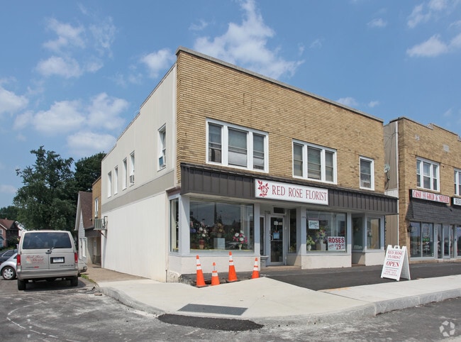
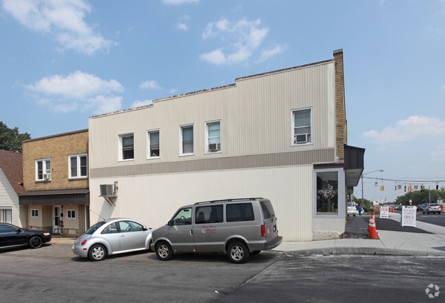
Property Record
2054 E Ridge Rd, Rochester, NY 14622
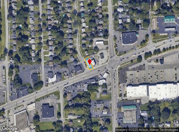
NEARBY LISTINGS FOR SALE OR LEASE
Property Detail
2054 E Ridge Rd
263400-077-180-0002-024-000
0034-14-07 WOODMAN RD LR1 00
Commercialofficeresidentialmixeduse
Monroe
X
New York
36055C0204G
24.000
2025
0.11 AC
2024
Northeast
010800
Rochester
6,856 SF
Rochester, NY
DEMOGRAPHICS near 2054 E Ridge Rd
1 Mile
3 Mile
5 Mile
2024 Total Population
11,065
102,307
263,839
2029 Population
10,966
100,689
259,881
Pop Growth 2024-2029
(0.89%)
(1.58%)
(1.50%)
Average Age
43
40
39
2024 Total Households
4,968
42,926
117,890
HH Growth 2024-2029
(0.95%)
(1.65%)
(1.50%)
Median Household Inc
$56,802
$53,406
$53,689
Avg Household Size
2.10
2.30
2.10
2024 Avg HH Vehicles
2.00
1.00
1.00
Median Home Value
$144,080
$139,721
$150,047
Median Year Built
1956
1951
1951
Nearby Places
- Restaurants
- Banks
- Shops
- Fitness
- Groceries
PUBLIC TRANSPORTATION
COMMUTER RAIL
Rochester (Empire Service - VIA Rail, Lake Shore Limited - VIA Rail, Maple Leaf - VIA Rail, Toronto - New York - VIA Rail)
DRIVE
WALK
Distance
Rochester (Empire Service - VIA Rail, Lake Shore Limited - VIA Rail, Maple Leaf - VIA Rail, Toronto - New York - VIA Rail)
8 min
4.2 mi
AIRPORT
Frederick Douglass/Greater Rochester International
DRIVE
WALK
Distance
Frederick Douglass/Greater Rochester International
16 min
9.4 mi
Freight Ports
Albany, NY Port
DRIVE
WALK
Distance
Albany, NY Port
268 min
227.9 mi
Nearby Properties
Address
Land Use
TOTAL SIZE
Lot Size
Zoning
Address
Land Use
TOTAL SIZE
Lot Size
Zoning
847,728 SF
41.57 AC
Address
Land Use
TOTAL SIZE
Lot Size
Zoning
270,150 SF
34.40 AC
02 - SINGL
Address
Land Use
TOTAL SIZE
Lot Size
Zoning
0.41 AC
Address
Land Use
TOTAL SIZE
Lot Size
Zoning
0.01 AC
Address
Land Use
TOTAL SIZE
Lot Size
Zoning
323,264 SF
21.06 AC
06 - INDUS
Address
Land Use
TOTAL SIZE
Lot Size
Zoning
0.65 AC
Address
Land Use
TOTAL SIZE
Lot Size
Zoning
491,375 SF
5.90 AC
Address
Land Use
TOTAL SIZE
Lot Size
Zoning
161,812 SF
5.18 AC
06 - INDUS
Address
Land Use
TOTAL SIZE
Lot Size
Zoning
410,400 SF
2.88 AC
Address
Land Use
TOTAL SIZE
Lot Size
Zoning
193,892 SF
18.62 AC
05 - COMME
Address
Land Use
TOTAL SIZE
Lot Size
Zoning
742,711 SF
56.05 AC
Address
Land Use
TOTAL SIZE
Lot Size
Zoning
130,000 SF
2.76 AC
LLD
Address
Land Use
TOTAL SIZE
Lot Size
Zoning
48,000 SF
19.51 AC
03 - MULTI
Address
Land Use
TOTAL SIZE
Lot Size
Zoning
215,405 SF
10.56 AC
Address
Land Use
TOTAL SIZE
Lot Size
Zoning
67,463 SF
1.80 AC
Address
Land Use
TOTAL SIZE
Lot Size
Zoning
224,048 SF
37.60 AC
02 - SINGL
Address
Land Use
TOTAL SIZE
Lot Size
Zoning
134,894 SF
16 AC
01 - NOT Z
Address
Land Use
TOTAL SIZE
Lot Size
Zoning
205,616 SF
3.10 AC
Address
Land Use
TOTAL SIZE
Lot Size
Zoning
9,634 SF
17.89 AC
03 - MULTI
Address
Land Use
TOTAL SIZE
Lot Size
Zoning
73,724 SF
11.79 AC
02 - SINGL
Address
Land Use
TOTAL SIZE
Lot Size
Zoning
187.40 AC
Address
Land Use
TOTAL SIZE
Lot Size
Zoning
55,296 SF
3.13 AC
Address
Land Use
TOTAL SIZE
Lot Size
Zoning
124,000 SF
8.99 AC
06 - INDUS
Address
Land Use
TOTAL SIZE
Lot Size
Zoning
930 SF
13.45 AC
03 - MULTI
Address
Land Use
TOTAL SIZE
Lot Size
Zoning
71,625 SF
14.28 AC
03 - MULTI
Address
Land Use
TOTAL SIZE
Lot Size
Zoning
50,976 SF
15.35 AC
Address
Land Use
TOTAL SIZE
Lot Size
Zoning
54,606 SF
5.53 AC
05 - COMME
Address
Land Use
TOTAL SIZE
Lot Size
Zoning
424,020 SF
1.68 AC
Address
Land Use
TOTAL SIZE
Lot Size
Zoning
Address
Land Use
TOTAL SIZE
Lot Size
Zoning
8,464 SF
9.60 AC
03 - MULTI
The World's #1 Commercial Real Estate Marketplace
Connect with us
© 2025 CoStar Group
The information above has been obtained from sources believed reliable. While we do not doubt its accuracy we have not verified it and make no guarantee, warranty or representation about it. It is your responsibility to independently confirm its accuracy and completeness. Any projections, opinions, assumptions, or estimates used are for example only and do not represent the current or future performance of the property. The value of this transaction to you depends on tax and other factors which should be evaluated by your tax, financial, and legal advisors. You and your advisors should conduct a careful, independent investigation of the property to determine to your satisfaction the suitability of the property for your needs.