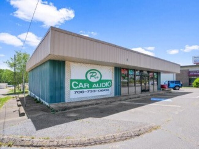
Property Record
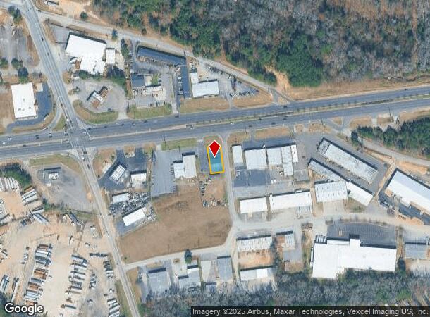
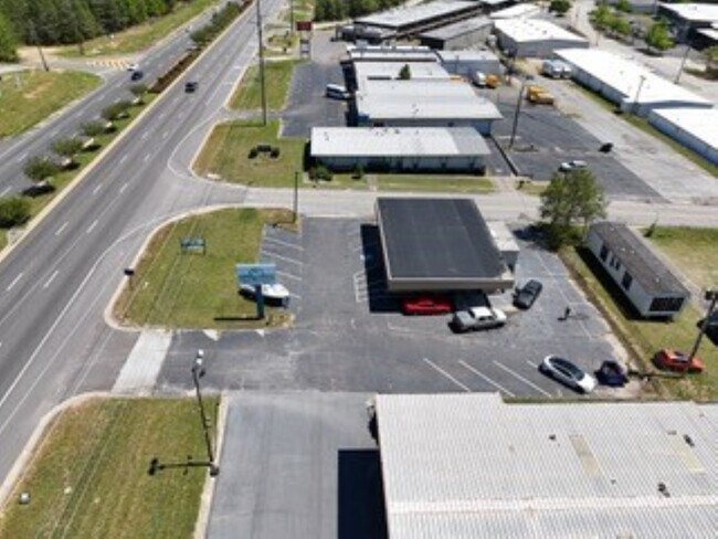
2056 Gordon Hwy, Augusta, GA 30909
NEARBY LISTINGS FOR SALE OR LEASE
Property Detail
2056 Gordon Hwy
0690005030
2054 GORDON HWY
Commercialacreage
Richmond
X
Georgia
13245C0108G
0.18 AC
2025
South Richmond County
2025
Augusta/Richmond County
010515
Augusta-Richmond County, GA-SC
2,118 SF
DEMOGRAPHICS near 2056 Gordon Hwy
1 Mile
3 Mile
5 Mile
2024 Total Population
5,036
58,629
144,889
2029 Population
4,967
57,905
144,999
Pop Growth 2024-2029
(1.37%)
(1.23%)
+ 0.08%
Average Age
36
38
38
2024 Total Households
2,154
24,868
60,980
HH Growth 2024-2029
(1.35%)
(1.17%)
0.00%
Median Household Inc
$36,521
$46,670
$48,955
Avg Household Size
2.20
2.30
2.30
2024 Avg HH Vehicles
2.00
2.00
2.00
Median Home Value
$98,428
$144,017
$144,254
Median Year Built
1968
1975
1976
Nearby Places
Map Layers
Map Styles
 Street
 Aerial
- Restaurants
- Banks
- Shops
- Fitness
- Groceries
PUBLIC TRANSPORTATION
AIRPORT
Augusta Regional at Bush Field
DRIVE
WALK
Distance
Augusta Regional at Bush Field
20 min
9.3 mi
Freight Ports
Georgia Ports - Savannah
DRIVE
WALK
Distance
Georgia Ports - Savannah
154 min
119.8 mi
SALE & LEASE HISTORY
LISTING DATE
SALE/LEASE

May 03, 2024
For Sale
Nearby Properties
Address
Land Use
TOTAL SIZE
Lot Size
Zoning
Address
Land Use
TOTAL SIZE
Lot Size
Zoning
1,100 SF
97.38 AC
R-1A
Address
Land Use
TOTAL SIZE
Lot Size
Zoning
292,232 SF
39.73 AC
B-2
Address
Land Use
TOTAL SIZE
Lot Size
Zoning
202,994 SF
19.25 AC
P-1
Address
Land Use
TOTAL SIZE
Lot Size
Zoning
5,541 SF
14.81 AC
B-2
Address
Land Use
TOTAL SIZE
Lot Size
Zoning
1,428 SF
75.91 AC
R-1A
Address
Land Use
TOTAL SIZE
Lot Size
Zoning
36,755 SF
12.09 AC
B-2
Address
Land Use
TOTAL SIZE
Lot Size
Zoning
1,620 SF
21.51 AC
R-3B
Address
Land Use
TOTAL SIZE
Lot Size
Zoning
3,829 SF
35.30 AC
R-3B
Address
Land Use
TOTAL SIZE
Lot Size
Zoning
38,080 SF
19.19 AC
R-3B
Address
Land Use
TOTAL SIZE
Lot Size
Zoning
4,108 SF
14.12 AC
B-2
Address
Land Use
TOTAL SIZE
Lot Size
Zoning
1,782 SF
26.27 AC
R-3A
Address
Land Use
TOTAL SIZE
Lot Size
Zoning
640 SF
12.17 AC
B-1
Address
Land Use
TOTAL SIZE
Lot Size
Zoning
6,323 SF
25.49 AC
R-3C
Address
Land Use
TOTAL SIZE
Lot Size
Zoning
241,284 SF
20.61 AC
R-1A
Address
Land Use
TOTAL SIZE
Lot Size
Zoning
8,640 SF
13.15 AC
R-3B
Address
Land Use
TOTAL SIZE
Lot Size
Zoning
102,060 SF
45.63 AC
R-3B
Address
Land Use
TOTAL SIZE
Lot Size
Zoning
42,617 SF
40.26 AC
R-1_B-1
Address
Land Use
TOTAL SIZE
Lot Size
Zoning
68,600 SF
20.94 AC
R-3A
Address
Land Use
TOTAL SIZE
Lot Size
Zoning
62,440 SF
5.70 AC
B-2
Address
Land Use
TOTAL SIZE
Lot Size
Zoning
156,372 SF
17.81 AC
B-2
Address
Land Use
TOTAL SIZE
Lot Size
Zoning
56,631 SF
11.62 AC
R-1A, B-2
Address
Land Use
TOTAL SIZE
Lot Size
Zoning
106,072 SF
9.35 AC
007
Address
Land Use
TOTAL SIZE
Lot Size
Zoning
2,725 SF
12.42 AC
B-2
Address
Land Use
TOTAL SIZE
Lot Size
Zoning
89,307 SF
3.62 AC
B-2 COND
Address
Land Use
TOTAL SIZE
Lot Size
Zoning
4,947 SF
71.24 AC
R-3B
Address
Land Use
TOTAL SIZE
Lot Size
Zoning
16,914 SF
29.85 AC
R-1
Address
Land Use
TOTAL SIZE
Lot Size
Zoning
16,120 SF
21.38 AC
R-3A
Address
Land Use
TOTAL SIZE
Lot Size
Zoning
158,192 SF
48.91 AC
R-1A
Address
Land Use
TOTAL SIZE
Lot Size
Zoning
66,685 SF
2.44 AC
B-2
Address
Land Use
TOTAL SIZE
Lot Size
Zoning
44,160 SF
12.46 AC
R-3B
The World's #1 Commercial Real Estate Marketplace
Connect with us
© 2025 CoStar Group
The information above has been obtained from sources believed reliable. While we do not doubt its accuracy we have not verified it and make no guarantee, warranty or representation about it. It is your responsibility to independently confirm its accuracy and completeness. Any projections, opinions, assumptions, or estimates used are for example only and do not represent the current or future performance of the property. The value of this transaction to you depends on tax and other factors which should be evaluated by your tax, financial, and legal advisors. You and your advisors should conduct a careful, independent investigation of the property to determine to your satisfaction the suitability of the property for your needs.