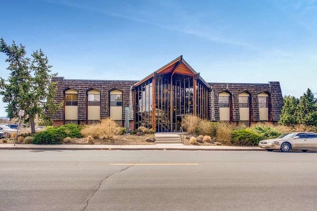
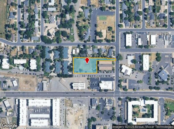
Property Record
2061 Oneida St, Denver, CO 80207
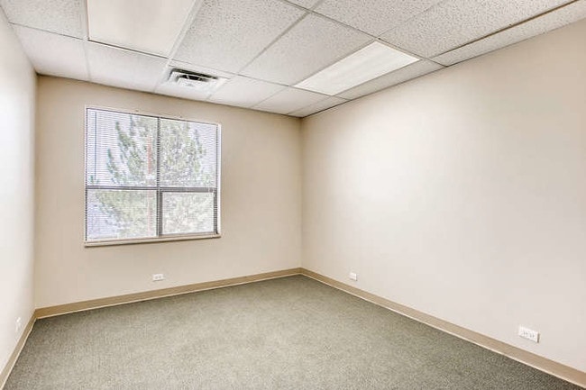

Current Lease Availabilities
NEARBY LISTINGS FOR SALE OR LEASE
Property Detail
2061 Oneida St
Denver-Aurora-Lakewood, CO
Harris Panorama Park South
6291-05-048
PORTION OF LOTS 5&6
Vacantlandnec
Denver
X
Colorado
0800460216H
10
2024
1.03 AC
2024
Glendale
004202
Denver
DEMOGRAPHICS near 2061 Oneida St
1 Mile
3 Mile
5 Mile
2024 Total Population
20,670
187,544
446,977
2029 Population
20,929
190,191
452,102
Pop Growth 2024-2029
+ 1.25%
+ 1.41%
+ 1.15%
Average Age
39
39
39
2024 Total Households
9,461
86,733
204,646
HH Growth 2024-2029
+ 1.14%
+ 1.35%
+ 1.13%
Median Household Inc
$76,237
$71,072
$76,510
Avg Household Size
2.10
2.10
2.10
2024 Avg HH Vehicles
2.00
2.00
2.00
Median Home Value
$480,279
$569,276
$602,836
Median Year Built
1978
1977
1975
Nearby Places
- Restaurants
- Banks
- Shops
- Fitness
- Groceries
PUBLIC TRANSPORTATION
COMMUTER RAIL
Central Park Station Track 1 (Union Station to Denver Airport Station - Regional Transportation District)
DRIVE
WALK
Distance
Central Park Station Track 1 (Union Station to Denver Airport Station - Regional Transportation District)
17 min
7.7 mi
Central Park Station Track 2 (Union Station to Denver Airport Station - Regional Transportation District)
DRIVE
WALK
Distance
Central Park Station Track 2 (Union Station to Denver Airport Station - Regional Transportation District)
17 min
7.7 mi
AIRPORT
Denver International
DRIVE
WALK
Distance
Denver International
34 min
24.8 mi
Freight Ports
Tulsa Port Of Catoosa
DRIVE
WALK
Distance
Tulsa Port Of Catoosa
731 min
707.6 mi
Nearby Properties
Address
Land Use
TOTAL SIZE
Lot Size
Zoning
Address
Land Use
TOTAL SIZE
Lot Size
Zoning
1,137,044 SF
35.49 AC
CMP-EI
Address
Land Use
TOTAL SIZE
Lot Size
Zoning
550,760 SF
13.25 AC
CMP-EI
Address
Land Use
TOTAL SIZE
Lot Size
Zoning
543,122 SF
13.43 AC
CMP-EI
Address
Land Use
TOTAL SIZE
Lot Size
Zoning
453,280 SF
5.45 AC
B-4
Address
Land Use
TOTAL SIZE
Lot Size
Zoning
416,096 SF
5.20 AC
C-MX-20
Address
Land Use
TOTAL SIZE
Lot Size
Zoning
240,545 SF
2.35 AC
C-MX-20
Address
Land Use
TOTAL SIZE
Lot Size
Zoning
281,456 SF
36.55 AC
R-5
Address
Land Use
TOTAL SIZE
Lot Size
Zoning
174,244 SF
17.26 AC
E-SU-DX
Address
Land Use
TOTAL SIZE
Lot Size
Zoning
1,054,198 SF
6.62 AC
PUD
Address
Land Use
TOTAL SIZE
Lot Size
Zoning
379,927 SF
8.06 AC
PUD
Address
Land Use
TOTAL SIZE
Lot Size
Zoning
14,878 SF
34.55 AC
OS-B
Address
Land Use
TOTAL SIZE
Lot Size
Zoning
320,589 SF
33.33 AC
S-SU-F
Address
Land Use
TOTAL SIZE
Lot Size
Zoning
167,621 SF
6.59 AC
E-SU-D
Address
Land Use
TOTAL SIZE
Lot Size
Zoning
124,658 SF
2.13 AC
CMP-EI
Address
Land Use
TOTAL SIZE
Lot Size
Zoning
231,867 SF
19.33 AC
S-MX-3A
Address
Land Use
TOTAL SIZE
Lot Size
Zoning
613,600 SF
29.40 AC
R-3
Address
Land Use
TOTAL SIZE
Lot Size
Zoning
158,805 SF
3.71 AC
CMP-EI
Address
Land Use
TOTAL SIZE
Lot Size
Zoning
479,448 SF
5.37 AC
Address
Land Use
TOTAL SIZE
Lot Size
Zoning
277,917 SF
12.59 AC
B-4
Address
Land Use
TOTAL SIZE
Lot Size
Zoning
205,129 SF
2.94 AC
C-MX-20
Address
Land Use
TOTAL SIZE
Lot Size
Zoning
377,735 SF
1.72 AC
G-RX
Address
Land Use
TOTAL SIZE
Lot Size
Zoning
169,350 SF
19.74 AC
H-1-B
Address
Land Use
TOTAL SIZE
Lot Size
Zoning
384,886 SF
18.66 AC
R-2-A
Address
Land Use
TOTAL SIZE
Lot Size
Zoning
282,798 SF
3.61 AC
C-MX-5
Address
Land Use
TOTAL SIZE
Lot Size
Zoning
451,335 SF
8.39 AC
B-A-3
Address
Land Use
TOTAL SIZE
Lot Size
Zoning
270,301 SF
2.26 AC
C-MX-8
Address
Land Use
TOTAL SIZE
Lot Size
Zoning
89,205 SF
6.83 AC
E-SU-DX
Address
Land Use
TOTAL SIZE
Lot Size
Zoning
380,376 SF
24.52 AC
E-SU-DX
Address
Land Use
TOTAL SIZE
Lot Size
Zoning
148,088 SF
10.61 AC
B-3
Address
Land Use
TOTAL SIZE
Lot Size
Zoning
325,778 SF
3.65 AC
PUD
The World's #1 Commercial Real Estate Marketplace
Connect with us
© 2025 CoStar Group
The information above has been obtained from sources believed reliable. While we do not doubt its accuracy we have not verified it and make no guarantee, warranty or representation about it. It is your responsibility to independently confirm its accuracy and completeness. Any projections, opinions, assumptions, or estimates used are for example only and do not represent the current or future performance of the property. The value of this transaction to you depends on tax and other factors which should be evaluated by your tax, financial, and legal advisors. You and your advisors should conduct a careful, independent investigation of the property to determine to your satisfaction the suitability of the property for your needs.