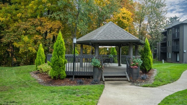
Property Record
2055 Se 44Th Ave, Hillsboro, OR 97123
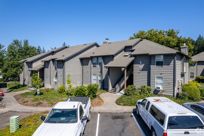

Property Detail
2055 Se 44Th Ave
R0338076
ACRES 12.58
Apartment
WASHINGTON
SFR-7
Oregon
A Areas with a 1% annual chance of flooding and a 26% chance of flooding over the life of a 30-year mortgage.
12.58 AC
2024
Southeast Hillsboro
2026
Portland
032412
Portland-Vancouver-Hillsboro, OR-WA
122,144 SF
NEARBY LISTINGS FOR SALE OR LEASE
DEMOGRAPHICS near 2055 Se 44Th Ave
1 mile
3 mile
5 mile
2025 Total Population
14,556
101,848
212,879
2030 Population
14,795
103,293
215,653
Pop Growth 2025-2030
+ 1.64%
+ 1.42%
+ 1.30%
Average Age
39
39
38
2025 Total Households
4,940
36,935
78,830
HH Growth 2025-2030
+ 1.76%
+ 1.56%
+ 1.43%
Median Household Inc
$117,296
$105,033
$103,450
Avg Household Size
2.80
2.70
2.60
2025 Avg HH Vehicles
2.00
2.00
2.00
Median Home Value
$534,987
$524,132
$544,138
Median Year Built
1994
1995
1993
Nearby Places
Map Layers
Map Styles
 Street
 Aerial
Layers
 Traffic
 Biking
Places
Listings with unknown addresses are not visible on the map
- Restaurants
- Banks
- Shops
- Fitness
- Groceries
PUBLIC TRANSPORTATION
COMMUTER RAIL
Beaverton Transit Center (West Side Express) (Westside Express Service - Tri-County Metropolitan Transportation District of Oregon Rail (TriMet Rail))
Drive
Walk
Distance
Beaverton Transit Center (West Side Express) (Westside Express Service - Tri-County Metropolitan Transportation District of Oregon Rail (TriMet Rail))
14 min
7.3 mi
Hall/Nimbus (Westside Express Service - Tri-County Metropolitan Transportation District of Oregon Rail (TriMet Rail))
Drive
Walk
Distance
Hall/Nimbus (Westside Express Service - Tri-County Metropolitan Transportation District of Oregon Rail (TriMet Rail))
18 min
9.7 mi
AIRPORT
Portland International
Drive
Walk
Distance
Portland International
46 min
27.5 mi
Freight Ports
Port of Portland
Drive
Walk
Distance
Port of Portland
29 min
16.5 mi
Nearby Properties
Address
Land Use
TOTAL SIZE
Lot Size
Zoning
Address
Land Use
TOTAL SIZE
Lot Size
Zoning
0.13 AC
I-P
Address
Land Use
TOTAL SIZE
Lot Size
Zoning
337.91 AC
I-P
Address
Land Use
TOTAL SIZE
Lot Size
Zoning
1,619,885 SF
115.71 AC
I-P
Address
Land Use
TOTAL SIZE
Lot Size
Zoning
9.97 AC
SCC-DT
Address
Land Use
TOTAL SIZE
Lot Size
Zoning
1,004,655 SF
24.55 AC
SCR-V
Address
Land Use
TOTAL SIZE
Lot Size
Zoning
60.97 AC
INST
Address
Land Use
TOTAL SIZE
Lot Size
Zoning
5.83 AC
INST
Address
Land Use
TOTAL SIZE
Lot Size
Zoning
2,016 SF
0.10 AC
I-S
Address
Land Use
TOTAL SIZE
Lot Size
Zoning
Address
Land Use
TOTAL SIZE
Lot Size
Zoning
248,332 SF
4.26 AC
SCC-DT
Address
Land Use
TOTAL SIZE
Lot Size
Zoning
37.66 AC
IND
Address
Land Use
TOTAL SIZE
Lot Size
Zoning
53.13 AC
SC-BP
Address
Land Use
TOTAL SIZE
Lot Size
Zoning
53.49 AC
SCFI
Address
Land Use
TOTAL SIZE
Lot Size
Zoning
256,652 SF
48.72 AC
SFR-7
Address
Land Use
TOTAL SIZE
Lot Size
Zoning
13,368 SF
112.70 AC
I-G
Address
Land Use
TOTAL SIZE
Lot Size
Zoning
82,297 SF
175.24 AC
I-G
Address
Land Use
TOTAL SIZE
Lot Size
Zoning
0.06 AC
I-P
Address
Land Use
TOTAL SIZE
Lot Size
Zoning
270,000 SF
37.85 AC
SFR-6
Address
Land Use
TOTAL SIZE
Lot Size
Zoning
0.68 AC
SCR-V
Address
Land Use
TOTAL SIZE
Lot Size
Zoning
252,251 SF
2.62 AC
SCC-DT
Address
Land Use
TOTAL SIZE
Lot Size
Zoning
3,616 SF
0.85 AC
SCC-DT
Address
Land Use
TOTAL SIZE
Lot Size
Zoning
495,454 SF
16.99 AC
SCR-V
Address
Land Use
TOTAL SIZE
Lot Size
Zoning
324,326 SF
4.23 AC
SCC-SC
Address
Land Use
TOTAL SIZE
Lot Size
Zoning
8.12 AC
SFR-4.5
Address
Land Use
TOTAL SIZE
Lot Size
Zoning
6.03 AC
SCR-MD
Address
Land Use
TOTAL SIZE
Lot Size
Zoning
24.26 AC
I-P
Address
Land Use
TOTAL SIZE
Lot Size
Zoning
43,041 SF
9.43 AC
SFR-7
Address
Land Use
TOTAL SIZE
Lot Size
Zoning
15.14 AC
MFR-3
Address
Land Use
TOTAL SIZE
Lot Size
Zoning
5.57 AC
MU-VTC
Address
Land Use
TOTAL SIZE
Lot Size
Zoning
219,963 SF
7.41 AC
TO:R18-24
The World's #1 Commercial Real Estate Marketplace
Connect with us
© 2026 CoStar Group
The information above has been obtained from sources believed reliable. While we do not doubt its accuracy we have not verified it and make no guarantee, warranty or representation about it. It is your responsibility to independently confirm its accuracy and completeness. Any projections, opinions, assumptions, or estimates used are for example only and do not represent the current or future performance of the property. The value of this transaction to you depends on tax and other factors which should be evaluated by your tax, financial, and legal advisors. You and your advisors should conduct a careful, independent investigation of the property to determine to your satisfaction the suitability of the property for your needs.