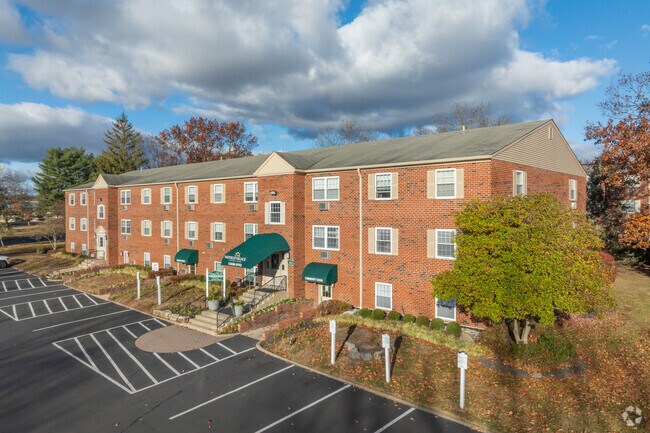
Property Record
2058 Maple Ave, Hatfield, PA 19440

Save to a Folder
{{folder.Name}}
{{folder.ListingIds.length}} Properties
{{folder.ListingIds.length}} Property
Create a New Folder
Property Detail
2058 Maple Ave
35-00-06454-009
U 78-79
Apartment
Montgomery
GA
Pennsylvania
AE The base floodplain where base flood elevations are provided. AE Zones are now used on new format FIRMs instead of A1-A30 Zones.
17
2026
70.93 AC
2026
Upper Montgomery County
200707
Philadelphia
977,439 SF
Philadelphia-Camden-Wilmington, PA-NJ-DE-MD
NEARBY LISTINGS FOR SALE OR LEASE
DEMOGRAPHICS near 2058 Maple Ave
1 mile
3 mile
5 mile
2025 Total Population
12,637
65,603
156,200
2030 Population
13,623
68,033
159,599
Pop Growth 2025-2030
+ 7.80%
+ 3.70%
+ 2.18%
Average Age
41
42
43
2025 Total Households
4,662
24,927
60,098
HH Growth 2025-2030
+ 6.80%
+ 3.45%
+ 2.05%
Median Household Inc
$94,978
$98,893
$104,213
Avg Household Size
2.60
2.50
2.50
2025 Avg HH Vehicles
2.00
2.00
2.00
Median Home Value
$432,460
$420,895
$432,244
Median Year Built
1985
1976
1980
Nearby Places
Map Layers
Map Styles
 Street
 Aerial
Layers
 Traffic
 Biking
Places
Listings with unknown addresses are not visible on the map
- Restaurants
- Banks
- Shops
- Fitness
- Groceries
PUBLIC TRANSPORTATION
COMMUTER RAIL
Fortuna (R5 - Southeastern Pennsylvania Transportation Authority Regional Rail (SEPTA Regional Rail))
Drive
Walk
Distance
Fortuna (R5 - Southeastern Pennsylvania Transportation Authority Regional Rail (SEPTA Regional Rail))
6 min
2.6 mi
Colmar (R5 - Southeastern Pennsylvania Transportation Authority Regional Rail (SEPTA Regional Rail))
Drive
Walk
Distance
Colmar (R5 - Southeastern Pennsylvania Transportation Authority Regional Rail (SEPTA Regional Rail))
8 min
3.8 mi
AIRPORT
Lehigh Valley International
Drive
Walk
Distance
Lehigh Valley International
52 min
31.7 mi
Trenton Mercer
Drive
Walk
Distance
Trenton Mercer
59 min
33.9 mi
Philadelphia International
Drive
Walk
Distance
Philadelphia International
59 min
41.3 mi
Freight Ports
Port of Philadelphia
Drive
Walk
Distance
Port of Philadelphia
45 min
26.8 mi
Nearby Properties
Address
Land Use
TOTAL SIZE
Lot Size
Zoning
Address
Land Use
TOTAL SIZE
Lot Size
Zoning
258,179 SF
65.34 AC
IN
Address
Land Use
TOTAL SIZE
Lot Size
Zoning
457,221 SF
37.18 AC
MRC
Address
Land Use
TOTAL SIZE
Lot Size
Zoning
517,834 SF
31.33 AC
GA
Address
Land Use
TOTAL SIZE
Lot Size
Zoning
832,830 SF
53.72 AC
LI
Address
Land Use
TOTAL SIZE
Lot Size
Zoning
349,078 SF
18.46 AC
INST
Address
Land Use
TOTAL SIZE
Lot Size
Zoning
253,915 SF
17.78 AC
GA
Address
Land Use
TOTAL SIZE
Lot Size
Zoning
219,869 SF
41.98 AC
LI
Address
Land Use
TOTAL SIZE
Lot Size
Zoning
211,561 SF
38.80 AC
LI
Address
Land Use
TOTAL SIZE
Lot Size
Zoning
225,154 SF
6.38 AC
B
Address
Land Use
TOTAL SIZE
Lot Size
Zoning
985,663 SF
64.82 AC
RC
Address
Land Use
TOTAL SIZE
Lot Size
Zoning
373,104 SF
31.94 AC
LI
Address
Land Use
TOTAL SIZE
Lot Size
Zoning
334,450 SF
18.86 AC
GA
Address
Land Use
TOTAL SIZE
Lot Size
Zoning
131,631 SF
18.12 AC
SC
Address
Land Use
TOTAL SIZE
Lot Size
Zoning
289,681 SF
4.75 AC
BPO
Address
Land Use
TOTAL SIZE
Lot Size
Zoning
220,124 SF
33.16 AC
SC
Address
Land Use
TOTAL SIZE
Lot Size
Zoning
168,557 SF
44.77 AC
RA1
Address
Land Use
TOTAL SIZE
Lot Size
Zoning
444,718 SF
46.51 AC
LI
Address
Land Use
TOTAL SIZE
Lot Size
Zoning
324,796 SF
42.20 AC
LI
Address
Land Use
TOTAL SIZE
Lot Size
Zoning
207,306 SF
14.50 AC
GA
Address
Land Use
TOTAL SIZE
Lot Size
Zoning
87,170 SF
10.23 AC
RA
Address
Land Use
TOTAL SIZE
Lot Size
Zoning
502,169 SF
83.16 AC
LI
Address
Land Use
TOTAL SIZE
Lot Size
Zoning
333,888 SF
35.37 AC
LI
Address
Land Use
TOTAL SIZE
Lot Size
Zoning
132,154 SF
21.50 AC
IN
Address
Land Use
TOTAL SIZE
Lot Size
Zoning
17,364 SF
31.92 AC
LI
Address
Land Use
TOTAL SIZE
Lot Size
Zoning
214,042 SF
26.53 AC
LI
Address
Land Use
TOTAL SIZE
Lot Size
Zoning
230,016 SF
11.27 AC
LI
Address
Land Use
TOTAL SIZE
Lot Size
Zoning
184,471 SF
0.80 AC
INST
Address
Land Use
TOTAL SIZE
Lot Size
Zoning
115,644 SF
1.90 AC
LI
Address
Land Use
TOTAL SIZE
Lot Size
Zoning
77,805 SF
21.18 AC
R2
The World's #1 Commercial Real Estate Marketplace
Connect with us
© 2026 CoStar Group
The information above has been obtained from sources believed reliable. While we do not doubt its accuracy we have not verified it and make no guarantee, warranty or representation about it. It is your responsibility to independently confirm its accuracy and completeness. Any projections, opinions, assumptions, or estimates used are for example only and do not represent the current or future performance of the property. The value of this transaction to you depends on tax and other factors which should be evaluated by your tax, financial, and legal advisors. You and your advisors should conduct a careful, independent investigation of the property to determine to your satisfaction the suitability of the property for your needs.