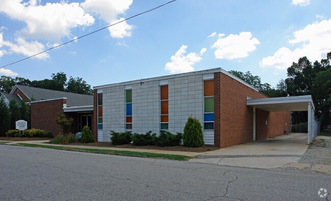
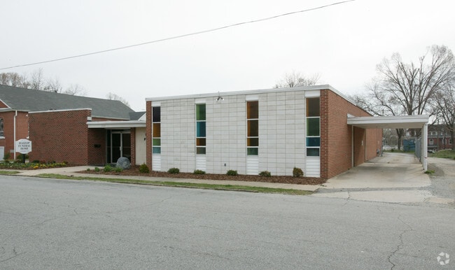
Property Record
206 4Th St, High Point, NC 27260

Property Detail
206 4Th St
0190468
9 & 10 PB 13-81 206 FOURTH ST PL:13-81
Cemetery
Guilford
CB
North Carolina
B and X Area of moderate flood hazard, usually the area between the limits of the 100-year and 500-year floods.
9-10
2024
0.34 AC
2025
High Point/SW Guilford Cty
013800
Greensboro/Winston-Salem
6,713 SF
Greensboro-High Point, NC
NEARBY LISTINGS FOR SALE OR LEASE
DEMOGRAPHICS near 206 4Th St
1 mile
3 mile
5 mile
2025 Total Population
13,103
65,505
116,771
2030 Population
13,817
68,111
120,892
Pop Growth 2025-2030
+ 5.45%
+ 3.98%
+ 3.53%
Average Age
35
38
40
2025 Total Households
4,299
24,729
45,892
HH Growth 2025-2030
+ 6.70%
+ 4.30%
+ 3.72%
Median Household Inc
$35,722
$48,288
$56,092
Avg Household Size
2.30
2.40
2.40
2025 Avg HH Vehicles
1.00
2.00
2.00
Median Home Value
$136,429
$175,080
$214,843
Median Year Built
1958
1971
1978
Nearby Places
Map Layers
Map Styles
 Street
 Aerial
Transit
 Traffic
 Biking
Places
Listings with unknown addresses are not visible on the map
- Restaurants
- Banks
- Shops
- Fitness
- Groceries
PUBLIC TRANSPORTATION
COMMUTER RAIL
High Point Station (Piedmont - North Carolina by Train (NC Train))
Drive
Walk
Distance
High Point Station (Piedmont - North Carolina by Train (NC Train))
1 min
11 min
0.6 mi
AIRPORT
Piedmont Triad International
Drive
Walk
Distance
Piedmont Triad International
25 min
11.8 mi
Freight Ports
Port of Wilmington
Drive
Walk
Distance
Port of Wilmington
251 min
212.7 mi
Nearby Properties
Address
Land Use
TOTAL SIZE
Lot Size
Zoning
Address
Land Use
TOTAL SIZE
Lot Size
Zoning
264,860 SF
62.75 AC
PI
Address
Land Use
TOTAL SIZE
Lot Size
Zoning
418,654 SF
17.20 AC
PI
Address
Land Use
TOTAL SIZE
Lot Size
Zoning
1,277,656 SF
2.47 AC
CB
Address
Land Use
TOTAL SIZE
Lot Size
Zoning
464,134 SF
11.28 AC
PI
Address
Land Use
TOTAL SIZE
Lot Size
Zoning
236,597 SF
13.83 AC
CU-PI
Address
Land Use
TOTAL SIZE
Lot Size
Zoning
484,289 SF
6.41 AC
CB
Address
Land Use
TOTAL SIZE
Lot Size
Zoning
139,254 SF
0.01 AC
PI
Address
Land Use
TOTAL SIZE
Lot Size
Zoning
796,121 SF
9.36 AC
CB
Address
Land Use
TOTAL SIZE
Lot Size
Zoning
802,214 SF
0.01 AC
CB
Address
Land Use
TOTAL SIZE
Lot Size
Zoning
805,958 SF
61.42 AC
LI
Address
Land Use
TOTAL SIZE
Lot Size
Zoning
706,686 SF
39.02 AC
R-5
Address
Land Use
TOTAL SIZE
Lot Size
Zoning
136,202 SF
30.02 AC
CZ-I
Address
Land Use
TOTAL SIZE
Lot Size
Zoning
457,534 SF
2.13 AC
CB
Address
Land Use
TOTAL SIZE
Lot Size
Zoning
142,800 SF
1.04 AC
CB
Address
Land Use
TOTAL SIZE
Lot Size
Zoning
285,094 SF
3.23 AC
CB
Address
Land Use
TOTAL SIZE
Lot Size
Zoning
104,686 SF
12.97 AC
GB
Address
Land Use
TOTAL SIZE
Lot Size
Zoning
100,121 SF
0.01 AC
PI
Address
Land Use
TOTAL SIZE
Lot Size
Zoning
215,222 SF
15.14 AC
RC
Address
Land Use
TOTAL SIZE
Lot Size
Zoning
185,320 SF
15.08 AC
PI
Address
Land Use
TOTAL SIZE
Lot Size
Zoning
170,183 SF
13.94 AC
RM-16
Address
Land Use
TOTAL SIZE
Lot Size
Zoning
166,196 SF
19.99 AC
RM-16
Address
Land Use
TOTAL SIZE
Lot Size
Zoning
355,633 SF
63.42 AC
HI
Address
Land Use
TOTAL SIZE
Lot Size
Zoning
322,779 SF
0.88 AC
CB
Address
Land Use
TOTAL SIZE
Lot Size
Zoning
164,027 SF
12.52 AC
RM-16
Address
Land Use
TOTAL SIZE
Lot Size
Zoning
90,060 SF
3.15 AC
CZ-I
Address
Land Use
TOTAL SIZE
Lot Size
Zoning
297,676 SF
0.48 AC
CB
Address
Land Use
TOTAL SIZE
Lot Size
Zoning
56,029 SF
9.36 AC
CU-GB
Address
Land Use
TOTAL SIZE
Lot Size
Zoning
319,603 SF
1.34 AC
CB
Address
Land Use
TOTAL SIZE
Lot Size
Zoning
196,353 SF
13.76 AC
RC
Address
Land Use
TOTAL SIZE
Lot Size
Zoning
250,573 SF
48.53 AC
R-5
The World's #1 Commercial Real Estate Marketplace
Connect with us
© 2026 CoStar Group
The information above has been obtained from sources believed reliable. While we do not doubt its accuracy we have not verified it and make no guarantee, warranty or representation about it. It is your responsibility to independently confirm its accuracy and completeness. Any projections, opinions, assumptions, or estimates used are for example only and do not represent the current or future performance of the property. The value of this transaction to you depends on tax and other factors which should be evaluated by your tax, financial, and legal advisors. You and your advisors should conduct a careful, independent investigation of the property to determine to your satisfaction the suitability of the property for your needs.