Property Record
206 Adams Rd, Williamstown, MA 01267
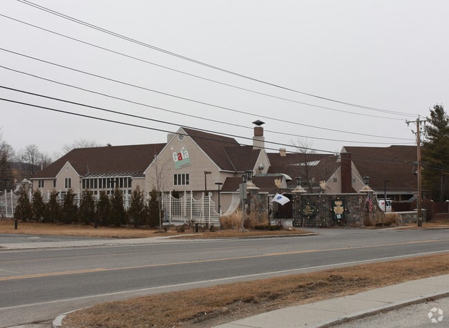

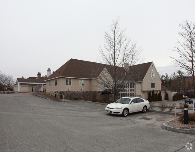
Property Detail
206 Adams Rd
WILL-000121-000000-000109
Berkshire
Resorthotel
Massachusetts
PB
2.72 AC
2025
Massachusetts North/West Area
2025
Other Market Areas
920102
Pittsfield, MA
32,702 SF
NEARBY LISTINGS FOR SALE OR LEASE
-
-
View all Williamstown listings for lease on LoopNet.com
DEMOGRAPHICS near 206 Adams Rd
1 mile
3 mile
5 mile
2025 Total Population
5,059
12,900
23,100
2030 Population
5,188
13,497
23,641
Pop Growth 2025-2030
+ 2.55%
+ 4.63%
+ 2.34%
Average Age
38
43
43
2025 Total Households
1,411
4,610
9,053
HH Growth 2025-2030
+ 1.91%
+ 4.69%
+ 1.98%
Median Household Inc
$79,446
$87,846
$70,068
Avg Household Size
2.10
2.10
2.10
2025 Avg HH Vehicles
1.00
2.00
2.00
Median Home Value
$413,520
$412,098
$290,414
Median Year Built
1957
1968
1954
Nearby Places
Map Layers
Map Styles
 Street
 Aerial
Layers
 Traffic
 Biking
Places
Listings with unknown addresses are not visible on the map
- Restaurants
- Banks
- Shops
- Fitness
- Groceries
SALE & LEASE HISTORY
LISTING DATE
SALE/LEASE

Nov 22, 2024
For Lease
Nearby Properties
Address
Land Use
TOTAL SIZE
Lot Size
Zoning
Address
Land Use
TOTAL SIZE
Lot Size
Zoning
17.72 AC
VB
Address
Land Use
TOTAL SIZE
Lot Size
Zoning
3,770 SF
134 AC
GR
Address
Land Use
TOTAL SIZE
Lot Size
Zoning
283,398 SF
14.50 AC
GR
Address
Land Use
TOTAL SIZE
Lot Size
Zoning
4.98 AC
GR
Address
Land Use
TOTAL SIZE
Lot Size
Zoning
61,182 SF
3.86 AC
GR
Address
Land Use
TOTAL SIZE
Lot Size
Zoning
91,474 SF
8.75 AC
PB
Address
Land Use
TOTAL SIZE
Lot Size
Zoning
5.24 AC
GR
Address
Land Use
TOTAL SIZE
Lot Size
Zoning
3,205 SF
132 AC
Address
Land Use
TOTAL SIZE
Lot Size
Zoning
37,254 SF
14.16 AC
GR
Address
Land Use
TOTAL SIZE
Lot Size
Zoning
4.30 AC
GR
Address
Land Use
TOTAL SIZE
Lot Size
Zoning
114,992 SF
5.95 AC
Address
Land Use
TOTAL SIZE
Lot Size
Zoning
64,956 SF
6.79 AC
Address
Land Use
TOTAL SIZE
Lot Size
Zoning
62,745 SF
3.40 AC
PB
Address
Land Use
TOTAL SIZE
Lot Size
Zoning
2,295.68 AC
RR1
Address
Land Use
TOTAL SIZE
Lot Size
Zoning
36,843 SF
114 AC
GR
Address
Land Use
TOTAL SIZE
Lot Size
Zoning
142,868 SF
11 AC
Address
Land Use
TOTAL SIZE
Lot Size
Zoning
1,233 AC
RR1
Address
Land Use
TOTAL SIZE
Lot Size
Zoning
10,224 SF
510 AC
Address
Land Use
TOTAL SIZE
Lot Size
Zoning
17 AC
GR
Address
Land Use
TOTAL SIZE
Lot Size
Zoning
117,566 SF
10 AC
Address
Land Use
TOTAL SIZE
Lot Size
Zoning
18.40 AC
GR
Address
Land Use
TOTAL SIZE
Lot Size
Zoning
2,492 SF
6.80 AC
GR
Address
Land Use
TOTAL SIZE
Lot Size
Zoning
146,228 SF
27 AC
PB
Address
Land Use
TOTAL SIZE
Lot Size
Zoning
1.01 AC
Address
Land Use
TOTAL SIZE
Lot Size
Zoning
5,779 SF
22.86 AC
GR
Address
Land Use
TOTAL SIZE
Lot Size
Zoning
365 AC
RR2
Address
Land Use
TOTAL SIZE
Lot Size
Zoning
7,016 SF
7.28 AC
GR
Address
Land Use
TOTAL SIZE
Lot Size
Zoning
5.44 AC
GR
Address
Land Use
TOTAL SIZE
Lot Size
Zoning
16,740 SF
4.90 AC
GR
Address
Land Use
TOTAL SIZE
Lot Size
Zoning
22,278 SF
0.25 AC
VB
The World's #1 Commercial Real Estate Marketplace
Connect with us
© 2026 CoStar Group
The information above has been obtained from sources believed reliable. While we do not doubt its accuracy we have not verified it and make no guarantee, warranty or representation about it. It is your responsibility to independently confirm its accuracy and completeness. Any projections, opinions, assumptions, or estimates used are for example only and do not represent the current or future performance of the property. The value of this transaction to you depends on tax and other factors which should be evaluated by your tax, financial, and legal advisors. You and your advisors should conduct a careful, independent investigation of the property to determine to your satisfaction the suitability of the property for your needs.