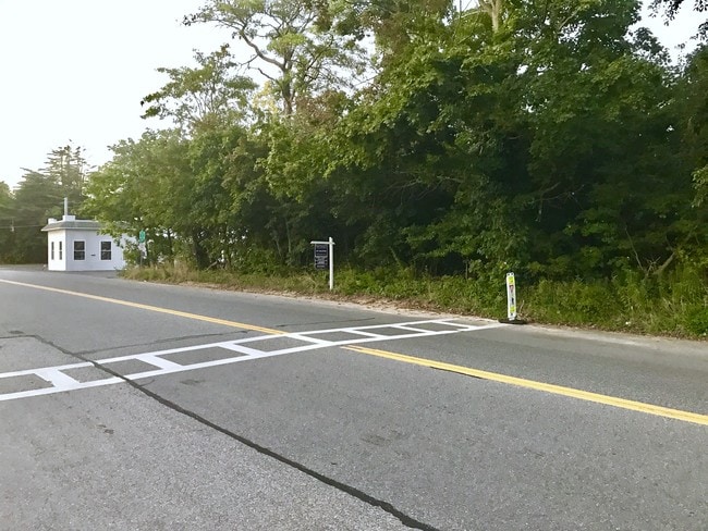
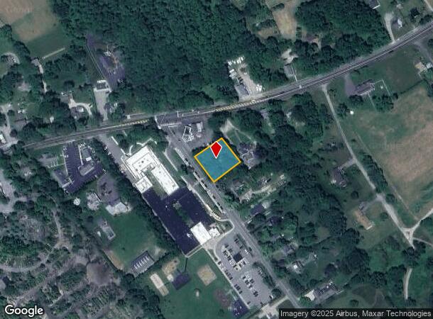
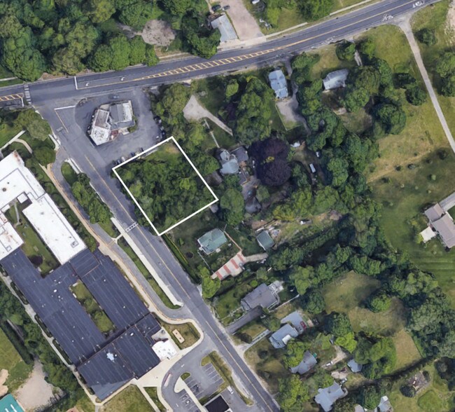
Property Record
206 Edgar Ave, Riverhead, NY 11901
NEARBY LISTINGS FOR SALE OR LEASE
Property Detail
206 Edgar Ave
0600-085-00-03-00-079-001
Suffolk
Commercialacreage
New York
X
79
36103C0460H
0.40 AC
2024
Eastern Suffolk
2024
Long Island (New York)
169906
Nassau County-Suffolk County, NY
DEMOGRAPHICS near 206 Edgar Ave
1 Mile
3 Mile
5 Mile
2024 Total Population
1,491
23,159
34,489
2029 Population
1,425
22,970
34,301
Pop Growth 2024-2029
(4.43%)
(0.82%)
(0.55%)
Average Age
43
42
43
2024 Total Households
538
8,140
12,550
HH Growth 2024-2029
(5.02%)
(1.14%)
(0.83%)
Median Household Inc
$133,984
$75,103
$73,310
Avg Household Size
2.70
2.70
2.60
2024 Avg HH Vehicles
3.00
2.00
2.00
Median Home Value
$636,926
$440,360
$440,479
Median Year Built
1980
1981
1982
Nearby Places
- Restaurants
- Banks
- Shops
- Fitness
- Groceries
PUBLIC TRANSPORTATION
COMMUTER RAIL
Riverhead Station (Greenport Branch - Long Island Rail Road)
DRIVE
WALK
Distance
Riverhead Station (Greenport Branch - Long Island Rail Road)
7 min
3.2 mi
Mattituck Station (Greenport Branch - Long Island Rail Road)
DRIVE
WALK
Distance
Mattituck Station (Greenport Branch - Long Island Rail Road)
12 min
6.5 mi
AIRPORT
Long Island MacArthur
DRIVE
WALK
Distance
Long Island MacArthur
49 min
31.8 mi
Freight Ports
Port of New Haven
DRIVE
WALK
Distance
Port of New Haven
152 min
62.0 mi
SALE & LEASE HISTORY
LISTING DATE
SALE/LEASE

Sep 28, 2017
For Sale
Sep 28, 2017
For Sale
Jun 15, 2019
For Sale
Nearby Properties
Address
Land Use
TOTAL SIZE
Lot Size
Zoning
Address
Land Use
TOTAL SIZE
Lot Size
Zoning
450,000 SF
8.50 AC
3
Address
Land Use
TOTAL SIZE
Lot Size
Zoning
252,053 SF
31.60 AC
3
Address
Land Use
TOTAL SIZE
Lot Size
Zoning
49,680 SF
1.30 AC
8
Address
Land Use
TOTAL SIZE
Lot Size
Zoning
176,704 SF
34.70 AC
3
Address
Land Use
TOTAL SIZE
Lot Size
Zoning
51.70 AC
R15
Address
Land Use
TOTAL SIZE
Lot Size
Zoning
8,100 SF
4.31 AC
LI40
Address
Land Use
TOTAL SIZE
Lot Size
Zoning
222 AC
H2O
Address
Land Use
TOTAL SIZE
Lot Size
Zoning
151,290 SF
6.17 AC
08
Address
Land Use
TOTAL SIZE
Lot Size
Zoning
81.70 AC
R60
Address
Land Use
TOTAL SIZE
Lot Size
Zoning
36,883 SF
14.80 AC
R15
Address
Land Use
TOTAL SIZE
Lot Size
Zoning
23,743 SF
5.80 AC
MTL
Address
Land Use
TOTAL SIZE
Lot Size
Zoning
16,699 SF
24.81 AC
03
Address
Land Use
TOTAL SIZE
Lot Size
Zoning
29.72 AC
R20
Address
Land Use
TOTAL SIZE
Lot Size
Zoning
3,468 SF
17.70 AC
CR60
Address
Land Use
TOTAL SIZE
Lot Size
Zoning
13,773 SF
11.65 AC
03
Address
Land Use
TOTAL SIZE
Lot Size
Zoning
36.60 AC
RC
Address
Land Use
TOTAL SIZE
Lot Size
Zoning
108,504 SF
31.20 AC
SC
Address
Land Use
TOTAL SIZE
Lot Size
Zoning
4,410 SF
1 AC
OD
Address
Land Use
TOTAL SIZE
Lot Size
Zoning
113,634 SF
27.49 AC
04
Address
Land Use
TOTAL SIZE
Lot Size
Zoning
3,362 SF
3 AC
RWB
Address
Land Use
TOTAL SIZE
Lot Size
Zoning
28.97 AC
R40
Address
Land Use
TOTAL SIZE
Lot Size
Zoning
73,651 SF
8.50 AC
3
Address
Land Use
TOTAL SIZE
Lot Size
Zoning
2,860 SF
9.38 AC
3
Address
Land Use
TOTAL SIZE
Lot Size
Zoning
14,520 SF
21.20 AC
04
Address
Land Use
TOTAL SIZE
Lot Size
Zoning
274.40 AC
05
Address
Land Use
TOTAL SIZE
Lot Size
Zoning
10,500 SF
1.45 AC
LI40
Address
Land Use
TOTAL SIZE
Lot Size
Zoning
15.40 AC
RA40
Address
Land Use
TOTAL SIZE
Lot Size
Zoning
12,570 SF
1.63 AC
8
Address
Land Use
TOTAL SIZE
Lot Size
Zoning
19,179 SF
0.74 AC
08
Address
Land Use
TOTAL SIZE
Lot Size
Zoning
3,676 SF
2 AC
VB
The World's #1 Commercial Real Estate Marketplace
Connect with us
© 2025 CoStar Group
The information above has been obtained from sources believed reliable. While we do not doubt its accuracy we have not verified it and make no guarantee, warranty or representation about it. It is your responsibility to independently confirm its accuracy and completeness. Any projections, opinions, assumptions, or estimates used are for example only and do not represent the current or future performance of the property. The value of this transaction to you depends on tax and other factors which should be evaluated by your tax, financial, and legal advisors. You and your advisors should conduct a careful, independent investigation of the property to determine to your satisfaction the suitability of the property for your needs.