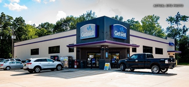
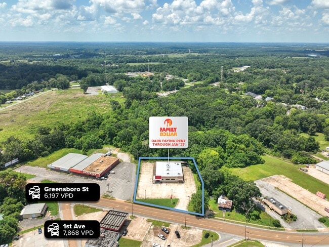
Property Record
320 Prairie Ave, Eutaw, AL 35462
Current Lease Availabilities
NEARBY LISTINGS FOR SALE OR LEASE
Property Detail
320 Prairie Ave
18083430080030000
BEG 900'(S) E & 700'(S) S OF NW COR SW1/4 TH N 192.7' SE 46'; NE 164.8'; SE ALG SW RD 96'; SW'LY 326.1' TO POB IN NW1/4 OF
Storebuilding
Greene
X
Alabama
01063C0375C
2 AC
2025
Greene County
2025
Birmingham
060101
Tuscaloosa, AL
8,576 SF
DEMOGRAPHICS near 320 Prairie Ave
1 Mile
3 Mile
5 Mile
2024 Total Population
1,522
2,544
2,898
2029 Population
1,417
2,360
2,701
Pop Growth 2024-2029
(6.90%)
(7.23%)
(6.80%)
Average Age
41
40
41
2024 Total Households
650
1,091
1,250
HH Growth 2024-2029
(6.00%)
(6.32%)
(6.00%)
Median Household Inc
$31,320
$31,802
$31,749
Avg Household Size
2.20
2.20
2.20
2024 Avg HH Vehicles
2.00
2.00
2.00
Median Home Value
$103,571
$102,731
$103,080
Median Year Built
1978
1977
1977
Nearby Places
Map Layers
Map Styles
 Street
 Aerial
- Restaurants
- Banks
- Shops
- Fitness
- Groceries
Nearby Properties
Address
Land Use
TOTAL SIZE
Lot Size
Zoning
Address
Land Use
TOTAL SIZE
Lot Size
Zoning
1.86 AC
Address
Land Use
TOTAL SIZE
Lot Size
Zoning
3,996 SF
1 AC
O
Address
Land Use
TOTAL SIZE
Lot Size
Zoning
2,759 SF
39 AC
Address
Land Use
TOTAL SIZE
Lot Size
Zoning
5,268 SF
6.20 AC
O
Address
Land Use
TOTAL SIZE
Lot Size
Zoning
3,636 SF
0.89 AC
O
Address
Land Use
TOTAL SIZE
Lot Size
Zoning
4,536 SF
1.33 AC
O
Address
Land Use
TOTAL SIZE
Lot Size
Zoning
2,987 SF
1.07 AC
O
Address
Land Use
TOTAL SIZE
Lot Size
Zoning
2,250 SF
0.43 AC
O
Address
Land Use
TOTAL SIZE
Lot Size
Zoning
3,432 SF
6 AC
O
Address
Land Use
TOTAL SIZE
Lot Size
Zoning
2,009 SF
0.43 AC
O
Address
Land Use
TOTAL SIZE
Lot Size
Zoning
2,009 SF
0.43 AC
O
Address
Land Use
TOTAL SIZE
Lot Size
Zoning
2,025 SF
0.42 AC
O
Address
Land Use
TOTAL SIZE
Lot Size
Zoning
2,021 SF
0.43 AC
O
The World's #1 Commercial Real Estate Marketplace
Connect with us
© 2026 CoStar Group
The information above has been obtained from sources believed reliable. While we do not doubt its accuracy we have not verified it and make no guarantee, warranty or representation about it. It is your responsibility to independently confirm its accuracy and completeness. Any projections, opinions, assumptions, or estimates used are for example only and do not represent the current or future performance of the property. The value of this transaction to you depends on tax and other factors which should be evaluated by your tax, financial, and legal advisors. You and your advisors should conduct a careful, independent investigation of the property to determine to your satisfaction the suitability of the property for your needs.