Property Record
206 N Randall St, Ingalls, IN 46048

NEARBY LISTINGS FOR SALE OR LEASE
Property Detail
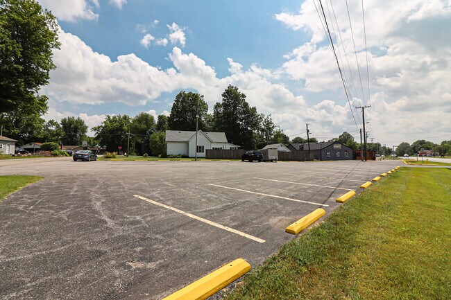
206 N Randall St
48-16-01-200-181.000-015
OP W2 V/A 0.0000ACRES STR: 00000 SECTION: PLAT: 00 IN: OUT:
Restaurantbuilding
Madison
X
Indiana
18057C0300G
0.12 AC
2024
Anderson/Madison Cnty
2025
Indianapolis
011800
Indianapolis-Carmel-Anderson, IN
DEMOGRAPHICS near 206 N Randall St
1 Mile
3 Mile
5 Mile
2024 Total Population
1,789
13,525
35,352
2029 Population
1,790
14,284
38,476
Pop Growth 2024-2029
+ 0.06%
+ 5.61%
+ 8.84%
Average Age
38
38
40
2024 Total Households
663
4,264
12,140
HH Growth 2024-2029
+ 0.15%
+ 7.20%
+ 9.53%
Median Household Inc
$56,792
$75,195
$91,720
Avg Household Size
2.70
2.60
2.60
2024 Avg HH Vehicles
2.00
2.00
2.00
Median Home Value
$152,166
$193,292
$275,985
Median Year Built
1981
1993
2002
Nearby Places
Map Layers
Map Styles
 Street
 Aerial
- Restaurants
- Banks
- Shops
- Fitness
- Groceries
SALE & LEASE HISTORY
LISTING DATE
SALE/LEASE

Jun 21, 2023
For Sale
Nearby Properties
Address
Land Use
TOTAL SIZE
Lot Size
Zoning
Address
Land Use
TOTAL SIZE
Lot Size
Zoning
1,200 SF
18.67 AC
Address
Land Use
TOTAL SIZE
Lot Size
Zoning
18,512 SF
4.26 AC
Address
Land Use
TOTAL SIZE
Lot Size
Zoning
78.98 AC
Address
Land Use
TOTAL SIZE
Lot Size
Zoning
6,720 SF
3.35 AC
Address
Land Use
TOTAL SIZE
Lot Size
Zoning
5,370 SF
6.97 AC
Address
Land Use
TOTAL SIZE
Lot Size
Zoning
43,039 SF
2.56 AC
Address
Land Use
TOTAL SIZE
Lot Size
Zoning
15,140 SF
2.73 AC
Address
Land Use
TOTAL SIZE
Lot Size
Zoning
60,406 SF
2.91 AC
Address
Land Use
TOTAL SIZE
Lot Size
Zoning
30,560 SF
11.27 AC
Address
Land Use
TOTAL SIZE
Lot Size
Zoning
44,732 SF
1.60 AC
Address
Land Use
TOTAL SIZE
Lot Size
Zoning
18,557 SF
9.92 AC
Address
Land Use
TOTAL SIZE
Lot Size
Zoning
1,352 SF
57.81 AC
Address
Land Use
TOTAL SIZE
Lot Size
Zoning
3,900 SF
3.66 AC
Address
Land Use
TOTAL SIZE
Lot Size
Zoning
6,798 SF
3.23 AC
Address
Land Use
TOTAL SIZE
Lot Size
Zoning
10,000 SF
2.94 AC
Address
Land Use
TOTAL SIZE
Lot Size
Zoning
25,763 SF
6.30 AC
Address
Land Use
TOTAL SIZE
Lot Size
Zoning
17,425 SF
2 AC
Address
Land Use
TOTAL SIZE
Lot Size
Zoning
8,700 SF
2.93 AC
Address
Land Use
TOTAL SIZE
Lot Size
Zoning
9,219 SF
0.63 AC
Address
Land Use
TOTAL SIZE
Lot Size
Zoning
3,863 SF
1.42 AC
Address
Land Use
TOTAL SIZE
Lot Size
Zoning
4,038 SF
1.21 AC
Address
Land Use
TOTAL SIZE
Lot Size
Zoning
10,940 SF
2.15 AC
Address
Land Use
TOTAL SIZE
Lot Size
Zoning
3,945 SF
0.65 AC
Address
Land Use
TOTAL SIZE
Lot Size
Zoning
5,000 SF
3.22 AC
Address
Land Use
TOTAL SIZE
Lot Size
Zoning
7,200 SF
20 AC
Address
Land Use
TOTAL SIZE
Lot Size
Zoning
293.49 AC
Address
Land Use
TOTAL SIZE
Lot Size
Zoning
14,000 SF
1.16 AC
Address
Land Use
TOTAL SIZE
Lot Size
Zoning
10,093 SF
1.88 AC
Address
Land Use
TOTAL SIZE
Lot Size
Zoning
10,274 SF
0.10 AC
Address
Land Use
TOTAL SIZE
Lot Size
Zoning
20,349 SF
2.31 AC
The World's #1 Commercial Real Estate Marketplace
Connect with us
© 2025 CoStar Group
The information above has been obtained from sources believed reliable. While we do not doubt its accuracy we have not verified it and make no guarantee, warranty or representation about it. It is your responsibility to independently confirm its accuracy and completeness. Any projections, opinions, assumptions, or estimates used are for example only and do not represent the current or future performance of the property. The value of this transaction to you depends on tax and other factors which should be evaluated by your tax, financial, and legal advisors. You and your advisors should conduct a careful, independent investigation of the property to determine to your satisfaction the suitability of the property for your needs.