Property Record
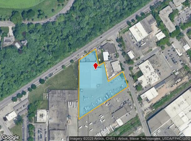
2060 7Th St W, Saint Paul, MN 55116

NEARBY LISTINGS FOR SALE OR LEASE
Property Detail
2060 7Th St W
Minneapolis-St. Paul-Bloomington, MN-WI
Fort Street Out Lots
15-28-23-43-0043
FORT STREET OUT LOTS EX ELY 56.66 FT OF NLY 150 FT LOT 4 & ALL OF LOT 3 & ALL OF LOT 10
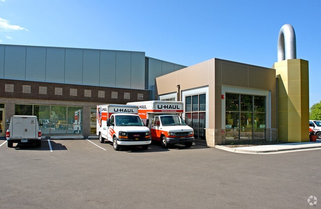
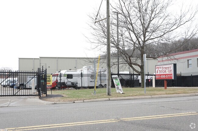
Publicstorage
Ramsey
X
Minnesota
27053C0400F
3-4,1
2024
3.42 AC
2025
St Paul
037603
Minneapolis/St Paul
125,350 SF
DEMOGRAPHICS near 2060 7Th St W
1 Mile
3 Mile
5 Mile
2024 Total Population
10,626
97,814
284,328
2029 Population
10,449
96,021
280,912
Pop Growth 2024-2029
(1.67%)
(1.83%)
(1.20%)
Average Age
43
41
39
2024 Total Households
4,912
42,713
124,189
HH Growth 2024-2029
(1.73%)
(2.07%)
(1.24%)
Median Household Inc
$64,186
$86,653
$73,111
Avg Household Size
2.10
2.20
2.20
2024 Avg HH Vehicles
1.00
2.00
2.00
Median Home Value
$381,330
$378,649
$319,551
Median Year Built
1972
1949
1953
Nearby Places
Map Layers
Map Styles
 Street
 Aerial
- Restaurants
- Banks
- Shops
- Fitness
- Groceries
PUBLIC TRANSPORTATION
COMMUTER RAIL
DRIVE
WALK
Distance
10 min
4.9 mi
AIRPORT
Minneapolis-St Paul International/Wold-Chamberlain
DRIVE
WALK
Distance
Minneapolis-St Paul International/Wold-Chamberlain
10 min
4.6 mi
Nearby Properties
Address
Land Use
TOTAL SIZE
Lot Size
Zoning
Address
Land Use
TOTAL SIZE
Lot Size
Zoning
141,277 SF
44.78 AC
Address
Land Use
TOTAL SIZE
Lot Size
Zoning
84,316 SF
40.83 AC
Address
Land Use
TOTAL SIZE
Lot Size
Zoning
504,049 SF
75.43 AC
Address
Land Use
TOTAL SIZE
Lot Size
Zoning
63.12 AC
Address
Land Use
TOTAL SIZE
Lot Size
Zoning
176,108 SF
27.45 AC
Address
Land Use
TOTAL SIZE
Lot Size
Zoning
2.65 AC
Address
Land Use
TOTAL SIZE
Lot Size
Zoning
267,530 SF
28.60 AC
Address
Land Use
TOTAL SIZE
Lot Size
Zoning
395,419 SF
2.73 AC
Address
Land Use
TOTAL SIZE
Lot Size
Zoning
173.22 AC
Address
Land Use
TOTAL SIZE
Lot Size
Zoning
445,437 SF
7.80 AC
Address
Land Use
TOTAL SIZE
Lot Size
Zoning
265,736 SF
6.67 AC
Address
Land Use
TOTAL SIZE
Lot Size
Zoning
Address
Land Use
TOTAL SIZE
Lot Size
Zoning
387,902 SF
14.81 AC
Address
Land Use
TOTAL SIZE
Lot Size
Zoning
217,620 SF
16.11 AC
Address
Land Use
TOTAL SIZE
Lot Size
Zoning
429,720 SF
6.02 AC
Address
Land Use
TOTAL SIZE
Lot Size
Zoning
247,470 SF
2.21 AC
Address
Land Use
TOTAL SIZE
Lot Size
Zoning
279,247 SF
1.65 AC
Address
Land Use
TOTAL SIZE
Lot Size
Zoning
377,319 SF
6.94 AC
Address
Land Use
TOTAL SIZE
Lot Size
Zoning
233,578 SF
9.56 AC
Address
Land Use
TOTAL SIZE
Lot Size
Zoning
237,685 SF
2.22 AC
Address
Land Use
TOTAL SIZE
Lot Size
Zoning
Address
Land Use
TOTAL SIZE
Lot Size
Zoning
378,880 SF
3.42 AC
Address
Land Use
TOTAL SIZE
Lot Size
Zoning
437,524 SF
6.11 AC
Address
Land Use
TOTAL SIZE
Lot Size
Zoning
196,078 SF
1.22 AC
Address
Land Use
TOTAL SIZE
Lot Size
Zoning
233,588 SF
2.35 AC
Address
Land Use
TOTAL SIZE
Lot Size
Zoning
288,834 SF
1.72 AC
Address
Land Use
TOTAL SIZE
Lot Size
Zoning
2.18 AC
Address
Land Use
TOTAL SIZE
Lot Size
Zoning
Address
Land Use
TOTAL SIZE
Lot Size
Zoning
Address
Land Use
TOTAL SIZE
Lot Size
Zoning
44,672 SF
63.51 AC
The World's #1 Commercial Real Estate Marketplace
Connect with us
© 2025 CoStar Group
The information above has been obtained from sources believed reliable. While we do not doubt its accuracy we have not verified it and make no guarantee, warranty or representation about it. It is your responsibility to independently confirm its accuracy and completeness. Any projections, opinions, assumptions, or estimates used are for example only and do not represent the current or future performance of the property. The value of this transaction to you depends on tax and other factors which should be evaluated by your tax, financial, and legal advisors. You and your advisors should conduct a careful, independent investigation of the property to determine to your satisfaction the suitability of the property for your needs.