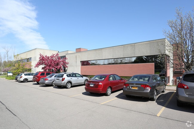
Property Record
2060 Frpt Nine Mile Pt Rd, Penfield, NY 14526
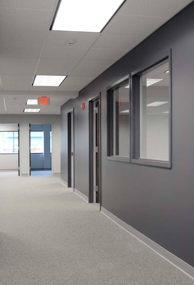
Current Lease Availabilities
NEARBY LISTINGS FOR SALE OR LEASE
Property Detail
2060 Frpt Nine Mile Pt Rd
264200 140.01-1-2.11
Platinum Office Park Subdivision
Professionalbldglegalinsurancerealestateetc
Monroe
X
New York
36055C0240G
2.110
2025
2.69 AC
2024
Northeast
011601
Rochester
25,220 SF
Rochester, NY
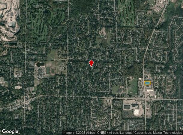
DEMOGRAPHICS near 2060 Frpt Nine Mile Pt Rd
1 Mile
3 Mile
5 Mile
2024 Total Population
9,272
42,432
107,135
2029 Population
9,163
41,741
105,682
Pop Growth 2024-2029
(1.18%)
(1.63%)
(1.36%)
Average Age
44
43
44
2024 Total Households
3,768
17,886
44,874
HH Growth 2024-2029
(1.25%)
(1.77%)
(1.44%)
Median Household Inc
$79,687
$78,721
$88,857
Avg Household Size
2.40
2.30
2.30
2024 Avg HH Vehicles
2.00
2.00
2.00
Median Home Value
$235,714
$240,935
$243,108
Median Year Built
1981
1974
1974
Nearby Places
- Restaurants
- Banks
- Shops
- Fitness
- Groceries
PUBLIC TRANSPORTATION
COMMUTER RAIL
Rochester (Empire Service - VIA Rail, Lake Shore Limited - VIA Rail, Maple Leaf - VIA Rail, Toronto - New York - VIA Rail)
DRIVE
WALK
Distance
Rochester (Empire Service - VIA Rail, Lake Shore Limited - VIA Rail, Maple Leaf - VIA Rail, Toronto - New York - VIA Rail)
18 min
9.9 mi
AIRPORT
Frederick Douglass/Greater Rochester International
DRIVE
WALK
Distance
Frederick Douglass/Greater Rochester International
23 min
13.3 mi
Freight Ports
Albany, NY Port
DRIVE
WALK
Distance
Albany, NY Port
267 min
223.0 mi
Nearby Properties
Address
Land Use
TOTAL SIZE
Lot Size
Zoning
Address
Land Use
TOTAL SIZE
Lot Size
Zoning
640 SF
84.10 AC
RA-2
Address
Land Use
TOTAL SIZE
Lot Size
Zoning
408,790 SF
31.90 AC
02 - SINGL
Address
Land Use
TOTAL SIZE
Lot Size
Zoning
3,752 SF
36.50 AC
MR
Address
Land Use
TOTAL SIZE
Lot Size
Zoning
251,359 SF
46.83 AC
GB
Address
Land Use
TOTAL SIZE
Lot Size
Zoning
364,800 SF
28.40 AC
R-1-15
Address
Land Use
TOTAL SIZE
Lot Size
Zoning
65,750 SF
42.60 AC
APT
Address
Land Use
TOTAL SIZE
Lot Size
Zoning
193,120 SF
10.83 AC
INDUSTRIAL
Address
Land Use
TOTAL SIZE
Lot Size
Zoning
283,456 SF
40.76 AC
R-1-20
Address
Land Use
TOTAL SIZE
Lot Size
Zoning
1,878 SF
56.60 AC
MHP
Address
Land Use
TOTAL SIZE
Lot Size
Zoning
74,490 SF
16.20 AC
MIXED USE
Address
Land Use
TOTAL SIZE
Lot Size
Zoning
90,684 SF
20.51 AC
LI
Address
Land Use
TOTAL SIZE
Lot Size
Zoning
38,776 SF
10.33 AC
MR
Address
Land Use
TOTAL SIZE
Lot Size
Zoning
4,210 SF
14.85 AC
PDD
Address
Land Use
TOTAL SIZE
Lot Size
Zoning
247,668 SF
36.68 AC
GB
Address
Land Use
TOTAL SIZE
Lot Size
Zoning
50,387 SF
4.10 AC
02 - SINGL
Address
Land Use
TOTAL SIZE
Lot Size
Zoning
105,674 SF
9.02 AC
MUD
Address
Land Use
TOTAL SIZE
Lot Size
Zoning
12,024 SF
17 AC
MR
Address
Land Use
TOTAL SIZE
Lot Size
Zoning
182,943 SF
15.83 AC
LI
Address
Land Use
TOTAL SIZE
Lot Size
Zoning
123,630 SF
11.72 AC
GB
Address
Land Use
TOTAL SIZE
Lot Size
Zoning
85,838 SF
3.70 AC
R-C
Address
Land Use
TOTAL SIZE
Lot Size
Zoning
153,371 SF
13.80 AC
05 - COMME
Address
Land Use
TOTAL SIZE
Lot Size
Zoning
62,776 SF
3.24 AC
LI
Address
Land Use
TOTAL SIZE
Lot Size
Zoning
287,176 SF
22.11 AC
M-1
Address
Land Use
TOTAL SIZE
Lot Size
Zoning
104,432 SF
14.82 AC
GB
Address
Land Use
TOTAL SIZE
Lot Size
Zoning
52,732 SF
1.81 AC
05 - COMME
Address
Land Use
TOTAL SIZE
Lot Size
Zoning
71,551 SF
9.80 AC
R-1-15
Address
Land Use
TOTAL SIZE
Lot Size
Zoning
150,853 SF
24.16 AC
LI
Address
Land Use
TOTAL SIZE
Lot Size
Zoning
33.29 AC
MHP
Address
Land Use
TOTAL SIZE
Lot Size
Zoning
43,015 SF
13.87 AC
05 - COMME
Address
Land Use
TOTAL SIZE
Lot Size
Zoning
145,246 SF
13.12 AC
M-1
The World's #1 Commercial Real Estate Marketplace
Connect with us
© 2025 CoStar Group
The information above has been obtained from sources believed reliable. While we do not doubt its accuracy we have not verified it and make no guarantee, warranty or representation about it. It is your responsibility to independently confirm its accuracy and completeness. Any projections, opinions, assumptions, or estimates used are for example only and do not represent the current or future performance of the property. The value of this transaction to you depends on tax and other factors which should be evaluated by your tax, financial, and legal advisors. You and your advisors should conduct a careful, independent investigation of the property to determine to your satisfaction the suitability of the property for your needs.