Property Record
2060 Lebanon Rd, Crawfordsville, IN 47933


NEARBY LISTINGS FOR SALE OR LEASE
-
-
View all Crawfordsville listings for lease on LoopNet.com
Property Detail
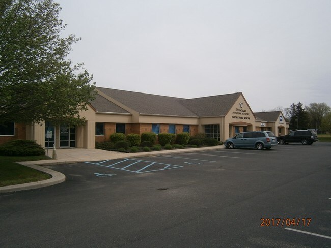
2060 Lebanon Rd
Crawfordsville, IN
Crawfordsville Commons Coml
54-07-33-100-001.006-028
LOT 3 CRAWFORDSVILLE COMMONS
Medicalbuilding
Montgomery
X
Indiana
18107C0161C
3
2024
1.66 AC
2024
Indiana North Area
957400
Other Market Areas
11,278 SF
DEMOGRAPHICS near 2060 Lebanon Rd
1 Mile
3 Mile
5 Mile
2024 Total Population
4,087
18,650
23,526
2029 Population
4,180
19,132
24,072
Pop Growth 2024-2029
+ 2.28%
+ 2.58%
+ 2.32%
Average Age
42
40
40
2024 Total Households
1,931
7,581
9,541
HH Growth 2024-2029
+ 2.28%
+ 2.65%
+ 2.39%
Median Household Inc
$44,499
$46,782
$52,242
Avg Household Size
2.10
2.30
2.30
2024 Avg HH Vehicles
2.00
2.00
2.00
Median Home Value
$142,733
$135,863
$148,251
Median Year Built
1971
1964
1966
Nearby Places
Map Layers
Map Styles
 Street
 Aerial
- Restaurants
- Banks
- Shops
- Fitness
- Groceries
PUBLIC TRANSPORTATION
COMMUTER RAIL
Crawfordsville Amtrak (Cardinal - Amtrak)
DRIVE
WALK
Distance
Crawfordsville Amtrak (Cardinal - Amtrak)
4 min
2.0 mi
Freight Ports
Port of Toledo
DRIVE
WALK
Distance
Port of Toledo
319 min
262.3 mi
SALE & LEASE HISTORY
LISTING DATE
SALE/LEASE

May 11, 2017
For Lease
Feb 03, 2023
For Lease
Nearby Properties
Address
Land Use
TOTAL SIZE
Lot Size
Zoning
Address
Land Use
TOTAL SIZE
Lot Size
Zoning
759,225 SF
196.83 AC
Address
Land Use
TOTAL SIZE
Lot Size
Zoning
384,000 SF
24.02 AC
Address
Land Use
TOTAL SIZE
Lot Size
Zoning
173,932 SF
211.35 AC
Address
Land Use
TOTAL SIZE
Lot Size
Zoning
200,000 SF
27.10 AC
Address
Land Use
TOTAL SIZE
Lot Size
Zoning
66,013 SF
17.58 AC
Address
Land Use
TOTAL SIZE
Lot Size
Zoning
57,236 SF
18.42 AC
Address
Land Use
TOTAL SIZE
Lot Size
Zoning
104,332 SF
16.56 AC
Address
Land Use
TOTAL SIZE
Lot Size
Zoning
43,444 SF
2.10 AC
Address
Land Use
TOTAL SIZE
Lot Size
Zoning
72,794 SF
1.79 AC
Address
Land Use
TOTAL SIZE
Lot Size
Zoning
168,100 SF
17.51 AC
Address
Land Use
TOTAL SIZE
Lot Size
Zoning
119,472 SF
23.23 AC
Address
Land Use
TOTAL SIZE
Lot Size
Zoning
185,656 SF
8.41 AC
Address
Land Use
TOTAL SIZE
Lot Size
Zoning
31,212 SF
16.80 AC
Address
Land Use
TOTAL SIZE
Lot Size
Zoning
133,107 SF
7.79 AC
Address
Land Use
TOTAL SIZE
Lot Size
Zoning
4,800 SF
3.40 AC
Address
Land Use
TOTAL SIZE
Lot Size
Zoning
12,688 SF
7.38 AC
Address
Land Use
TOTAL SIZE
Lot Size
Zoning
12,688 SF
7.50 AC
Address
Land Use
TOTAL SIZE
Lot Size
Zoning
25,253 SF
4.82 AC
Address
Land Use
TOTAL SIZE
Lot Size
Zoning
23,550 SF
17.38 AC
Address
Land Use
TOTAL SIZE
Lot Size
Zoning
236,167 SF
64.30 AC
Address
Land Use
TOTAL SIZE
Lot Size
Zoning
100,605 SF
8.01 AC
Address
Land Use
TOTAL SIZE
Lot Size
Zoning
22,061 SF
0.42 AC
Address
Land Use
TOTAL SIZE
Lot Size
Zoning
46,724 SF
0.84 AC
Address
Land Use
TOTAL SIZE
Lot Size
Zoning
184,766 SF
22.50 AC
Address
Land Use
TOTAL SIZE
Lot Size
Zoning
182,160 SF
13.57 AC
Address
Land Use
TOTAL SIZE
Lot Size
Zoning
54,501 SF
3.98 AC
Address
Land Use
TOTAL SIZE
Lot Size
Zoning
166,250 SF
27.65 AC
Address
Land Use
TOTAL SIZE
Lot Size
Zoning
15,955 SF
0.26 AC
Address
Land Use
TOTAL SIZE
Lot Size
Zoning
15,955 SF
0.24 AC
Address
Land Use
TOTAL SIZE
Lot Size
Zoning
22,828 SF
0.62 AC
The World's #1 Commercial Real Estate Marketplace
Connect with us
© 2026 CoStar Group
The information above has been obtained from sources believed reliable. While we do not doubt its accuracy we have not verified it and make no guarantee, warranty or representation about it. It is your responsibility to independently confirm its accuracy and completeness. Any projections, opinions, assumptions, or estimates used are for example only and do not represent the current or future performance of the property. The value of this transaction to you depends on tax and other factors which should be evaluated by your tax, financial, and legal advisors. You and your advisors should conduct a careful, independent investigation of the property to determine to your satisfaction the suitability of the property for your needs.