Property Record
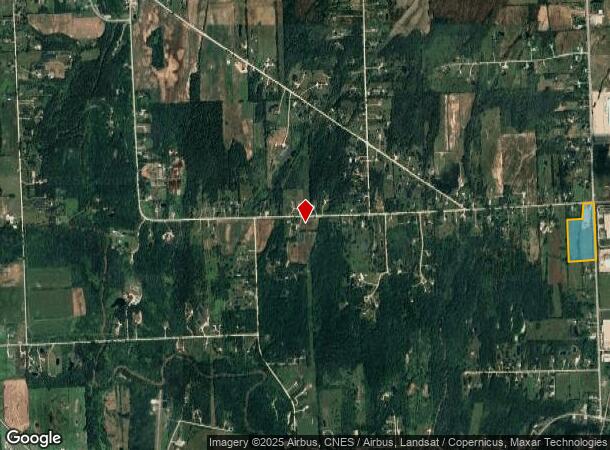
2060 S Range Rd, Saint Clair, MI 48079

Property Detail
2060 S Range Rd
30-025-2010-000
RETIRED PARCEL 08-05-24; SPLIT BEG N 2D 24M 11S E 1353.59' FROM E 1/4 COR, TH N 2D 24M 11S E 1319.02', TH N 88D 54M W
Agriculturalland
ST. CLAIR
RU
Michigan
B and X Area of moderate flood hazard, usually the area between the limits of the 100-year and 500-year floods.
16.09 AC
2024
St Clair & Lapeer Counties
2025
Detroit
640200
Detroit-Warren-Dearborn, MI
NEARBY LISTINGS FOR SALE OR LEASE
DEMOGRAPHICS near 2060 S Range Rd
1 mile
3 mile
5 mile
2025 Total Population
1,966
11,120
19,562
2030 Population
1,999
11,226
19,603
Pop Growth 2025-2030
+ 1.68%
+ 0.95%
+ 0.21%
Average Age
44
44
44
2025 Total Households
765
4,782
8,325
HH Growth 2025-2030
+ 1.70%
+ 0.92%
+ 0.17%
Median Household Inc
$86,666
$71,269
$71,105
Avg Household Size
2.50
2.30
2.30
2025 Avg HH Vehicles
2.00
2.00
2.00
Median Home Value
$297,100
$269,269
$250,949
Median Year Built
1985
1976
1976
Nearby Places
Map Layers
Map Styles
 Street
 Aerial
Transit
 Traffic
 Biking
Places
Listings with unknown addresses are not visible on the map
- Restaurants
- Banks
- Shops
- Fitness
- Groceries
SALE & LEASE HISTORY
LISTING DATE
SALE/LEASE

Jun 11, 2024
For Sale
Nearby Properties
Address
Land Use
TOTAL SIZE
Lot Size
Zoning
Address
Land Use
TOTAL SIZE
Lot Size
Zoning
720,000 SF
Address
Land Use
TOTAL SIZE
Lot Size
Zoning
369,800 SF
Address
Land Use
TOTAL SIZE
Lot Size
Zoning
682,515 SF
211.45 AC
M-2
Address
Land Use
TOTAL SIZE
Lot Size
Zoning
98,904 SF
29.48 AC
R1-A
Address
Land Use
TOTAL SIZE
Lot Size
Zoning
79,276 SF
311.74 AC
M-1
Address
Land Use
TOTAL SIZE
Lot Size
Zoning
98,736 SF
8.49 AC
RM
Address
Land Use
TOTAL SIZE
Lot Size
Zoning
112,914 SF
9.89 AC
R-3 MLTPLE
Address
Land Use
TOTAL SIZE
Lot Size
Zoning
84,198 SF
8.95 AC
C-2 GENERA
Address
Land Use
TOTAL SIZE
Lot Size
Zoning
46,800 SF
Address
Land Use
TOTAL SIZE
Lot Size
Zoning
Address
Land Use
TOTAL SIZE
Lot Size
Zoning
133,345 SF
11.69 AC
M-1 LIGHT
Address
Land Use
TOTAL SIZE
Lot Size
Zoning
108,767 SF
7.29 AC
R1-A
Address
Land Use
TOTAL SIZE
Lot Size
Zoning
25,111 SF
90.62 AC
B-2
Address
Land Use
TOTAL SIZE
Lot Size
Zoning
579,846 SF
8.21 AC
M-2 HEAVY
Address
Land Use
TOTAL SIZE
Lot Size
Zoning
137,000 SF
11.14 AC
M-1 LIGHT
Address
Land Use
TOTAL SIZE
Lot Size
Zoning
112,486 SF
11.91 AC
M-1 LIGHT
Address
Land Use
TOTAL SIZE
Lot Size
Zoning
53,291 SF
Address
Land Use
TOTAL SIZE
Lot Size
Zoning
30.80 AC
R-3 MLTPLE
Address
Land Use
TOTAL SIZE
Lot Size
Zoning
39,000 SF
8.46 AC
B-2
Address
Land Use
TOTAL SIZE
Lot Size
Zoning
50,314 SF
58.60 AC
M-2
Address
Land Use
TOTAL SIZE
Lot Size
Zoning
68,348 SF
6.33 AC
M-1
Address
Land Use
TOTAL SIZE
Lot Size
Zoning
9.60 AC
R-1 LOW DE
Address
Land Use
TOTAL SIZE
Lot Size
Zoning
54,096 SF
6.10 AC
R-1A MED D
Address
Land Use
TOTAL SIZE
Lot Size
Zoning
24,261 SF
4.42 AC
C-2 GENERA
Address
Land Use
TOTAL SIZE
Lot Size
Zoning
24,727 SF
0.90 AC
C-1 LOCAL
Address
Land Use
TOTAL SIZE
Lot Size
Zoning
11,565 SF
4.43 AC
C-2 GENERA
Address
Land Use
TOTAL SIZE
Lot Size
Zoning
66,521 SF
5.78 AC
M-1 LIGHT
Address
Land Use
TOTAL SIZE
Lot Size
Zoning
34,726 SF
6.33 AC
R-3 MLTPLE
Address
Land Use
TOTAL SIZE
Lot Size
Zoning
17,417 SF
1.27 AC
B-2
Address
Land Use
TOTAL SIZE
Lot Size
Zoning
91.42 AC
M-1 LIGHT
The World's #1 Commercial Real Estate Marketplace
Connect with us
© 2026 CoStar Group
The information above has been obtained from sources believed reliable. While we do not doubt its accuracy we have not verified it and make no guarantee, warranty or representation about it. It is your responsibility to independently confirm its accuracy and completeness. Any projections, opinions, assumptions, or estimates used are for example only and do not represent the current or future performance of the property. The value of this transaction to you depends on tax and other factors which should be evaluated by your tax, financial, and legal advisors. You and your advisors should conduct a careful, independent investigation of the property to determine to your satisfaction the suitability of the property for your needs.