Property Record
20609 Ne 29Th Ave, Ridgefield, WA 98642


NEARBY LISTINGS FOR SALE OR LEASE
Property Detail
20609 Ne 29Th Ave
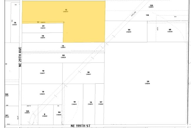
178853-000
#15 SEC 1 T3N R1EWM 15.36 ACRE FOR ASSESSOR USE ONLY THE NORTH HALF OT THE SOUTH HALF OFTHE NORTHWEST QUARTER OFTHE SOUTHWEST QUARTER AND THE EAST HALF OF THE SOUTH HALF OF THE SOUTH HALT OF THE NORTHWEST QUARTER OF THE SOUTHWEST QUARTER OF SECTION 1
Privateschool
Clark
X
Washington
53015C1020G
15
2025
15.36 AC
2025
Clark County Outlying
040403
Portland
9,352 SF
Portland-Vancouver-Hillsboro, OR-WA
DEMOGRAPHICS near 20609 Ne 29Th Ave
1 Mile
3 Mile
5 Mile
2024 Total Population
1,210
14,579
75,667
2029 Population
1,320
15,797
82,289
Pop Growth 2024-2029
+ 9.09%
+ 8.35%
+ 8.75%
Average Age
43
43
41
2024 Total Households
410
5,259
26,936
HH Growth 2024-2029
+ 9.02%
+ 8.37%
+ 8.89%
Median Household Inc
$110,698
$104,658
$103,527
Avg Household Size
3.00
2.80
2.80
2024 Avg HH Vehicles
3.00
2.00
2.00
Median Home Value
$764,084
$612,421
$522,139
Median Year Built
1985
1995
1997
Nearby Places
Map Layers
Map Styles
 Street
 Aerial
- Restaurants
- Banks
- Shops
- Fitness
- Groceries
PUBLIC TRANSPORTATION
AIRPORT
Portland International
DRIVE
WALK
Distance
Portland International
29 min
19.4 mi
Freight Ports
Port of Vancouver
DRIVE
WALK
Distance
Port of Vancouver
21 min
12.5 mi
Nearby Properties
Address
Land Use
TOTAL SIZE
Lot Size
Zoning
Address
Land Use
TOTAL SIZE
Lot Size
Zoning
540,669 SF
272.10 AC
U
Address
Land Use
TOTAL SIZE
Lot Size
Zoning
741,237 SF
42.05 AC
E
Address
Land Use
TOTAL SIZE
Lot Size
Zoning
173,174 SF
7.18 AC
OR-22
Address
Land Use
TOTAL SIZE
Lot Size
Zoning
477,314 SF
57.47 AC
PF
Address
Land Use
TOTAL SIZE
Lot Size
Zoning
107,064 SF
38.66 AC
U
Address
Land Use
TOTAL SIZE
Lot Size
Zoning
93,616 SF
41.61 AC
PF
Address
Land Use
TOTAL SIZE
Lot Size
Zoning
244,012 SF
2.83 AC
R-18
Address
Land Use
TOTAL SIZE
Lot Size
Zoning
163,716 SF
4.55 AC
R-12
Address
Land Use
TOTAL SIZE
Lot Size
Zoning
138,825 SF
5.92 AC
OR-22
Address
Land Use
TOTAL SIZE
Lot Size
Zoning
69,424 SF
9.39 AC
IL
Address
Land Use
TOTAL SIZE
Lot Size
Zoning
32,553 SF
11.84 AC
BP
Address
Land Use
TOTAL SIZE
Lot Size
Zoning
6,664 SF
4.92 AC
GC
Address
Land Use
TOTAL SIZE
Lot Size
Zoning
37,500 SF
10.90 AC
E
Address
Land Use
TOTAL SIZE
Lot Size
Zoning
64,029 SF
16.42 AC
R-5
Address
Land Use
TOTAL SIZE
Lot Size
Zoning
68.61 AC
PF
Address
Land Use
TOTAL SIZE
Lot Size
Zoning
44.87 AC
R1-20
Address
Land Use
TOTAL SIZE
Lot Size
Zoning
18,475 SF
4.66 AC
GC
Address
Land Use
TOTAL SIZE
Lot Size
Zoning
24,195 SF
5 AC
R-5
Address
Land Use
TOTAL SIZE
Lot Size
Zoning
41,754 SF
0.84 AC
OR-30
Address
Land Use
TOTAL SIZE
Lot Size
Zoning
73,992 SF
1.31 AC
IL
Address
Land Use
TOTAL SIZE
Lot Size
Zoning
49,955 SF
3.97 AC
IL
Address
Land Use
TOTAL SIZE
Lot Size
Zoning
58,268 SF
9.73 AC
BP
Address
Land Use
TOTAL SIZE
Lot Size
Zoning
3,044 SF
22.54 AC
GC
Address
Land Use
TOTAL SIZE
Lot Size
Zoning
54,310 SF
2.64 AC
IL
Address
Land Use
TOTAL SIZE
Lot Size
Zoning
45,675 SF
4.86 AC
IL
Address
Land Use
TOTAL SIZE
Lot Size
Zoning
840 SF
28.46 AC
R1-20
Address
Land Use
TOTAL SIZE
Lot Size
Zoning
18,945 SF
6.63 AC
PF
Address
Land Use
TOTAL SIZE
Lot Size
Zoning
19.39 AC
U
Address
Land Use
TOTAL SIZE
Lot Size
Zoning
52,943 SF
3.91 AC
IL
Address
Land Use
TOTAL SIZE
Lot Size
Zoning
1,440 SF
30.18 AC
PF
The World's #1 Commercial Real Estate Marketplace
Connect with us
© 2026 CoStar Group
The information above has been obtained from sources believed reliable. While we do not doubt its accuracy we have not verified it and make no guarantee, warranty or representation about it. It is your responsibility to independently confirm its accuracy and completeness. Any projections, opinions, assumptions, or estimates used are for example only and do not represent the current or future performance of the property. The value of this transaction to you depends on tax and other factors which should be evaluated by your tax, financial, and legal advisors. You and your advisors should conduct a careful, independent investigation of the property to determine to your satisfaction the suitability of the property for your needs.