Property Record
2061 Experiment Station Rd, Watkinsville, GA 30677

NEARBY LISTINGS FOR SALE OR LEASE
-
-
View all Watkinsville listings for sale on LoopNet.com
Property Detail
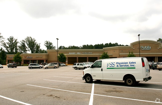
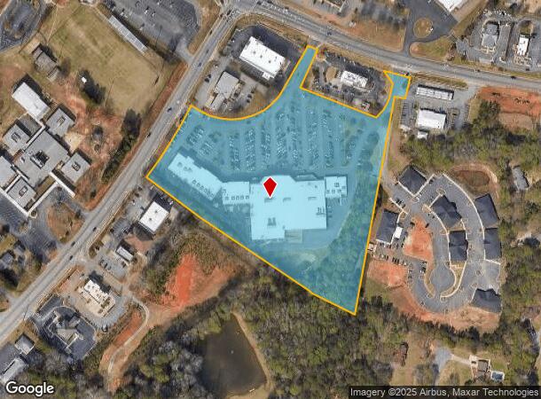
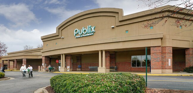
2061 Experiment Station Rd
B-06-005 01
1460/261 1223/77 448/543 PUBLIX TRACT
Supermarket
Oconee
X
Georgia
13219C0130E
10.25 AC
2024
Athens/Gainesville
2024
Other Market Areas
030401
Athens-Clarke County, GA
76,360 SF
DEMOGRAPHICS near 2061 Experiment Station Rd
1 Mile
3 Mile
5 Mile
2024 Total Population
1,857
15,299
43,494
2029 Population
2,065
17,129
47,021
Pop Growth 2024-2029
+ 11.20%
+ 11.96%
+ 8.11%
Average Age
40
39
38
2024 Total Households
646
5,316
16,352
HH Growth 2024-2029
+ 11.30%
+ 12.00%
+ 7.53%
Median Household Inc
$95,226
$102,913
$85,466
Avg Household Size
2.90
2.80
2.60
2024 Avg HH Vehicles
2.00
2.00
2.00
Median Home Value
$313,281
$354,684
$353,537
Median Year Built
1989
1992
1994
Nearby Places
- Restaurants
- Banks
- Shops
- Fitness
- Groceries
Nearby Properties
Address
Land Use
TOTAL SIZE
Lot Size
Zoning
Address
Land Use
TOTAL SIZE
Lot Size
Zoning
11,600 SF
154.32 AC
AR
Address
Land Use
TOTAL SIZE
Lot Size
Zoning
20,748 SF
80.77 AC
AG
Address
Land Use
TOTAL SIZE
Lot Size
Zoning
Address
Land Use
TOTAL SIZE
Lot Size
Zoning
107,030 SF
34.62 AC
AR
Address
Land Use
TOTAL SIZE
Lot Size
Zoning
70,000 SF
5.40 AC
O-B-P
Address
Land Use
TOTAL SIZE
Lot Size
Zoning
90,670 SF
11.86 AC
B-2
Address
Land Use
TOTAL SIZE
Lot Size
Zoning
12,483 SF
8.13 AC
Address
Land Use
TOTAL SIZE
Lot Size
Zoning
68,931 SF
5.56 AC
O-B-P
Address
Land Use
TOTAL SIZE
Lot Size
Zoning
4.86 AC
B-1
Address
Land Use
TOTAL SIZE
Lot Size
Zoning
29,376 SF
197.43 AC
AG
Address
Land Use
TOTAL SIZE
Lot Size
Zoning
58,725 SF
3.14 AC
B-2
Address
Land Use
TOTAL SIZE
Lot Size
Zoning
5,216 SF
12.81 AC
R-3
Address
Land Use
TOTAL SIZE
Lot Size
Zoning
29,032 SF
14 AC
AG
Address
Land Use
TOTAL SIZE
Lot Size
Zoning
37,572 SF
0.43 AC
O-B-P
Address
Land Use
TOTAL SIZE
Lot Size
Zoning
78,525 SF
15.81 AC
Address
Land Use
TOTAL SIZE
Lot Size
Zoning
57,735 SF
35 AC
AG
Address
Land Use
TOTAL SIZE
Lot Size
Zoning
37,572 SF
0.43 AC
O-B-P
Address
Land Use
TOTAL SIZE
Lot Size
Zoning
25,519 SF
7.63 AC
OIP
Address
Land Use
TOTAL SIZE
Lot Size
Zoning
45,945 SF
2.27 AC
OIP
Address
Land Use
TOTAL SIZE
Lot Size
Zoning
Address
Land Use
TOTAL SIZE
Lot Size
Zoning
62,635 SF
6.30 AC
O-B-P
Address
Land Use
TOTAL SIZE
Lot Size
Zoning
5,880 SF
17.18 AC
AG
Address
Land Use
TOTAL SIZE
Lot Size
Zoning
60,596 SF
15 AC
001
Address
Land Use
TOTAL SIZE
Lot Size
Zoning
101,830 SF
12.68 AC
B-2
Address
Land Use
TOTAL SIZE
Lot Size
Zoning
4,000 SF
253.45 AC
AG
Address
Land Use
TOTAL SIZE
Lot Size
Zoning
3,600 SF
3.28 AC
B-2
Address
Land Use
TOTAL SIZE
Lot Size
Zoning
18,962 SF
0.43 AC
O-B-P
Address
Land Use
TOTAL SIZE
Lot Size
Zoning
61.15 AC
AG
Address
Land Use
TOTAL SIZE
Lot Size
Zoning
6,894 SF
1.47 AC
O-I-P
The World's #1 Commercial Real Estate Marketplace
Connect with us
© 2025 CoStar Group
The information above has been obtained from sources believed reliable. While we do not doubt its accuracy we have not verified it and make no guarantee, warranty or representation about it. It is your responsibility to independently confirm its accuracy and completeness. Any projections, opinions, assumptions, or estimates used are for example only and do not represent the current or future performance of the property. The value of this transaction to you depends on tax and other factors which should be evaluated by your tax, financial, and legal advisors. You and your advisors should conduct a careful, independent investigation of the property to determine to your satisfaction the suitability of the property for your needs.