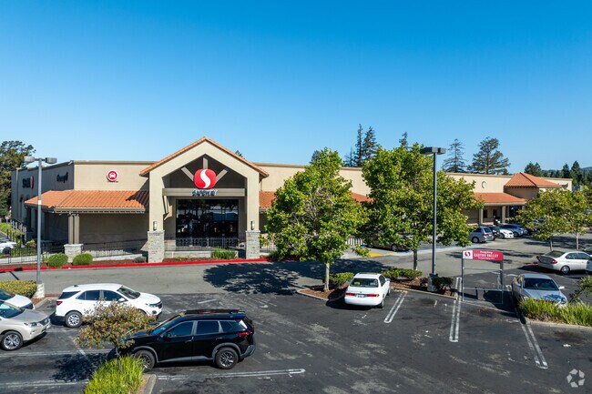
Property Record
20629 Redwood Rd, Castro Valley, CA 94546


NEARBY LISTINGS FOR SALE OR LEASE
Property Detail
20629 Redwood Rd
84A-80-11-12
LOT: 00011 BLK: 0011 AR: 084A PAGE: 0080 ;LOT: 00012 BLK: 0011 AR: 084A PAGE: 0080
Supermarket
Alameda
X
California
06001C0279G
3.79 AC
2024
Hayward/Castro Valley
2025
East Bay/Oakland
430900
Oakland-Hayward-Berkeley, CA
42,359 SF
DEMOGRAPHICS near 20629 Redwood Rd
1 Mile
3 Mile
5 Mile
2024 Total Population
26,610
162,469
333,874
2029 Population
25,768
157,042
322,751
Pop Growth 2024-2029
(3.16%)
(3.34%)
(3.33%)
Average Age
41
40
40
2024 Total Households
9,665
54,395
109,278
HH Growth 2024-2029
(3.36%)
(3.51%)
(3.53%)
Median Household Inc
$99,721
$99,067
$97,777
Avg Household Size
2.70
2.90
2.90
2024 Avg HH Vehicles
2.00
2.00
2.00
Median Home Value
$785,595
$811,971
$775,819
Median Year Built
1961
1967
1966
Nearby Places
Map Layers
Map Styles
 Street
 Aerial
- Restaurants
- Banks
- Shops
- Fitness
- Groceries
PUBLIC TRANSPORTATION
TRANSIT/SUBWAY
Castro Valley Station (Daly City to Dublin/Pleasanton - Bay Area Rapid Transit (BART), Dublin/Pleasanton - Millbrae - Bay Area Rapid Transit (BART), Dublin/Pleasanton to Daly City - Bay Area Rapid Transit (BART))
DRIVE
WALK
Distance
Castro Valley Station (Daly City to Dublin/Pleasanton - Bay Area Rapid Transit (BART), Dublin/Pleasanton - Millbrae - Bay Area Rapid Transit (BART), Dublin/Pleasanton to Daly City - Bay Area Rapid Transit (BART))
4 min
11 min
0.6 mi
COMMUTER RAIL
Hayward Amtrak (Capitol Corridor - Amtrak)
DRIVE
WALK
Distance
Hayward Amtrak (Capitol Corridor - Amtrak)
7 min
3.0 mi
Hayward (Capitol Corridor - Capitol Corridor Joint Powers Authority)
DRIVE
WALK
Distance
Hayward (Capitol Corridor - Capitol Corridor Joint Powers Authority)
7 min
3.0 mi
AIRPORT
Metro Oakland International
DRIVE
WALK
Distance
Metro Oakland International
15 min
10.5 mi
San Francisco International
DRIVE
WALK
Distance
San Francisco International
35 min
25.1 mi
Norman Y Mineta San Jose International
DRIVE
WALK
Distance
Norman Y Mineta San Jose International
39 min
29.6 mi
Freight Ports
Port of Oakland
DRIVE
WALK
Distance
Port of Oakland
19 min
15.1 mi
Nearby Properties
Address
Land Use
TOTAL SIZE
Lot Size
Zoning
Address
Land Use
TOTAL SIZE
Lot Size
Zoning
4.90 AC
Address
Land Use
TOTAL SIZE
Lot Size
Zoning
2.48 AC
Address
Land Use
TOTAL SIZE
Lot Size
Zoning
470,929 SF
31.62 AC
Address
Land Use
TOTAL SIZE
Lot Size
Zoning
1.50 AC
Address
Land Use
TOTAL SIZE
Lot Size
Zoning
187,926 SF
1.19 AC
Address
Land Use
TOTAL SIZE
Lot Size
Zoning
297,592 SF
11.65 AC
Address
Land Use
TOTAL SIZE
Lot Size
Zoning
310,072 SF
14.96 AC
Address
Land Use
TOTAL SIZE
Lot Size
Zoning
228,736 SF
5.95 AC
Address
Land Use
TOTAL SIZE
Lot Size
Zoning
169,371 SF
4.63 AC
Address
Land Use
TOTAL SIZE
Lot Size
Zoning
625,101 SF
35.95 AC
Address
Land Use
TOTAL SIZE
Lot Size
Zoning
116,750 SF
4.72 AC
Address
Land Use
TOTAL SIZE
Lot Size
Zoning
105,730 SF
5.32 AC
Address
Land Use
TOTAL SIZE
Lot Size
Zoning
119,800 SF
5.72 AC
Address
Land Use
TOTAL SIZE
Lot Size
Zoning
93,258 SF
6.24 AC
Address
Land Use
TOTAL SIZE
Lot Size
Zoning
57,497 SF
4.92 AC
Address
Land Use
TOTAL SIZE
Lot Size
Zoning
120,441 SF
1.34 AC
Address
Land Use
TOTAL SIZE
Lot Size
Zoning
152,950 SF
4.96 AC
Address
Land Use
TOTAL SIZE
Lot Size
Zoning
115,648 SF
11.19 AC
Address
Land Use
TOTAL SIZE
Lot Size
Zoning
92,534 SF
3.04 AC
Address
Land Use
TOTAL SIZE
Lot Size
Zoning
25,000 SF
1.24 AC
Address
Land Use
TOTAL SIZE
Lot Size
Zoning
147,525 SF
8.18 AC
Address
Land Use
TOTAL SIZE
Lot Size
Zoning
124,513 SF
7.52 AC
Address
Land Use
TOTAL SIZE
Lot Size
Zoning
61,330 SF
5.78 AC
Address
Land Use
TOTAL SIZE
Lot Size
Zoning
61,355 SF
4.31 AC
Address
Land Use
TOTAL SIZE
Lot Size
Zoning
52,110 SF
2.06 AC
Address
Land Use
TOTAL SIZE
Lot Size
Zoning
56,410 SF
5.01 AC
Address
Land Use
TOTAL SIZE
Lot Size
Zoning
46,540 SF
2.92 AC
R5D
Address
Land Use
TOTAL SIZE
Lot Size
Zoning
78,326 SF
6.88 AC
Address
Land Use
TOTAL SIZE
Lot Size
Zoning
138,960 SF
2.62 AC
The World's #1 Commercial Real Estate Marketplace
Connect with us
© 2025 CoStar Group
The information above has been obtained from sources believed reliable. While we do not doubt its accuracy we have not verified it and make no guarantee, warranty or representation about it. It is your responsibility to independently confirm its accuracy and completeness. Any projections, opinions, assumptions, or estimates used are for example only and do not represent the current or future performance of the property. The value of this transaction to you depends on tax and other factors which should be evaluated by your tax, financial, and legal advisors. You and your advisors should conduct a careful, independent investigation of the property to determine to your satisfaction the suitability of the property for your needs.