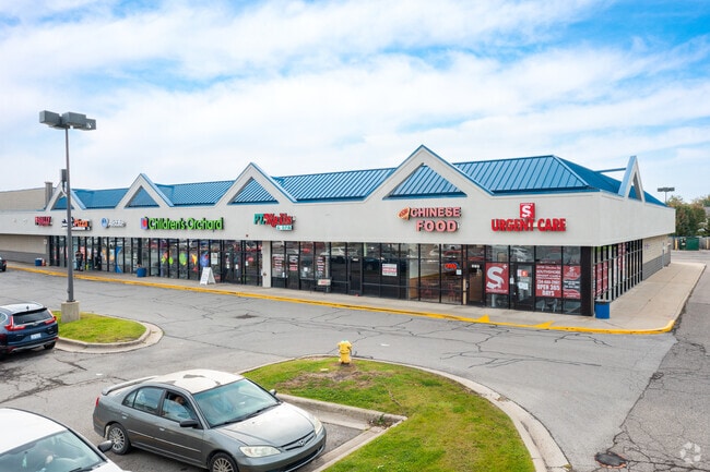
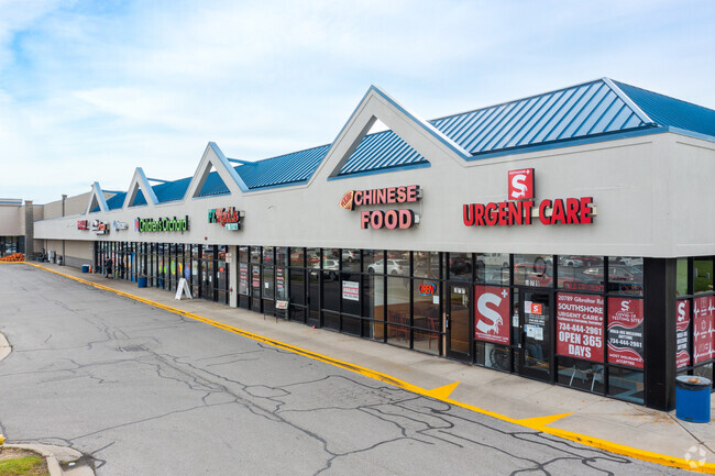
Property Record
20645 Gibraltar Rd, Brownstown Twp, MI 48183
NEARBY LISTINGS FOR SALE OR LEASE
Property Detail
20645 Gibraltar Rd
Detroit-Warren-Dearborn, MI
Of L Cass Sub
70-126-99-0009-719
COMM AT A COR WHICH IS COMMON TO THE SW COR OF PC 355, THE NW COR OF PC 354, AND THE E AND OF THE N LINE OF FRAC SEC 3, T5S, R10E ALSO KNOWN AS THE NW COR OF LOT 12 OF CASS TRACT, AS REC IN L14 OF DEEDS, P301 WCR; TH S 01D 02M 36S W 80.06 FT; TH S 88
Commercialnec
Wayne
X
Michigan
26163C0528F
12
2025
15.33 AC
2025
Downriver South
591900
Detroit
101,861 SF
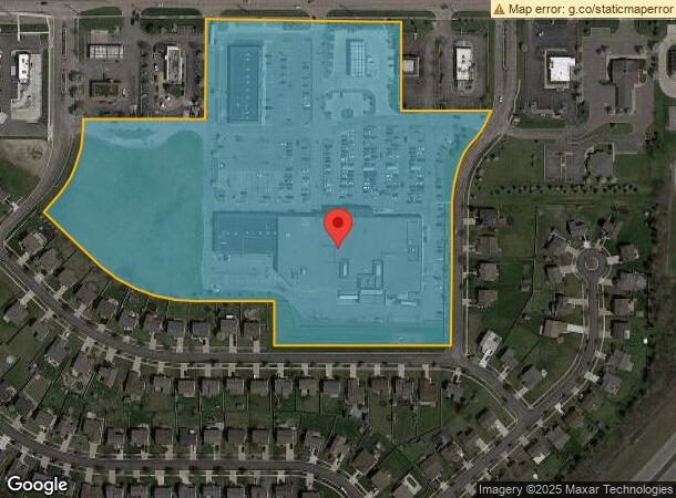
DEMOGRAPHICS near 20645 Gibraltar Rd
1 Mile
3 Mile
5 Mile
2024 Total Population
3,978
38,042
79,866
2029 Population
3,793
36,583
76,875
Pop Growth 2024-2029
(4.65%)
(3.84%)
(3.75%)
Average Age
42
41
43
2024 Total Households
1,586
15,082
32,777
HH Growth 2024-2029
(4.67%)
(3.85%)
(3.75%)
Median Household Inc
$82,744
$78,506
$79,972
Avg Household Size
2.40
2.50
2.40
2024 Avg HH Vehicles
2.00
2.00
2.00
Median Home Value
$178,393
$204,631
$221,152
Median Year Built
1976
1977
1976
Nearby Places
Map Layers
Map Styles
 Street
 Aerial
- Restaurants
- Banks
- Shops
- Fitness
- Groceries
SALE & LEASE HISTORY
LISTING DATE
SALE/LEASE

Sep 25, 2016
For Lease
Nearby Properties
Address
Land Use
TOTAL SIZE
Lot Size
Zoning
Address
Land Use
TOTAL SIZE
Lot Size
Zoning
3,189,689 SF
228.88 AC
Address
Land Use
TOTAL SIZE
Lot Size
Zoning
215,724 SF
Address
Land Use
TOTAL SIZE
Lot Size
Zoning
235,489 SF
23.47 AC
Address
Land Use
TOTAL SIZE
Lot Size
Zoning
249,836 SF
22.18 AC
AG
Address
Land Use
TOTAL SIZE
Lot Size
Zoning
1,021,918 SF
163.58 AC
Address
Land Use
TOTAL SIZE
Lot Size
Zoning
3,280 SF
99.72 AC
Address
Land Use
TOTAL SIZE
Lot Size
Zoning
178,682 SF
19.23 AC
Address
Land Use
TOTAL SIZE
Lot Size
Zoning
33,600 SF
100.03 AC
Address
Land Use
TOTAL SIZE
Lot Size
Zoning
92,397 SF
12.63 AC
PUD
Address
Land Use
TOTAL SIZE
Lot Size
Zoning
61,784 SF
6.78 AC
Address
Land Use
TOTAL SIZE
Lot Size
Zoning
169,192 SF
11.90 AC
R1
Address
Land Use
TOTAL SIZE
Lot Size
Zoning
59,427 SF
5.50 AC
Address
Land Use
TOTAL SIZE
Lot Size
Zoning
68,409 SF
64.56 AC
Address
Land Use
TOTAL SIZE
Lot Size
Zoning
2,368 SF
32.58 AC
Address
Land Use
TOTAL SIZE
Lot Size
Zoning
95,650 SF
73.78 AC
Address
Land Use
TOTAL SIZE
Lot Size
Zoning
52.37 AC
Address
Land Use
TOTAL SIZE
Lot Size
Zoning
48,760 SF
4.86 AC
Address
Land Use
TOTAL SIZE
Lot Size
Zoning
18,678 SF
3.10 AC
R1-ONE
Address
Land Use
TOTAL SIZE
Lot Size
Zoning
3,870 SF
38.38 AC
Address
Land Use
TOTAL SIZE
Lot Size
Zoning
2,816 SF
86.70 AC
RESIDE
Address
Land Use
TOTAL SIZE
Lot Size
Zoning
146,300 SF
25.84 AC
Address
Land Use
TOTAL SIZE
Lot Size
Zoning
44,733 SF
10.51 AC
Address
Land Use
TOTAL SIZE
Lot Size
Zoning
164,567 SF
13.78 AC
RESIDE
Address
Land Use
TOTAL SIZE
Lot Size
Zoning
114,165 SF
13.07 AC
Address
Land Use
TOTAL SIZE
Lot Size
Zoning
551,184 SF
RESIDE
Address
Land Use
TOTAL SIZE
Lot Size
Zoning
124,102 SF
17.09 AC
Address
Land Use
TOTAL SIZE
Lot Size
Zoning
124,602 SF
10.20 AC
Address
Land Use
TOTAL SIZE
Lot Size
Zoning
52,085 SF
5 AC
RM-1
Address
Land Use
TOTAL SIZE
Lot Size
Zoning
14,400 SF
20 AC
The World's #1 Commercial Real Estate Marketplace
Connect with us
© 2026 CoStar Group
The information above has been obtained from sources believed reliable. While we do not doubt its accuracy we have not verified it and make no guarantee, warranty or representation about it. It is your responsibility to independently confirm its accuracy and completeness. Any projections, opinions, assumptions, or estimates used are for example only and do not represent the current or future performance of the property. The value of this transaction to you depends on tax and other factors which should be evaluated by your tax, financial, and legal advisors. You and your advisors should conduct a careful, independent investigation of the property to determine to your satisfaction the suitability of the property for your needs.