Property Record
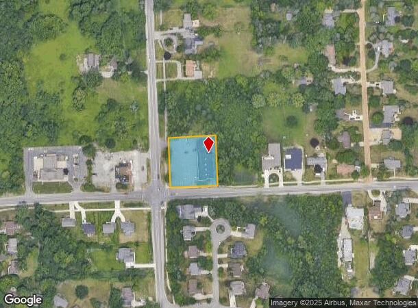
2065 Hiller Rd, West Bloomfield, MI 48324

NEARBY LISTINGS FOR SALE OR LEASE
Property Detail
2065 Hiller Rd
Detroit-Warren-Dearborn, MI
Suprvrs Of Cooley Lake Road Fa
18-04-176-046
T2N, R9E, SEC 4 SUPERVISOR'S PLAT OF COOLEY LAKE ROAD FARMS NO 1 W 200 FT OF S 70.10 FT OF LOT 54, ALSO W 200 FT OF LOT 55
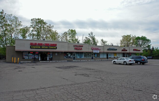
Stripcommercialcenter
Oakland
X
Michigan
26125C0482F
54-55
2024
0.96 AC
2024
Lakes Area
154600
Detroit
8,508 SF
DEMOGRAPHICS near 2065 Hiller Rd
1 Mile
3 Mile
5 Mile
2024 Total Population
5,998
49,583
148,311
2029 Population
5,945
49,158
147,419
Pop Growth 2024-2029
(0.88%)
(0.86%)
(0.60%)
Average Age
43
42
43
2024 Total Households
2,208
20,575
60,997
HH Growth 2024-2029
(0.91%)
(0.87%)
(0.57%)
Median Household Inc
$115,749
$86,388
$84,746
Avg Household Size
2.70
2.40
2.40
2024 Avg HH Vehicles
2.00
2.00
2.00
Median Home Value
$341,307
$293,981
$291,480
Median Year Built
1984
1977
1976
Nearby Places
Map Layers
Map Styles
 Street
 Aerial
- Restaurants
- Banks
- Shops
- Fitness
- Groceries
PUBLIC TRANSPORTATION
COMMUTER RAIL
Pontiac Amtrak Station (Wolverine - Amtrak)
DRIVE
WALK
Distance
Pontiac Amtrak Station (Wolverine - Amtrak)
15 min
7.6 mi
AIRPORT
Detroit Metro Wayne County
DRIVE
WALK
Distance
Detroit Metro Wayne County
47 min
35.9 mi
Freight Ports
Port of Toledo
DRIVE
WALK
Distance
Port of Toledo
97 min
77.6 mi
SALE & LEASE HISTORY
LISTING DATE
SALE/LEASE

Sep 29, 2016
For Lease
Nearby Properties
Address
Land Use
TOTAL SIZE
Lot Size
Zoning
Address
Land Use
TOTAL SIZE
Lot Size
Zoning
481,186 SF
42.14 AC
AI
Address
Land Use
TOTAL SIZE
Lot Size
Zoning
300,934 SF
25.30 AC
AI
Address
Land Use
TOTAL SIZE
Lot Size
Zoning
240,398 SF
23.50 AC
AI
Address
Land Use
TOTAL SIZE
Lot Size
Zoning
219,124 SF
18.63 AC
AI
Address
Land Use
TOTAL SIZE
Lot Size
Zoning
139,227 SF
13.13 AC
BI
Address
Land Use
TOTAL SIZE
Lot Size
Zoning
147,624 SF
6.59 AC
AI
Address
Land Use
TOTAL SIZE
Lot Size
Zoning
93,706 SF
1.13 AC
Address
Land Use
TOTAL SIZE
Lot Size
Zoning
169,638 SF
16.39 AC
Address
Land Use
TOTAL SIZE
Lot Size
Zoning
50,927 SF
145.83 AC
Address
Land Use
TOTAL SIZE
Lot Size
Zoning
106.04 AC
RV
Address
Land Use
TOTAL SIZE
Lot Size
Zoning
97,080 SF
12.53 AC
BI
Address
Land Use
TOTAL SIZE
Lot Size
Zoning
102,042 SF
7.07 AC
AI
Address
Land Use
TOTAL SIZE
Lot Size
Zoning
65,034 SF
10.28 AC
AI
Address
Land Use
TOTAL SIZE
Lot Size
Zoning
120,132 SF
9.29 AC
AI
Address
Land Use
TOTAL SIZE
Lot Size
Zoning
95,592 SF
12.43 AC
AI
Address
Land Use
TOTAL SIZE
Lot Size
Zoning
105,312 SF
12.64 AC
AI
Address
Land Use
TOTAL SIZE
Lot Size
Zoning
124,185 SF
6.25 AC
AI
Address
Land Use
TOTAL SIZE
Lot Size
Zoning
93,456 SF
8.22 AC
AI
Address
Land Use
TOTAL SIZE
Lot Size
Zoning
91,376 SF
11.06 AC
BI
Address
Land Use
TOTAL SIZE
Lot Size
Zoning
94,314 SF
6.41 AC
AI
Address
Land Use
TOTAL SIZE
Lot Size
Zoning
25,155 SF
11.71 AC
BI
Address
Land Use
TOTAL SIZE
Lot Size
Zoning
84,144 SF
8.13 AC
AI
Address
Land Use
TOTAL SIZE
Lot Size
Zoning
79,852 SF
6.36 AC
AI
Address
Land Use
TOTAL SIZE
Lot Size
Zoning
66,154 SF
5.65 AC
BI
Address
Land Use
TOTAL SIZE
Lot Size
Zoning
67,656 SF
9.10 AC
AI
Address
Land Use
TOTAL SIZE
Lot Size
Zoning
66,154 SF
5.65 AC
BI
Address
Land Use
TOTAL SIZE
Lot Size
Zoning
14,090 SF
2.11 AC
BI
Address
Land Use
TOTAL SIZE
Lot Size
Zoning
44,594 SF
BI
Address
Land Use
TOTAL SIZE
Lot Size
Zoning
37,752 SF
9.18 AC
II
Address
Land Use
TOTAL SIZE
Lot Size
Zoning
18,416 SF
1.44 AC
The World's #1 Commercial Real Estate Marketplace
Connect with us
© 2025 CoStar Group
The information above has been obtained from sources believed reliable. While we do not doubt its accuracy we have not verified it and make no guarantee, warranty or representation about it. It is your responsibility to independently confirm its accuracy and completeness. Any projections, opinions, assumptions, or estimates used are for example only and do not represent the current or future performance of the property. The value of this transaction to you depends on tax and other factors which should be evaluated by your tax, financial, and legal advisors. You and your advisors should conduct a careful, independent investigation of the property to determine to your satisfaction the suitability of the property for your needs.