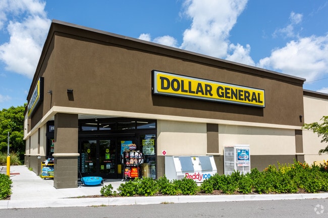
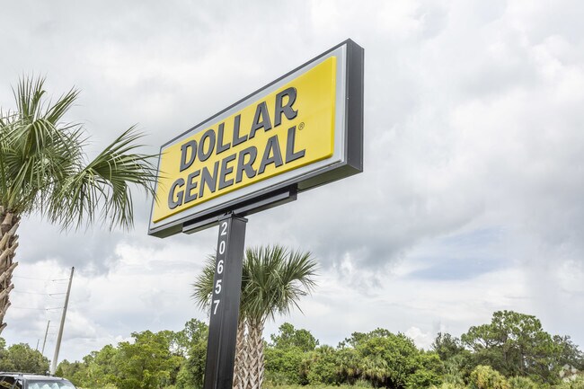
Property Record
20657 Kenilworth Blvd, Port Charlotte, FL 33954

NEARBY LISTINGS FOR SALE OR LEASE
Property Detail
20657 Kenilworth Blvd
Punta Gorda, FL
Port Charlotte
402203152011
PORT CHARLOTTE SEC34 BLK867 LT 16 817/1611 972-270 CD1850/921 1850/923 1862/591 1862/591 2714/1188 4268/1367 E4268/1369 E4318/1291 E4360/1395 4360/1405 E4691/541
Storebuilding
Charlotte
X
Florida
12015C0063G
16
2024
1.18 AC
2025
Charlotte County
020206
Southwest Florida
9,301 SF
DEMOGRAPHICS near 20657 Kenilworth Blvd
1 Mile
3 Mile
5 Mile
2024 Total Population
4,178
43,155
100,905
2029 Population
4,971
50,885
119,230
Pop Growth 2024-2029
+ 18.98%
+ 17.91%
+ 18.16%
Average Age
46
46
48
2024 Total Households
1,573
17,898
43,007
HH Growth 2024-2029
+ 19.20%
+ 18.23%
+ 18.51%
Median Household Inc
$68,295
$57,998
$59,828
Avg Household Size
2.50
2.30
2.30
2024 Avg HH Vehicles
2.00
2.00
2.00
Median Home Value
$253,706
$221,290
$230,048
Median Year Built
1988
1986
1988
Nearby Places
Map Layers
Map Styles
 Street
 Aerial
- Restaurants
- Banks
- Shops
- Fitness
- Groceries
PUBLIC TRANSPORTATION
AIRPORT
Punta Gorda
DRIVE
WALK
Distance
Punta Gorda
21 min
13.9 mi
Freight Ports
Port Manatee
DRIVE
WALK
Distance
Port Manatee
81 min
65.0 mi
Nearby Properties
Address
Land Use
TOTAL SIZE
Lot Size
Zoning
Address
Land Use
TOTAL SIZE
Lot Size
Zoning
156,350 SF
12.49 AC
OMI
Address
Land Use
TOTAL SIZE
Lot Size
Zoning
129,475 SF
16.04 AC
OMI
Address
Land Use
TOTAL SIZE
Lot Size
Zoning
53,564 SF
22 AC
PD
Address
Land Use
TOTAL SIZE
Lot Size
Zoning
174,965 SF
13.52 AC
CG
Address
Land Use
TOTAL SIZE
Lot Size
Zoning
135,300 SF
34.83 AC
GU
Address
Land Use
TOTAL SIZE
Lot Size
Zoning
583,831 SF
54.32 AC
CG
Address
Land Use
TOTAL SIZE
Lot Size
Zoning
141,619 SF
12.39 AC
II
Address
Land Use
TOTAL SIZE
Lot Size
Zoning
208,372 SF
21.98 AC
II
Address
Land Use
TOTAL SIZE
Lot Size
Zoning
122,030 SF
7.43 AC
CG
Address
Land Use
TOTAL SIZE
Lot Size
Zoning
141,647 SF
20.29 AC
CG
Address
Land Use
TOTAL SIZE
Lot Size
Zoning
102,337 SF
10.43 AC
RSF3.5
Address
Land Use
TOTAL SIZE
Lot Size
Zoning
98,599 SF
9.75 AC
CG
Address
Land Use
TOTAL SIZE
Lot Size
Zoning
107,237 SF
20.14 AC
CG
Address
Land Use
TOTAL SIZE
Lot Size
Zoning
91,281 SF
10 AC
CG
Address
Land Use
TOTAL SIZE
Lot Size
Zoning
50,970 SF
9.74 AC
RSF3.5
Address
Land Use
TOTAL SIZE
Lot Size
Zoning
96,253 SF
7.89 AC
CG
Address
Land Use
TOTAL SIZE
Lot Size
Zoning
37,045 SF
21.20 AC
PD
Address
Land Use
TOTAL SIZE
Lot Size
Zoning
88,259 SF
4.71 AC
CG
Address
Land Use
TOTAL SIZE
Lot Size
Zoning
135,717 SF
10.55 AC
CG
Address
Land Use
TOTAL SIZE
Lot Size
Zoning
34,975 SF
2.90 AC
RMF15
Address
Land Use
TOTAL SIZE
Lot Size
Zoning
82,800 SF
9.45 AC
CG
Address
Land Use
TOTAL SIZE
Lot Size
Zoning
35,587 SF
6.27 AC
RMF15
Address
Land Use
TOTAL SIZE
Lot Size
Zoning
22,919 SF
4.70 AC
CG
Address
Land Use
TOTAL SIZE
Lot Size
Zoning
116,980 SF
16.23 AC
II
Address
Land Use
TOTAL SIZE
Lot Size
Zoning
3,652 SF
11.79 AC
IG
Address
Land Use
TOTAL SIZE
Lot Size
Zoning
95,056 SF
9.51 AC
CG
Address
Land Use
TOTAL SIZE
Lot Size
Zoning
21,809 SF
3.37 AC
CG
Address
Land Use
TOTAL SIZE
Lot Size
Zoning
12,039 SF
1.69 AC
PD
Address
Land Use
TOTAL SIZE
Lot Size
Zoning
67,750 SF
15.60 AC
OMI
Address
Land Use
TOTAL SIZE
Lot Size
Zoning
3,641 SF
7.20 AC
CG
The World's #1 Commercial Real Estate Marketplace
Connect with us
© 2026 CoStar Group
The information above has been obtained from sources believed reliable. While we do not doubt its accuracy we have not verified it and make no guarantee, warranty or representation about it. It is your responsibility to independently confirm its accuracy and completeness. Any projections, opinions, assumptions, or estimates used are for example only and do not represent the current or future performance of the property. The value of this transaction to you depends on tax and other factors which should be evaluated by your tax, financial, and legal advisors. You and your advisors should conduct a careful, independent investigation of the property to determine to your satisfaction the suitability of the property for your needs.