Property Record
2066 E Copper Ave, Fresno, CA 93730


NEARBY LISTINGS FOR SALE OR LEASE
-
-
View all Fresno listings for sale on LoopNet.com
Property Detail
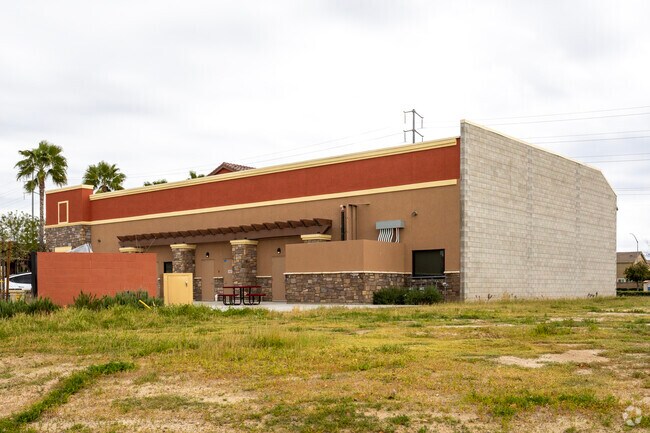
2066 E Copper Ave
579-220-23S
Parcel D Of Parcel Map No 2008-02
Medicalbuilding
1.04 AC SUR RT PAR D P/M 2008-02 BK 69 PGS 95-97
X
Fresno
06019C1040H
California
2025
1.04 AC
2025
E Outlying Fresno Cnty
005503
Fresno
5,410 SF
Fresno, CA
DEMOGRAPHICS near 2066 E Copper Ave
1 mile
3 mile
5 mile
2024 Total Population
11,225
51,259
119,079
2029 Population
11,628
52,659
122,410
Pop Growth 2024-2029
+ 3.59%
+ 2.73%
+ 2.80%
Average Age
38
40
40
2024 Total Households
3,760
18,733
43,909
HH Growth 2024-2029
+ 3.67%
+ 2.68%
+ 2.72%
Median Household Inc
$136,750
$122,867
$106,128
Avg Household Size
3.00
2.70
2.70
2024 Avg HH Vehicles
2.00
2.00
2.00
Median Home Value
$591,547
$476,521
$442,973
Median Year Built
2005
1997
1993
Nearby Places
Map Layers
Map Styles
 Street
 Aerial
Transit
 Traffic
 Biking
Places
Listings with unknown addresses are not visible on the map
- Restaurants
- Banks
- Shops
- Fitness
- Groceries
PUBLIC TRANSPORTATION
AIRPORT
Fresno Yosemite International
Drive
Walk
Distance
Fresno Yosemite International
20 min
10.9 mi
Nearby Properties
Address
Land Use
TOTAL SIZE
Lot Size
Zoning
Address
Land Use
TOTAL SIZE
Lot Size
Zoning
188,913 SF
7.90 AC
Address
Land Use
TOTAL SIZE
Lot Size
Zoning
119,869 SF
11.08 AC
C1
Address
Land Use
TOTAL SIZE
Lot Size
Zoning
212,354 SF
13.12 AC
R2
Address
Land Use
TOTAL SIZE
Lot Size
Zoning
188,177 SF
5.58 AC
CP
Address
Land Use
TOTAL SIZE
Lot Size
Zoning
200,826 SF
19.23 AC
R2
Address
Land Use
TOTAL SIZE
Lot Size
Zoning
152,550 SF
9.23 AC
R3
Address
Land Use
TOTAL SIZE
Lot Size
Zoning
129,860 SF
6.10 AC
Address
Land Use
TOTAL SIZE
Lot Size
Zoning
77,858 SF
4.23 AC
CP
Address
Land Use
TOTAL SIZE
Lot Size
Zoning
98,128 SF
5.42 AC
O
Address
Land Use
TOTAL SIZE
Lot Size
Zoning
50,025 SF
40.36 AC
AE20
Address
Land Use
TOTAL SIZE
Lot Size
Zoning
120,570 SF
6.22 AC
R2
Address
Land Use
TOTAL SIZE
Lot Size
Zoning
109,957 SF
6.76 AC
R2
Address
Land Use
TOTAL SIZE
Lot Size
Zoning
67,940 SF
1.09 AC
SPLIT
Address
Land Use
TOTAL SIZE
Lot Size
Zoning
73,391 SF
4.72 AC
SPLIT
Address
Land Use
TOTAL SIZE
Lot Size
Zoning
50,610 SF
4.41 AC
C2
Address
Land Use
TOTAL SIZE
Lot Size
Zoning
1,706 SF
77.50 AC
AE20
Address
Land Use
TOTAL SIZE
Lot Size
Zoning
38,275 SF
18.16 AC
Address
Land Use
TOTAL SIZE
Lot Size
Zoning
25,985 SF
119.22 AC
AE20
Address
Land Use
TOTAL SIZE
Lot Size
Zoning
128,940 SF
34 AC
AL20
Address
Land Use
TOTAL SIZE
Lot Size
Zoning
29,265 SF
3.05 AC
C2
Address
Land Use
TOTAL SIZE
Lot Size
Zoning
1,526 SF
7.51 AC
R1C
Address
Land Use
TOTAL SIZE
Lot Size
Zoning
31,500 SF
2.35 AC
CP
Address
Land Use
TOTAL SIZE
Lot Size
Zoning
35,070 SF
3.53 AC
C2
Address
Land Use
TOTAL SIZE
Lot Size
Zoning
37,974 SF
2.27 AC
AE5
Address
Land Use
TOTAL SIZE
Lot Size
Zoning
2,835 SF
57.03 AC
ARV-20
Address
Land Use
TOTAL SIZE
Lot Size
Zoning
22,400 SF
2.12 AC
C2
The World's #1 Commercial Real Estate Marketplace
Connect with us
© 2026 CoStar Group
The information above has been obtained from sources believed reliable. While we do not doubt its accuracy we have not verified it and make no guarantee, warranty or representation about it. It is your responsibility to independently confirm its accuracy and completeness. Any projections, opinions, assumptions, or estimates used are for example only and do not represent the current or future performance of the property. The value of this transaction to you depends on tax and other factors which should be evaluated by your tax, financial, and legal advisors. You and your advisors should conduct a careful, independent investigation of the property to determine to your satisfaction the suitability of the property for your needs.