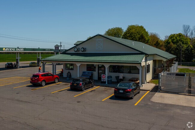
Property Record
2067 State Route 96, Phelps, NY 14532
NEARBY LISTINGS FOR SALE OR LEASE
-
-
View all Phelps listings for sale on LoopNet.com
Property Detail
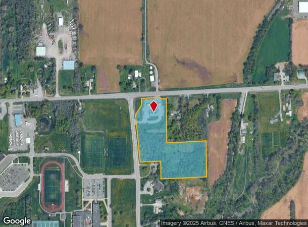
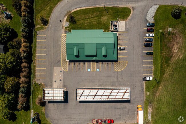
2067 State Route 96
Rochester, NY
902/250 9.90 ACRES
324089-047-000-0001-010-131
Ontario
Servicestationmarket
New York
2025
10.131
2024
9.90 AC
050402
Outlying Ontario County
3,960 SF
Rochester
DEMOGRAPHICS near 2067 State Route 96
1 Mile
3 Mile
5 Mile
2024 Total Population
152
6,132
11,137
2029 Population
151
6,108
11,061
Pop Growth 2024-2029
(0.66%)
(0.39%)
(0.68%)
Average Age
43
44
44
2024 Total Households
65
2,522
4,625
HH Growth 2024-2029
(1.54%)
(0.36%)
(0.71%)
Median Household Inc
$72,856
$74,448
$69,835
Avg Household Size
2.30
2.30
2.30
2024 Avg HH Vehicles
2.00
2.00
2.00
Median Home Value
$158,620
$154,088
$147,076
Median Year Built
1952
1948
1957
Nearby Places
Map Layers
Map Styles
 Street
 Aerial
- Restaurants
- Banks
- Shops
- Fitness
- Groceries
SALE & LEASE HISTORY
LISTING DATE
SALE/LEASE

Nov 21, 2016
For Sale
Nearby Properties
Address
Land Use
TOTAL SIZE
Lot Size
Zoning
Address
Land Use
TOTAL SIZE
Lot Size
Zoning
118.90 AC
05 - COMME
Address
Land Use
TOTAL SIZE
Lot Size
Zoning
21.50 AC
03 - MULTI
Address
Land Use
TOTAL SIZE
Lot Size
Zoning
Address
Land Use
TOTAL SIZE
Lot Size
Zoning
Address
Land Use
TOTAL SIZE
Lot Size
Zoning
65,130 SF
25.60 AC
06 - INDUS
Address
Land Use
TOTAL SIZE
Lot Size
Zoning
263,986 SF
26.70 AC
03 - MULTI
Address
Land Use
TOTAL SIZE
Lot Size
Zoning
Address
Land Use
TOTAL SIZE
Lot Size
Zoning
Address
Land Use
TOTAL SIZE
Lot Size
Zoning
23.10 AC
4
Address
Land Use
TOTAL SIZE
Lot Size
Zoning
1.70 AC
03 - MULTI
Address
Land Use
TOTAL SIZE
Lot Size
Zoning
4,416 SF
4.20 AC
05 - COMME
Address
Land Use
TOTAL SIZE
Lot Size
Zoning
0.45 AC
03 - MULTI
Address
Land Use
TOTAL SIZE
Lot Size
Zoning
308.90 AC
04 - FARM
Address
Land Use
TOTAL SIZE
Lot Size
Zoning
Address
Land Use
TOTAL SIZE
Lot Size
Zoning
2,100 SF
1.30 AC
02 - SINGL
Address
Land Use
TOTAL SIZE
Lot Size
Zoning
54,700 SF
9.50 AC
06 - INDUS
Address
Land Use
TOTAL SIZE
Lot Size
Zoning
7.10 AC
04 - FARM
Address
Land Use
TOTAL SIZE
Lot Size
Zoning
0.57 AC
03 - MULTI
Address
Land Use
TOTAL SIZE
Lot Size
Zoning
7,700 SF
5.60 AC
06 - INDUS
Address
Land Use
TOTAL SIZE
Lot Size
Zoning
9,728 SF
5.40 AC
06 - INDUS
Address
Land Use
TOTAL SIZE
Lot Size
Zoning
6.10 AC
04 - FARM
Address
Land Use
TOTAL SIZE
Lot Size
Zoning
32,539 SF
10.80 AC
06 - INDUS
Address
Land Use
TOTAL SIZE
Lot Size
Zoning
30,000 SF
6.70 AC
06 - INDUS
Address
Land Use
TOTAL SIZE
Lot Size
Zoning
Address
Land Use
TOTAL SIZE
Lot Size
Zoning
51,455 SF
12.14 AC
05 - COMME
Address
Land Use
TOTAL SIZE
Lot Size
Zoning
6,816 SF
19.10 AC
02 - SINGL
Address
Land Use
TOTAL SIZE
Lot Size
Zoning
22,696 SF
1.60 AC
05 - COMME
Address
Land Use
TOTAL SIZE
Lot Size
Zoning
Address
Land Use
TOTAL SIZE
Lot Size
Zoning
Address
Land Use
TOTAL SIZE
Lot Size
Zoning
The World's #1 Commercial Real Estate Marketplace
Connect with us
© 2026 CoStar Group
The information above has been obtained from sources believed reliable. While we do not doubt its accuracy we have not verified it and make no guarantee, warranty or representation about it. It is your responsibility to independently confirm its accuracy and completeness. Any projections, opinions, assumptions, or estimates used are for example only and do not represent the current or future performance of the property. The value of this transaction to you depends on tax and other factors which should be evaluated by your tax, financial, and legal advisors. You and your advisors should conduct a careful, independent investigation of the property to determine to your satisfaction the suitability of the property for your needs.