Property Record
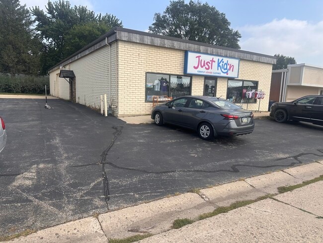
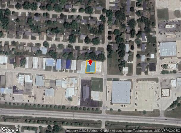
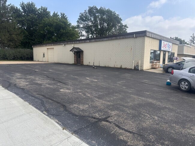
207 10Th St Sw, Spencer, IA 51301
Current Lease Availabilities
NEARBY LISTINGS FOR SALE OR LEASE
-
-
-
No Photo
-
View all Spencer listings for lease on LoopNet.com
Property Detail
207 10Th St Sw
9636-18-353-025
Southmoor 2Nd Commercial Add
Storebuilding
E 87.5' OF W 175' 1 1 SOUTHMOOR 2ND COMM
AE
Clay
19041C0194D
Iowa
2025
0.23 AC
2025
Iowa West Area
080302
Other Market Areas
3,960 SF
Spencer, IA
DEMOGRAPHICS near 207 10Th St Sw
1 Mile
3 Mile
5 Mile
2024 Total Population
3,882
12,150
12,548
2029 Population
3,905
12,285
12,666
Pop Growth 2024-2029
+ 0.59%
+ 1.11%
+ 0.94%
Average Age
42
42
42
2024 Total Households
1,833
5,413
5,580
HH Growth 2024-2029
+ 0.49%
+ 1.09%
+ 0.91%
Median Household Inc
$43,378
$47,330
$48,169
Avg Household Size
2.10
2.20
2.20
2024 Avg HH Vehicles
2.00
2.00
2.00
Median Home Value
$151,284
$162,374
$162,658
Median Year Built
1973
1970
1970
Nearby Places
- Restaurants
- Banks
- Shops
- Fitness
- Groceries
Nearby Properties
Address
Land Use
TOTAL SIZE
Lot Size
Zoning
Address
Land Use
TOTAL SIZE
Lot Size
Zoning
221,178 SF
2.09 AC
C-1 GENERA
Address
Land Use
TOTAL SIZE
Lot Size
Zoning
12,880 SF
20.77 AC
Address
Land Use
TOTAL SIZE
Lot Size
Zoning
10,699 SF
22.28 AC
Address
Land Use
TOTAL SIZE
Lot Size
Zoning
4,988 SF
1.72 AC
Address
Land Use
TOTAL SIZE
Lot Size
Zoning
130,787 SF
15.26 AC
Address
Land Use
TOTAL SIZE
Lot Size
Zoning
75,361 SF
11.70 AC
Address
Land Use
TOTAL SIZE
Lot Size
Zoning
162,300 SF
21.91 AC
C-2 HIGHWA
Address
Land Use
TOTAL SIZE
Lot Size
Zoning
14,953 SF
17.55 AC
Address
Land Use
TOTAL SIZE
Lot Size
Zoning
96,943 SF
10.23 AC
Address
Land Use
TOTAL SIZE
Lot Size
Zoning
31,766 SF
7.45 AC
A-1 AGRICU
Address
Land Use
TOTAL SIZE
Lot Size
Zoning
12,743 SF
1.83 AC
C-1 GENERA
Address
Land Use
TOTAL SIZE
Lot Size
Zoning
146,609 SF
14.26 AC
C-2 HIGHWA
Address
Land Use
TOTAL SIZE
Lot Size
Zoning
46,745 SF
1.50 AC
Address
Land Use
TOTAL SIZE
Lot Size
Zoning
61,391 SF
9.05 AC
Address
Land Use
TOTAL SIZE
Lot Size
Zoning
8,600 SF
1.20 AC
C-1 GENERA
Address
Land Use
TOTAL SIZE
Lot Size
Zoning
4,336 SF
4.50 AC
Address
Land Use
TOTAL SIZE
Lot Size
Zoning
200,010 SF
22.64 AC
Address
Land Use
TOTAL SIZE
Lot Size
Zoning
15,004 SF
4.55 AC
C-1 GENERA
Address
Land Use
TOTAL SIZE
Lot Size
Zoning
5,353 SF
2.07 AC
C-1 GENERA
Address
Land Use
TOTAL SIZE
Lot Size
Zoning
8,342 SF
24.05 AC
Address
Land Use
TOTAL SIZE
Lot Size
Zoning
1,836 SF
10.87 AC
Address
Land Use
TOTAL SIZE
Lot Size
Zoning
46,451 SF
7.42 AC
Address
Land Use
TOTAL SIZE
Lot Size
Zoning
14,032 SF
2.07 AC
C-1 GENERA
Address
Land Use
TOTAL SIZE
Lot Size
Zoning
67,335 SF
3.22 AC
A-1 AGRICU
Address
Land Use
TOTAL SIZE
Lot Size
Zoning
63,543 SF
2.11 AC
A-1 AGRICU
Address
Land Use
TOTAL SIZE
Lot Size
Zoning
137,878 SF
27.27 AC
Address
Land Use
TOTAL SIZE
Lot Size
Zoning
2,880 SF
148.70 AC
C-1 GENERA
Address
Land Use
TOTAL SIZE
Lot Size
Zoning
4,000 SF
62.84 AC
I-2 HEAVY
Address
Land Use
TOTAL SIZE
Lot Size
Zoning
58,719 SF
Address
Land Use
TOTAL SIZE
Lot Size
Zoning
136,485 SF
11.24 AC
C-2 HIGHWA
The World's #1 Commercial Real Estate Marketplace
Connect with us
© 2025 CoStar Group
The information above has been obtained from sources believed reliable. While we do not doubt its accuracy we have not verified it and make no guarantee, warranty or representation about it. It is your responsibility to independently confirm its accuracy and completeness. Any projections, opinions, assumptions, or estimates used are for example only and do not represent the current or future performance of the property. The value of this transaction to you depends on tax and other factors which should be evaluated by your tax, financial, and legal advisors. You and your advisors should conduct a careful, independent investigation of the property to determine to your satisfaction the suitability of the property for your needs.