Property Record
207 Central St, Hudson, NH 03051
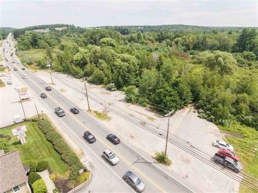

Property Detail
207 Central St
HDSO-000176-000041
HILLSBOROUGH
Commercialacreage
New Hampshire
BD
24.21 AC
A Areas with a 1% annual chance of flooding and a 26% chance of flooding over the life of a 30-year mortgage.
Hillsborough
2025
Boston
2025
Manchester-Nashua, NH
012301
NEARBY LISTINGS FOR SALE OR LEASE
DEMOGRAPHICS near 207 Central St
1 mile
3 mile
5 mile
2025 Total Population
4,723
41,564
110,441
2030 Population
4,825
42,220
111,911
Pop Growth 2025-2030
+ 2.16%
+ 1.58%
+ 1.33%
Average Age
43
42
42
2025 Total Households
1,780
16,741
43,880
HH Growth 2025-2030
+ 2.19%
+ 1.64%
+ 1.40%
Median Household Inc
$145,312
$99,254
$108,300
Avg Household Size
2.60
2.40
2.40
2025 Avg HH Vehicles
2.00
2.00
2.00
Median Home Value
$415,711
$432,512
$450,389
Median Year Built
1985
1972
1975
Nearby Places
Map Layers
Map Styles
 Street
 Aerial
Layers
 Traffic
 Biking
Places
Listings with unknown addresses are not visible on the map
- Restaurants
- Banks
- Shops
- Fitness
- Groceries
PUBLIC TRANSPORTATION
AIRPORT
Manchester Boston Regional
Drive
Walk
Distance
Manchester Boston Regional
31 min
17.5 mi
General Edward Lawrence Logan International
Drive
Walk
Distance
General Edward Lawrence Logan International
62 min
45.4 mi
Freight Ports
Port of Boston
Drive
Walk
Distance
Port of Boston
63 min
45.1 mi
SALE & LEASE HISTORY
LISTING DATE
SALE/LEASE

Sep 24, 2016
For Sale
Jan 25, 2021
For Sale
Nearby Properties
Address
Land Use
TOTAL SIZE
Lot Size
Zoning
Address
Land Use
TOTAL SIZE
Lot Size
Zoning
27.98 AC
GI
Address
Land Use
TOTAL SIZE
Lot Size
Zoning
522,476 SF
74.89 AC
ID
Address
Land Use
TOTAL SIZE
Lot Size
Zoning
220,295 SF
4.34 AC
D1MU
Address
Land Use
TOTAL SIZE
Lot Size
Zoning
5.30 AC
GIMU
Address
Land Use
TOTAL SIZE
Lot Size
Zoning
133,390 SF
97.42 AC
B
Address
Land Use
TOTAL SIZE
Lot Size
Zoning
2.77 AC
GIMU
Address
Land Use
TOTAL SIZE
Lot Size
Zoning
188,520 SF
111.12 AC
GD
Address
Land Use
TOTAL SIZE
Lot Size
Zoning
37.57 AC
R9
Address
Land Use
TOTAL SIZE
Lot Size
Zoning
8.87 AC
RC
Address
Land Use
TOTAL SIZE
Lot Size
Zoning
21.16 AC
D3MU
Address
Land Use
TOTAL SIZE
Lot Size
Zoning
312,738 SF
25.84 AC
ID
Address
Land Use
TOTAL SIZE
Lot Size
Zoning
185,242 SF
35.75 AC
ID
Address
Land Use
TOTAL SIZE
Lot Size
Zoning
180,284 SF
16.13 AC
RB
Address
Land Use
TOTAL SIZE
Lot Size
Zoning
127,825 SF
D1MU
Address
Land Use
TOTAL SIZE
Lot Size
Zoning
148,042 SF
28.53 AC
R2
Address
Land Use
TOTAL SIZE
Lot Size
Zoning
28.33 AC
GI
Address
Land Use
TOTAL SIZE
Lot Size
Zoning
162,163 SF
14.23 AC
ID
Address
Land Use
TOTAL SIZE
Lot Size
Zoning
80,863 SF
18 AC
R1
Address
Land Use
TOTAL SIZE
Lot Size
Zoning
5.80 AC
GI
Address
Land Use
TOTAL SIZE
Lot Size
Zoning
57,128 SF
10.60 AC
BD
Address
Land Use
TOTAL SIZE
Lot Size
Zoning
2,724 SF
43.90 AC
RA
Address
Land Use
TOTAL SIZE
Lot Size
Zoning
2.22 AC
GI
Address
Land Use
TOTAL SIZE
Lot Size
Zoning
161 AC
R9
Address
Land Use
TOTAL SIZE
Lot Size
Zoning
50,884 SF
0.76 AC
GIMU
Address
Land Use
TOTAL SIZE
Lot Size
Zoning
84,710 SF
16.24 AC
BD
Address
Land Use
TOTAL SIZE
Lot Size
Zoning
70,334 SF
0.92 AC
GI
Address
Land Use
TOTAL SIZE
Lot Size
Zoning
27,847 SF
5.13 AC
BD
Address
Land Use
TOTAL SIZE
Lot Size
Zoning
51,564 SF
1.81 AC
RC
Address
Land Use
TOTAL SIZE
Lot Size
Zoning
27.10 AC
GI
Address
Land Use
TOTAL SIZE
Lot Size
Zoning
81,662 SF
14.01 AC
R2
The World's #1 Commercial Real Estate Marketplace
Connect with us
© 2026 CoStar Group
The information above has been obtained from sources believed reliable. While we do not doubt its accuracy we have not verified it and make no guarantee, warranty or representation about it. It is your responsibility to independently confirm its accuracy and completeness. Any projections, opinions, assumptions, or estimates used are for example only and do not represent the current or future performance of the property. The value of this transaction to you depends on tax and other factors which should be evaluated by your tax, financial, and legal advisors. You and your advisors should conduct a careful, independent investigation of the property to determine to your satisfaction the suitability of the property for your needs.