Property Record
207 E Prosser Rd, Cheyenne, WY 82007
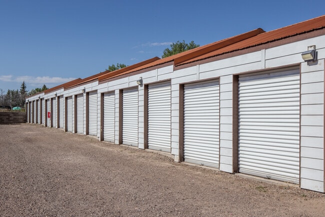

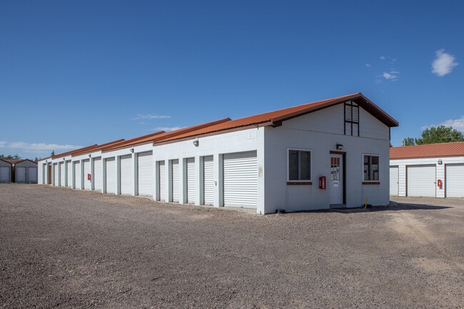
Property Detail
207 E Prosser Rd
Cheyenne, WY
WIESE SUBDIVISION, 2ND FILING: LOT 1, BLOCK 1
1-9348-0001-0001-0
Laramie
Commercialnec
Wyoming
B and X Area of moderate flood hazard, usually the area between the limits of the 100-year and 500-year floods.
1
2025
2.30 AC
2025
I-80 Corridor/Cheyenne
000403
Other Market Areas
33,953 SF
NEARBY LISTINGS FOR SALE OR LEASE
-
-
View all Cheyenne listings for lease on LoopNet.com
DEMOGRAPHICS near 207 E Prosser Rd
1 mile
3 mile
5 mile
2025 Total Population
8,797
33,418
68,884
2030 Population
8,890
33,471
69,196
Pop Growth 2025-2030
+ 1.06%
+ 0.16%
+ 0.45%
Average Age
37
39
39
2025 Total Households
3,696
14,580
29,593
HH Growth 2025-2030
+ 1.33%
+ 0.35%
+ 0.55%
Median Household Inc
$55,389
$59,032
$66,031
Avg Household Size
2.30
2.20
2.20
2025 Avg HH Vehicles
2.00
2.00
2.00
Median Home Value
$187,096
$247,477
$289,142
Median Year Built
1989
1967
1976
Nearby Places
Map Layers
Map Styles
 Street
 Aerial
Layers
 Traffic
 Biking
Places
Listings with unknown addresses are not visible on the map
- Restaurants
- Banks
- Shops
- Fitness
- Groceries
SALE & LEASE HISTORY
LISTING DATE
SALE/LEASE

Jul 26, 2022
For Sale
Apr 10, 2024
For Lease
Nearby Properties
Address
Land Use
TOTAL SIZE
Lot Size
Zoning
Address
Land Use
TOTAL SIZE
Lot Size
Zoning
240.51 AC
A2
Address
Land Use
TOTAL SIZE
Lot Size
Zoning
Address
Land Use
TOTAL SIZE
Lot Size
Zoning
91,021 SF
7.40 AC
Address
Land Use
TOTAL SIZE
Lot Size
Zoning
189,952 SF
11.15 AC
HR2
Address
Land Use
TOTAL SIZE
Lot Size
Zoning
Address
Land Use
TOTAL SIZE
Lot Size
Zoning
148,018 SF
Address
Land Use
TOTAL SIZE
Lot Size
Zoning
136,488 SF
13.38 AC
CB
Address
Land Use
TOTAL SIZE
Lot Size
Zoning
69,726 SF
0.80 AC
CBD
Address
Land Use
TOTAL SIZE
Lot Size
Zoning
135,427 SF
6.61 AC
Address
Land Use
TOTAL SIZE
Lot Size
Zoning
193,881 SF
21.36 AC
CB
Address
Land Use
TOTAL SIZE
Lot Size
Zoning
109,744 SF
7.04 AC
Address
Land Use
TOTAL SIZE
Lot Size
Zoning
81,948 SF
9.39 AC
CB
Address
Land Use
TOTAL SIZE
Lot Size
Zoning
108,716 SF
12.45 AC
Address
Land Use
TOTAL SIZE
Lot Size
Zoning
69,941 SF
4.31 AC
LI
Address
Land Use
TOTAL SIZE
Lot Size
Zoning
86,860 SF
1.70 AC
CB
Address
Land Use
TOTAL SIZE
Lot Size
Zoning
59,325 SF
0.85 AC
CBD
Address
Land Use
TOTAL SIZE
Lot Size
Zoning
69,103 SF
17.34 AC
Address
Land Use
TOTAL SIZE
Lot Size
Zoning
108,332 SF
0.80 AC
MUB
Address
Land Use
TOTAL SIZE
Lot Size
Zoning
56,724 SF
2.25 AC
Address
Land Use
TOTAL SIZE
Lot Size
Zoning
210,518 SF
20.50 AC
LI
Address
Land Use
TOTAL SIZE
Lot Size
Zoning
71,841 SF
8.11 AC
Address
Land Use
TOTAL SIZE
Lot Size
Zoning
30,024 SF
9.53 AC
Address
Land Use
TOTAL SIZE
Lot Size
Zoning
55,750 SF
1.58 AC
Address
Land Use
TOTAL SIZE
Lot Size
Zoning
56,714 SF
5.69 AC
CB
Address
Land Use
TOTAL SIZE
Lot Size
Zoning
91,109 SF
24.34 AC
LI
Address
Land Use
TOTAL SIZE
Lot Size
Zoning
46,705 SF
14.11 AC
HI
Address
Land Use
TOTAL SIZE
Lot Size
Zoning
43,820 SF
4.34 AC
Address
Land Use
TOTAL SIZE
Lot Size
Zoning
58,352 SF
2.28 AC
Address
Land Use
TOTAL SIZE
Lot Size
Zoning
103,144 SF
10.24 AC
LI
Address
Land Use
TOTAL SIZE
Lot Size
Zoning
58,373 SF
0.85 AC
CB
The World's #1 Commercial Real Estate Marketplace
Connect with us
© 2026 CoStar Group
The information above has been obtained from sources believed reliable. While we do not doubt its accuracy we have not verified it and make no guarantee, warranty or representation about it. It is your responsibility to independently confirm its accuracy and completeness. Any projections, opinions, assumptions, or estimates used are for example only and do not represent the current or future performance of the property. The value of this transaction to you depends on tax and other factors which should be evaluated by your tax, financial, and legal advisors. You and your advisors should conduct a careful, independent investigation of the property to determine to your satisfaction the suitability of the property for your needs.