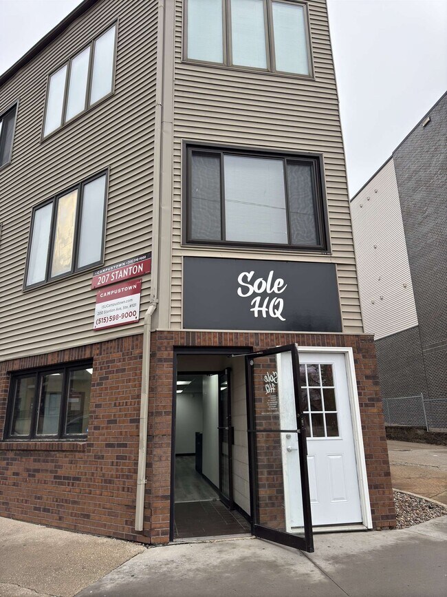
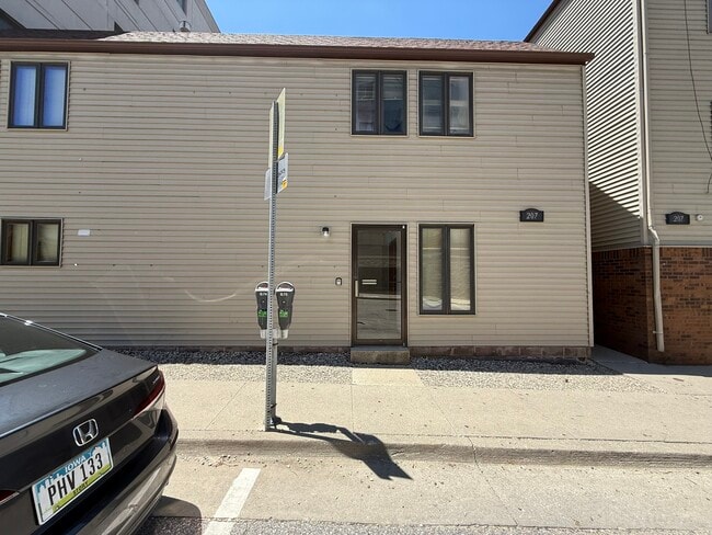
Property Record
207 Stanton Ave, Ames, IA 50014


Current Lease Availabilities
Property Detail
207 Stanton Ave
09-09-131-055
TERRA FIRMA SD 2ND ADD LOT:1 AMES
Apartment
Story
CSC
Iowa
B and X Area of moderate flood hazard, usually the area between the limits of the 100-year and 500-year floods.
1
2024
0.11 AC
2025
Campustown
001102
Other Market Areas
4,131 SF
Ames, IA
NEARBY LISTINGS FOR SALE OR LEASE
DEMOGRAPHICS near 207 Stanton Ave
1 mile
3 mile
5 mile
2025 Total Population
18,464
68,264
73,424
2030 Population
18,729
69,583
74,932
Pop Growth 2025-2030
+ 1.44%
+ 1.93%
+ 2.05%
Average Age
25
33
33
2025 Total Households
4,254
26,068
28,079
HH Growth 2025-2030
+ 2.05%
+ 2.37%
+ 2.50%
Median Household Inc
$37,834
$60,628
$62,430
Avg Household Size
2.10
2.10
2.10
2025 Avg HH Vehicles
2.00
2.00
2.00
Median Home Value
$383,806
$294,422
$296,676
Median Year Built
1993
1991
1990
Nearby Places
Map Layers
Map Styles
 Street
 Aerial
Layers
 Traffic
 Biking
Places
Listings with unknown addresses are not visible on the map
- Restaurants
- Banks
- Shops
- Fitness
- Groceries
PUBLIC TRANSPORTATION
AIRPORT
Des Moines International
Drive
Walk
Distance
Des Moines International
58 min
42.0 mi
Nearby Properties
Address
Land Use
TOTAL SIZE
Lot Size
Zoning
Address
Land Use
TOTAL SIZE
Lot Size
Zoning
2,216 SF
25.86 AC
RH
Address
Land Use
TOTAL SIZE
Lot Size
Zoning
54,112 SF
12.70 AC
Address
Land Use
TOTAL SIZE
Lot Size
Zoning
289,606 SF
1.77 AC
CSC
Address
Land Use
TOTAL SIZE
Lot Size
Zoning
33,530 SF
28.91 AC
Address
Land Use
TOTAL SIZE
Lot Size
Zoning
45,250 SF
12.69 AC
Address
Land Use
TOTAL SIZE
Lot Size
Zoning
45,627 SF
8.91 AC
RH
Address
Land Use
TOTAL SIZE
Lot Size
Zoning
215,689 SF
22.56 AC
HOC
Address
Land Use
TOTAL SIZE
Lot Size
Zoning
75,302 SF
16.66 AC
HOC
Address
Land Use
TOTAL SIZE
Lot Size
Zoning
177,201 SF
26.29 AC
Address
Land Use
TOTAL SIZE
Lot Size
Zoning
117,797 SF
7.88 AC
Address
Land Use
TOTAL SIZE
Lot Size
Zoning
82,734 SF
1.42 AC
CSC
Address
Land Use
TOTAL SIZE
Lot Size
Zoning
156,833 SF
14.54 AC
PRC
Address
Land Use
TOTAL SIZE
Lot Size
Zoning
16,222 SF
10.44 AC
Address
Land Use
TOTAL SIZE
Lot Size
Zoning
78,379 SF
7.92 AC
SHM
Address
Land Use
TOTAL SIZE
Lot Size
Zoning
120,842 SF
26.68 AC
PI
Address
Land Use
TOTAL SIZE
Lot Size
Zoning
52,980 SF
8.53 AC
PI
Address
Land Use
TOTAL SIZE
Lot Size
Zoning
6,090 SF
20.72 AC
F-PRD
Address
Land Use
TOTAL SIZE
Lot Size
Zoning
93,813 SF
7.11 AC
GI
Address
Land Use
TOTAL SIZE
Lot Size
Zoning
133,668 SF
3.71 AC
RH
Address
Land Use
TOTAL SIZE
Lot Size
Zoning
20,619 SF
2.44 AC
RH
Address
Land Use
TOTAL SIZE
Lot Size
Zoning
54,066 SF
4.93 AC
RI
Address
Land Use
TOTAL SIZE
Lot Size
Zoning
84,132 SF
3.57 AC
FS-RM
Address
Land Use
TOTAL SIZE
Lot Size
Zoning
115,338 SF
16.41 AC
HOC
Address
Land Use
TOTAL SIZE
Lot Size
Zoning
35,264 SF
11.88 AC
Address
Land Use
TOTAL SIZE
Lot Size
Zoning
105,550 SF
0.62 AC
CSC
Address
Land Use
TOTAL SIZE
Lot Size
Zoning
7,181 SF
20.11 AC
PRC
Address
Land Use
TOTAL SIZE
Lot Size
Zoning
97,767 SF
0.05 AC
CSC
Address
Land Use
TOTAL SIZE
Lot Size
Zoning
122,502 SF
10.96 AC
HOC
Address
Land Use
TOTAL SIZE
Lot Size
Zoning
88,584 SF
0.57 AC
Address
Land Use
TOTAL SIZE
Lot Size
Zoning
114,744 SF
14.35 AC
HOC
The World's #1 Commercial Real Estate Marketplace
Connect with us
© 2026 CoStar Group
The information above has been obtained from sources believed reliable. While we do not doubt its accuracy we have not verified it and make no guarantee, warranty or representation about it. It is your responsibility to independently confirm its accuracy and completeness. Any projections, opinions, assumptions, or estimates used are for example only and do not represent the current or future performance of the property. The value of this transaction to you depends on tax and other factors which should be evaluated by your tax, financial, and legal advisors. You and your advisors should conduct a careful, independent investigation of the property to determine to your satisfaction the suitability of the property for your needs.