Property Record
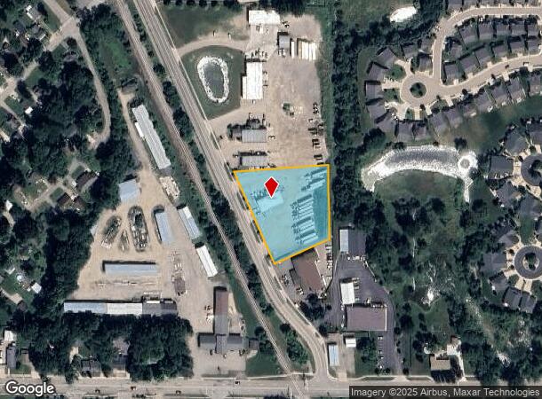
2070 Depot St, Holt, MI 48842


NEARBY LISTINGS FOR SALE OR LEASE
Property Detail
2070 Depot St
Lansing-East Lansing, MI
Delhi
25-05-14-478-008
(DP 2827-1) PART OF LOT 23 SUPERVISOR'S PLAT NO 11 OF DELHI DESC AS BEG AT PT 491 FT N00DEG 18'W FROM SE COR OF SEC 14 T3N
Warehouse
Ingham
X
Michigan
26065C0144D
23
2024
1.69 AC
2025
Southern Lansing
005502
West Michigan
3,200 SF
DEMOGRAPHICS near 2070 Depot St
1 Mile
3 Mile
5 Mile
2024 Total Population
5,876
29,462
75,031
2029 Population
5,814
29,285
74,704
Pop Growth 2024-2029
(1.06%)
(0.60%)
(0.44%)
Average Age
40
39
38
2024 Total Households
2,601
12,741
31,741
HH Growth 2024-2029
(0.81%)
(0.59%)
(0.47%)
Median Household Inc
$55,682
$61,011
$59,889
Avg Household Size
2.20
2.30
2.30
2024 Avg HH Vehicles
2.00
2.00
2.00
Median Home Value
$159,625
$165,125
$152,665
Median Year Built
1978
1978
1975
Nearby Places
Map Layers
Map Styles
 Street
 Aerial
- Restaurants
- Banks
- Shops
- Fitness
- Groceries
PUBLIC TRANSPORTATION
COMMUTER RAIL
DRIVE
WALK
Distance
14 min
8.6 mi
AIRPORT
Capital Region International
DRIVE
WALK
Distance
Capital Region International
23 min
12.2 mi
Nearby Properties
Address
Land Use
TOTAL SIZE
Lot Size
Zoning
Address
Land Use
TOTAL SIZE
Lot Size
Zoning
21,447 SF
56.20 AC
RM
Address
Land Use
TOTAL SIZE
Lot Size
Zoning
3,246 SF
13.54 AC
DM-1 RE
Address
Land Use
TOTAL SIZE
Lot Size
Zoning
178,096 SF
22.80 AC
IP
Address
Land Use
TOTAL SIZE
Lot Size
Zoning
269,915 SF
Address
Land Use
TOTAL SIZE
Lot Size
Zoning
410 AC
Address
Land Use
TOTAL SIZE
Lot Size
Zoning
912 SF
20.97 AC
RM
Address
Land Use
TOTAL SIZE
Lot Size
Zoning
7,868 SF
12.03 AC
RM
Address
Land Use
TOTAL SIZE
Lot Size
Zoning
8,341 SF
27.70 AC
RM
Address
Land Use
TOTAL SIZE
Lot Size
Zoning
23,940 SF
13.44 AC
CUP
Address
Land Use
TOTAL SIZE
Lot Size
Zoning
616,146 SF
111.68 AC
IP
Address
Land Use
TOTAL SIZE
Lot Size
Zoning
17,920 SF
208 AC
Address
Land Use
TOTAL SIZE
Lot Size
Zoning
351 SF
20.90 AC
Address
Land Use
TOTAL SIZE
Lot Size
Zoning
1,642 SF
288 AC
DM-1 RE
Address
Land Use
TOTAL SIZE
Lot Size
Zoning
10,112 SF
12.57 AC
RM-1
Address
Land Use
TOTAL SIZE
Lot Size
Zoning
47,352 SF
2.41 AC
TC
Address
Land Use
TOTAL SIZE
Lot Size
Zoning
14,981 SF
12.66 AC
R-1E
Address
Land Use
TOTAL SIZE
Lot Size
Zoning
75,476 SF
17.70 AC
Address
Land Use
TOTAL SIZE
Lot Size
Zoning
168,480 SF
15.30 AC
G-2 WHO
Address
Land Use
TOTAL SIZE
Lot Size
Zoning
3,528 SF
230 AC
Address
Land Use
TOTAL SIZE
Lot Size
Zoning
80,080 SF
7.91 AC
D-1 PRO
Address
Land Use
TOTAL SIZE
Lot Size
Zoning
Address
Land Use
TOTAL SIZE
Lot Size
Zoning
16,913 SF
11.25 AC
R-1E
Address
Land Use
TOTAL SIZE
Lot Size
Zoning
15,439 SF
13.13 AC
R-1E
Address
Land Use
TOTAL SIZE
Lot Size
Zoning
26,042 SF
3.58 AC
C-2
Address
Land Use
TOTAL SIZE
Lot Size
Zoning
20,834 SF
11.85 AC
F COMM
Address
Land Use
TOTAL SIZE
Lot Size
Zoning
29,965 SF
4.52 AC
A-1
Address
Land Use
TOTAL SIZE
Lot Size
Zoning
138,424 SF
14.80 AC
MIXED Z
Address
Land Use
TOTAL SIZE
Lot Size
Zoning
135,318 SF
10.59 AC
G-2 WHO
Address
Land Use
TOTAL SIZE
Lot Size
Zoning
72,523 SF
6.75 AC
Address
Land Use
TOTAL SIZE
Lot Size
Zoning
50,007 SF
CUP
The World's #1 Commercial Real Estate Marketplace
Connect with us
© 2025 CoStar Group
The information above has been obtained from sources believed reliable. While we do not doubt its accuracy we have not verified it and make no guarantee, warranty or representation about it. It is your responsibility to independently confirm its accuracy and completeness. Any projections, opinions, assumptions, or estimates used are for example only and do not represent the current or future performance of the property. The value of this transaction to you depends on tax and other factors which should be evaluated by your tax, financial, and legal advisors. You and your advisors should conduct a careful, independent investigation of the property to determine to your satisfaction the suitability of the property for your needs.